I was flying the Mavic 2 Pro for this capture. The client wants jpeg and RAW which is why I was using the M2P. I thought it would be my only option of my airframes to get both formats. I tried to do waypoints with my M3E but I couldn’t get it to work and it only allows pano capture in jpegs.
I did have an ND filter on the M2P. Didn’t even think about that. I’ll try taking it off.
What would you suggest I do/adjust to make this mission a success? I definitely need to produce jpeg and RAW files for my client. That was an absolute need for them.
I’m pretty sure I have shot panos while capturing both raw and jpeg. Is it possible that you are using a less-than-optimum microSD card whose write-speed is not fast enough to capture both? If so, try a faster card. Also, if you did change to jpeg only, and it worked, that would indicate that it is a write-speed issue. That would be a good troubleshooting step.
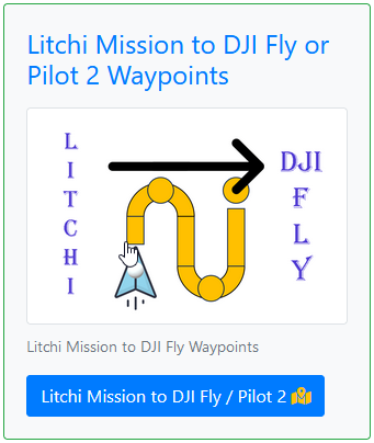
You could try my mission converter to convert a pano mission to M3E format.
I just executed a panorama mission created from my web utility using my Mavic 2 Zoom with the photo capture set to JPEG+RAW. It captured all of the photos, 22 jpegs and 22 raw images. I tried when using both auto-focus and manual-focus. Both times it worked as expected.
I’m running out of ideas why it might not be working for you. Have you tried using manual-focus? That would at least eliminate the focusing step before taking each photo.
I saw that you made that change. I was able to successfully have the M3E run my test mission. It took 22 jpeg and 22 RAW images at 3 different waypoints. The angles are a bit off cause it didn’t capture the sky totally but I think that more a problem of the capability of the gimbal than anything else. I’ll take it though and hoping it is sufficient for the clients needs.
Yes. I added the word “Pilot 2” to make it more obvious.
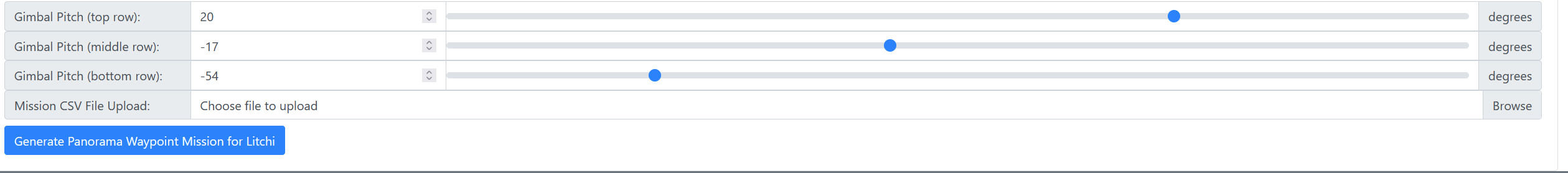
Excellent!. I’m glad it worked. None of my drones capture all of the sky. That has to be filled in manually. At most, I can angle the gimbal 20 degrees upward. That is, at least, a Litchi limitation.
Is there any way to send you a video? I tried to run the 9 waypoint mission today with the M3E but it was taking pictures along the route instead of just at the waypoint. I’m convinced that I have to be doing something wrong in the setup if it working for you and everyone else.
My workflow for this flight/mission to get the pano’s was to first set up the 9 waypoints in Litchi then run it through your utility to create the 360 pano’s. I then exported that back to the utility for Pilot 2 and loaded the KMZ file through my SC.
I can’t see what I did wrong in that process but the fact that I can’t get the mission to work on the M2P or the M3E tells me that I’m more than likely doing something wrong or maybe I need to break them down to less waypoints?
Share your mission. Thats the easiest and best way for users to see what is going on and help you.
Here is some info, if you arent familiar with how to share a mission.
Your ‘Path Mode’ is set to Curved Turns. No waypoint actions are performed unless Path Mode is set to Straight Lines.
Your Photo Capture Interval is set to 2.0 seconds.
The only waypoint actions you have set are ‘Stay For 45 secs’ for waypoints #1 thru #8.
I would expect your mission to capture a LOT of images, taking pictures every 2 seconds like you have set up.
There are no ‘panos’ occurring in the mission that you shared.
That one is not a panorama mission either. It might be the INPUT you use to create a pano mission using Wes’s utility, but it doesnt take panos the way it is set up.
This mission also just takes pictures every 2 seconds, but NO pano
I’m working on saving the missions. I have to do three of them, one at 150ft, one at 75ft, and the last at 250ft, so I’m changing the heights and saving them.
i can see now where I didn’t give it enough info to start with.
Your begging info was sufficient. You just didnt follow all of the instructions on Wes’s pano mission page and generate the final CSV file for you to download and import into the Mission Hub.