I often see people asking this question: “Can I fly to a waypoint and then capture a 360-degree panorama?”
Litchi may provide this feature at some point in the future but it is not available today. There is a “Panorama Preset” as a camera action, however, this preset captures only one row of photos. So, depending on what you require, this may or may not work for you.
To make the capturing of a 360-degree panorama at a waypoint available now, I have created a web application that can be used to create a Litchi mission to capture 22 photos at each defined waypoint that can be stitched into 360-degree panoramas.
My solution does include some idiosyncrasies due to constraints of Litchi waypoint missions. These constraints include:
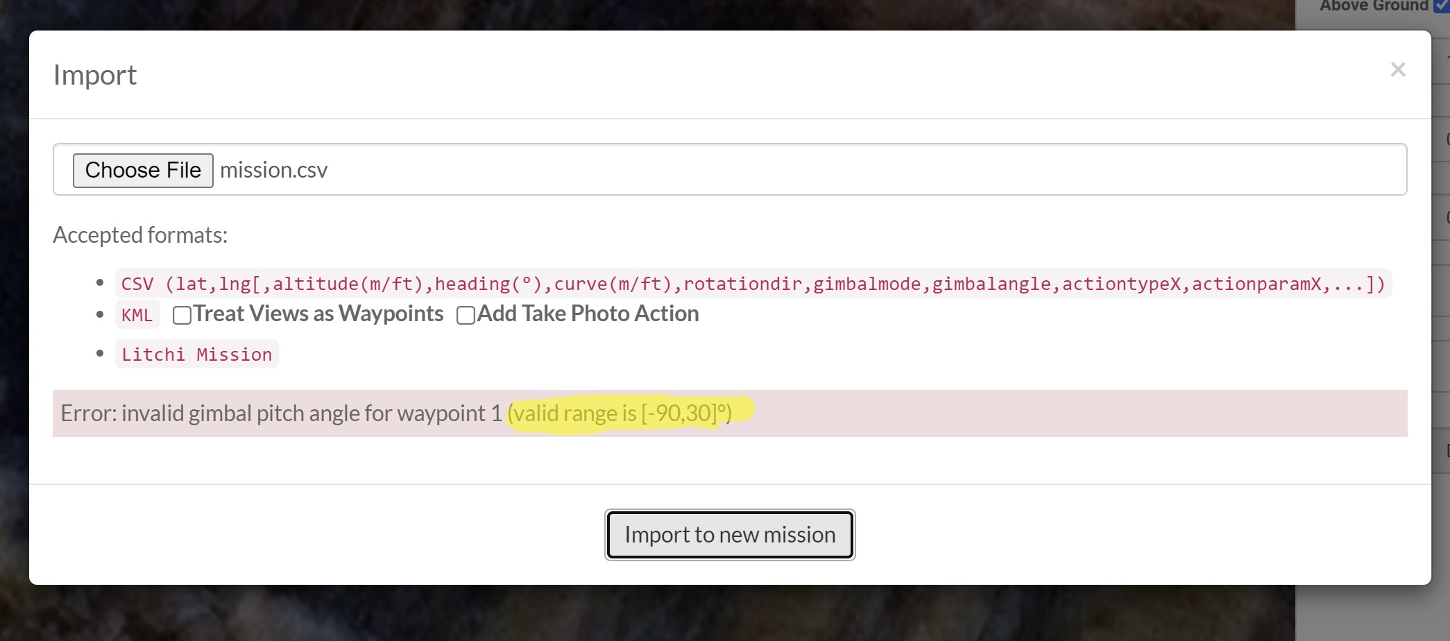
The “Tilt Camera” waypoint action does not allow positive gimbal pitch angles.
No two adjacent waypoints can share the same coordinates.
A maximum of 15 camera actions can be configured per waypoint.
To use this software, simply create a Litchi mission with one or more waypoints (maximum of 10) where the height of each waypoint specifies the height at which each 360-degree panorama is to be captured. Export the CSV file from Litchi’s Mission Hub and use it as an input to my web application. The default gimbal pitch angles used are the same as those used in Litchi’s auto-panorama function. The output of my web application should then be imported back into Litchi’s Mission Hub as a new mission.
Full instructions and details can be found within this web application.
I have tested these panorama missions with success on:
You have created yet another useful tool!
Thanks for that.
Just an observation:
The litchi app accepts positive gimbal tilt angles in waypoint actions, the mission hub does not.
In your instructions, parts 1-d & 1-e are the same (Save this mission (optional)).
Here’s a (useful) list you may include:
Controllable Gimbal Tilt Angles:
Phantom 3 -90° to 30°
Phantom 4 -90° to 30°
Mavic Pro -90° to 30°
Spark -85° to 0°
Mavic Air -90° to 17°
Mavic 2 -90° to 30°
Mavic Mini(SE) -90° to 20°
Mavic Air 2 -90° to 24°
Mini 2 -90° to 20°
Air 2S -90° to 24°
Mavic 3 -90° to 35°
Mini 3 Pro -90° to 60°
I have made the correction and added the tilt angles you supplied.
I did find a couple anomalies when testing. When set to +20 degrees, my Phantom 3 Standard only tilted to +19 degrees. When set to +20 degrees, my Mavic 2 Zoom only tilted to +10 degrees. Even so, I was able to create good panoramas from both.
I have added an option to this web application which will allow one to save, as an image, each of the component views that make up the panorama.
I am not sure how useful this will be and it does require some manual steps. However, with this new addition, you will be able to create a panorama mission then save an image for each of the component images, all from Google Earth Pro.
This way, one can create a complete 360-degree panorama prior to flying the mission with your drone.
Thanks very much for this. There was a time when Litchi would allow you to save a panorama mission so that you could fly it multiple times. I don’t know what happened to it but it has forced me to fly a waypoint mission and then switch to pano mode each time. I’m currently working a weekly construction progression gig for a solar farm with an eBeeX and the client also wants repeatable panos from various locations each week as well. This is going to be a huge help. $10 donation sent as a small token of my gratitude.
Hello there that’s an interesting piece of software you have created. I was wondering if your solution solves my problem?
I have a Mini 3 Pro and looking forward to the development of the Litchi Pilot App. My dream is that one day Litchi would incorporate full almost unlimited steps in their Panorama Preset to allow the programming of ANY configuration of Panorama with any compatible drone but until then your solution seems to get around that limitation.
The Mini 3 Pro is unique in that with a 60 degree upward gimbal pitch and a vertical FOV of 61.57 that means it’s possible to capture a FULL 360 pano with the camera pushing through that 90 degree upward zone (just). I do this now using DJI Fly in 360 Pano Mode then taking 1 or 2 manual shots looking up at 60 degrees. This results in a stitched Pano with no infill required.
Sorry about the long winded preamble!
But is your software with the Mini 3 Pro able to achieve the same end?
Yes, you could do what you describe with my software. The current default values and ranges for gimbal pitch angles are appropriate for most drones. Your example would require me to increase the gimbal pitch range for the upper row to +60 degrees.
My software is not designed to take upward, 90 degree (the opposite of a nadir) photo but it sounds like that is not necessary anyway.
That sounds really encouraging! Is it a big job to do? I know DJI will allow you to tilt to +60 degrees but is there any Litchi limitations that would kick in?
It is an easy change. Since this is a new app, I am unaware of any limitations such as this? Do you have the beta version of Litchi Pilot? If so, I can make the change and you can test.
Thank you Sir just need Litchi Pilot to stop telling me the flight is interrupted as the flight mode was changed which I haven’t touched…
Only rises 2m then stops when playing a simple mission. Once I sort that I’m very keen to try your pano edit.
Many thanks
Andrew
Specs for testing
DJI Mini 3 Pro, Firmware 01.00.0600
DJI Fly App Version 1.10.6
Litchi Pilot Version 1.0.0_Beta-dji Build 125
Samsung A54 Phone , One UI Version 5.1, Android Version 13
DJI RC-N1 Controller Firmware 04.14.0600
Seems like a bug Litchi Pilot lets me fly manually in the same zone. In terms of flight mode the top centre screen only ever says Tripod / GPS / Sport relating to Cine / Normal / Sport Controller Modes.
Haven’t really nailed Geo Zone is the issue, will drive out of it and test same mission to see if works…
CAUSE OF “FLIGHT INTERRUPTED. FLIGHT MODE CHANGED” AND MISSION NOT RUNNING
So I trialed my mission outside the Geo Zone and it ran fine! So the Geo Zone appears to be causing the issue. I’m hoping Litchi can sort as even though when in a Geo Zone the mission won’t run you can still fly the drone manually using the Litchi Pilot (after you have gotten authority from DJI) so if you can fly it manually there must be something triggering the flight mode change in the mission scenario that Litchi can fix. Here’s hoping… I have also passed feedback via the app option.
I’m pretty sure when I had the Mini 1 I could use missions in my Geo Zone using Litchi so hopefully is just a bug that can be solved.
I can now try and load up your higher pitching Pano Software and try outside my Geo Zone. I’ll let you know how I go…
Does the panorama calculation place several waypoint on each other?
I’m thinking I could make a simple excel where this can be done.
I like to try different ways to do mapping missions and if it’s possible to have several waypoint on each position to do more than can be done normally in litchi it would help.
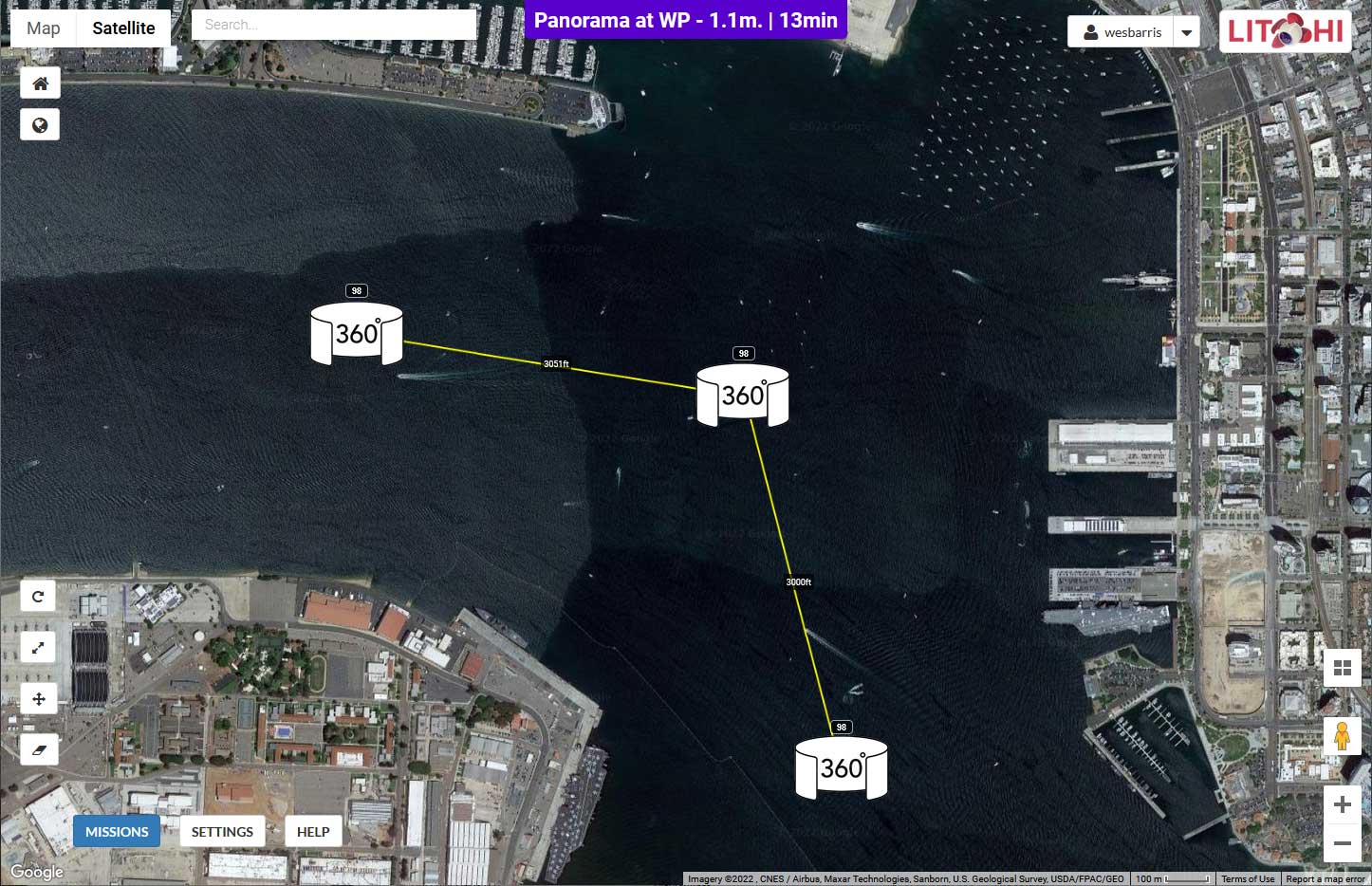
My web application creates a path where several waypoints share the same location. However, because two adjacent waypoints cannot share the same location I must place intermediate waypoints between those that are used to capture the photos.
I tried to set up a waypoint mission to capture pano’s at 9 different GPS coordinates. For whatever reason it is only taking 7 photos per location and three of them are coming out severely blurry. Can you please help me to get this sorted cause I don’t know what I am doing wrong…
Hmmm. I use this function and I always get all photos. If you have your photos preferences set to take both jpg and raw, try changing that to just jpg. What drone are you using?
It should be taking 8 photos in the top and middle rows then 5 in the bottom row. Do you know which ones it is taking?
That would depend on your camera settings. With a sufficiently high shutter speed there should be no blur. What was your shutter speed? Do you have an ND filter installed? If so, remove it. There is no need for an ND filter when taking photos unless you want to introduce motion blur.