Would it be possible to add support for use with DJI mini 3 pro ? thank you
2 Likes
Hi – is the tool able to support the Inspire series? I made sure the camera GSD specs are the same for the Inspire 1 X3 (4.32 cm/px at 100m elevation) but wasn’t sure if anything else would need to be forced to fit Inspire specs. Thanks!
Hello!
In case you find yourself here some time after the thread has closed. @wesbarris was able to build a linear multi-action mission planner. It can be found here:
Corridor Mapping Mission Creator
Feed it a string and it will place waypoints along that string with an export that is Litchi compatible.
Cheers,
Jeff
Hi James. I’m reviving this thread because I haven’t seen the circular mission generator that was mentioned. I created a 3D scan tool using excel but I would love to learn how to do it using the map like you did. I have a 3D scan mission generator as well as a tower inspection tool, both of which use a circular pattern. If you could steer me in the right direction to learn how to convert this to use a map on a site much like your too (which I really appreciate, by the way), that would be fantastic. Hopefully, this gets to you. Thanks. ![]()
@Sean_Foster have you seen this website and app?
or
Hello @James1,
First of all, thank you very much for your effort in providing this tool for us! I have used it several times, and it works perfectly.
Would it be possible to implement a Cross Pass feature? So far, I’ve always flown two sessions—one in the normal orientation and once rotated 90°. I’ve been doing this manually, but an automated solution would be a great help.
Best regards!
Love the tool, really handy. Would be good to display the coordinates of the polygon nodes to allow fine tuning of the polygon position in relation to features of interest not visible on the base map or satellite map.
Keep up the good work, much appreciated!
Hello James and thank you for this brilliant utility you’ve created. It is really easy to use, and I now have several grid mapping missions ready to fly. They are all set for 160 feet AGL, 10 mph speed, and range between 2 and 4 miles long, covered during flight times of between 20 and 30 minutes once imported as CSV files for display on the Litchi Mission Hub map screen. I’ll be using my Mavic 2 Pro with the extra range battery that makes possible 35 minute flight times
I would like to ask how I should go about instructing the drone to take photographs as it flies the grid patterns I have created. I checked the camera actions at each waypoint and no camera action is currently specified at each of the waypoints in the imported CSV file.
I’ve only ever used Litchi for video filming in the past, hence my asking this basic question. I am hoping to learn that there is a global edit tool that I can use to specify one photograph to be taken per waypoint, or stated unit distance, as the case may be. Thanks in advance for any pointers that can be offered regarding this question.
@Mad_Pup
In the Mission Settings, you can set a Photo Interval. It can be set to take photos at a distance Interval or time Interval.
1 Like
Spotted it now. Thanks Sam G. I am now ready to try this new drone flying artform. I’ll no doubt have more questions but hopefully this earlier thread will answer them .
Grid missions? I’ve seen a few posts about rhis but don’t understand what it is. Anyo e explain this to me or point me to maybe a video tutorial on what it is and how to implement it.
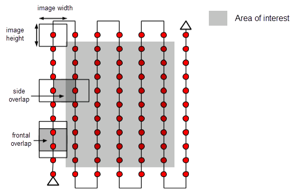
Imagine a lawnmower going up and down a path as it moves across the lawn. A drone mission can perform that same flight path, taking photos along the way.
Some drone mappers will perform that path again, this time flying back and firth (side to side) oriented 90° from the original path.
1 Like
This is the first mention I have seen describing the flight path getting repeated at right angles to the previous one. This reminds me of the matrix operations that baffled me so much in math.
Hi James,
I’d also like to thank you a lot for this tool. I’ve been using it from time to time to make orthophotos and it really works like a charm.
I’m wondering if you’d be willing to share the source code so that I can make some personal tweaks (or is it already published somewhere?).
Thanks in advance!
1 Like
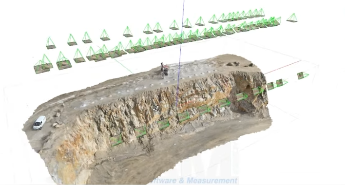
With WebODM flight missions that have their axis rotated 10-20 degrees from a previous grid along with the camera 10 degrees from Nadir (-90) alos produce good resutls, I’ve read from others that the overlap can be reduced on the complimentary flight as well wich results in fewer photos needing to be processed saving time to deliver to the client.
The flight rotation button works great for this, along with the camera angle adjustment.
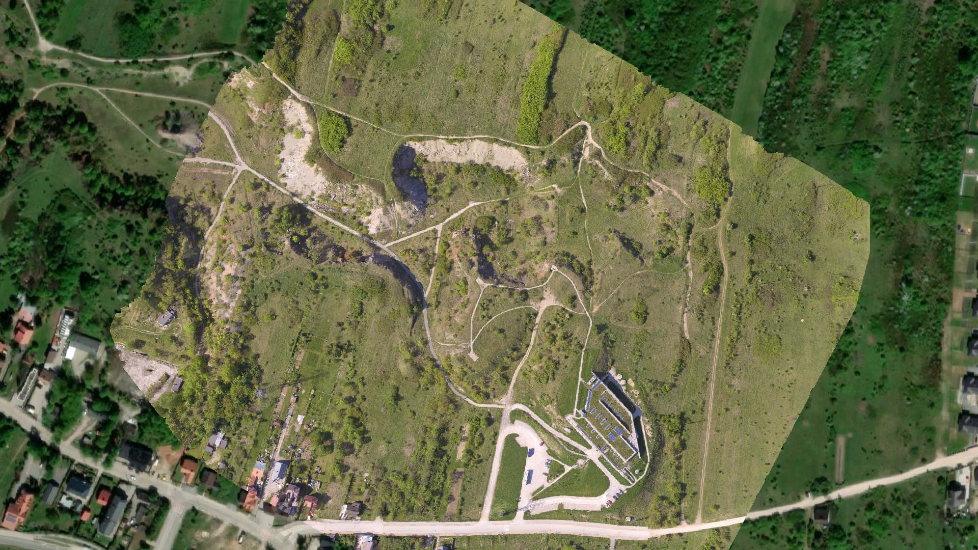
Here is a sample map processed in WebODM, in case you are curious what the final product may look like. (This was captured using a single grid mission.)
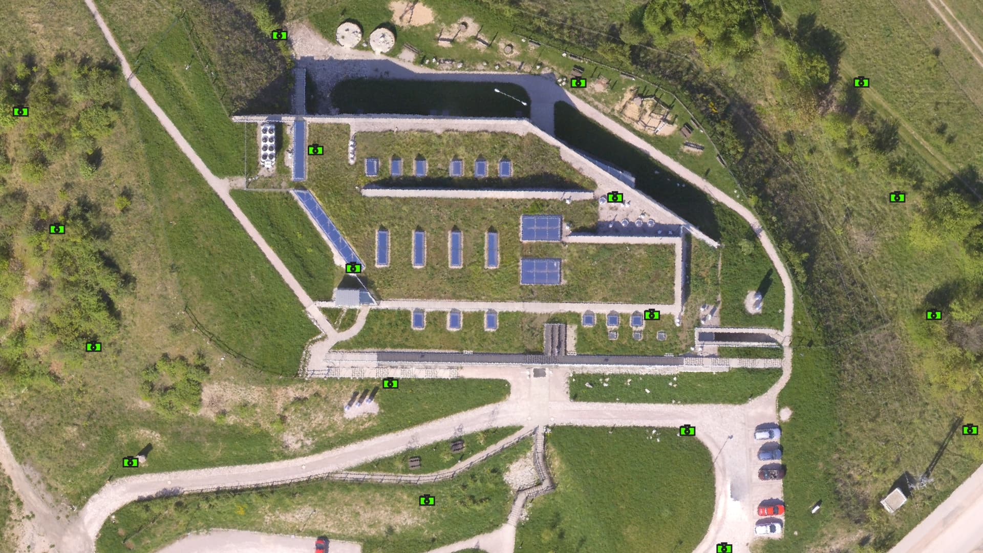
The GSD for this mission averaged 6.45 cm/pixel (2.53"/pixel). I have other ortho phots I can share from a project where the GSD is 1.6 cm/pixel (5/8"/pixel).
This image is at a scale of 1:5000.
This image is zoomed on the building and rotated to a scale of 1:1000.

And resulting orthophoto with photo locations.
1 Like
Hi!
Great tool. My problem is I can not get the Satellite Imagery tool to work. Only a blank white Imagery
Is it my fault?
Perhaps the area you are zoomed into is fully covered with snow.
Zoom out to investigate.
Hi Hi
No way. It is the same around the world in all scales, in all web browsers for me.
Welcome to the forum.
I don’t think this is your fault. I just tried it and see the same thing as you – enabling satellite imagery results in a blank white display.
The author of this utility has not posted here in a long time. It is possible that this utility is no longer supported and the imagery is no longer being provided.
There are other grid waypoint utilities available. I would suggest you try one of the others.
I’ve been using this for a couple of years and till 3 weeks ago and worked like a charm. Now I have the same issue with the satellite imagery.