In my Litchi app (v4.24.1-g), the setting for “Maximum Altitude” is empty. The mission I had created took the drone up the side of a hill, but when I look at the log in AirData, the maximum altitude is 497.7’. Is it possible the drone uses a max altitude of 500’ when the units are set to imperial?
No, the maximum altitude above takeoff point for all DJI drones is 500 meters, regardless of the units set.
That’s because this setting is stored in the drone itself and only becomes visible when your drone is connected.
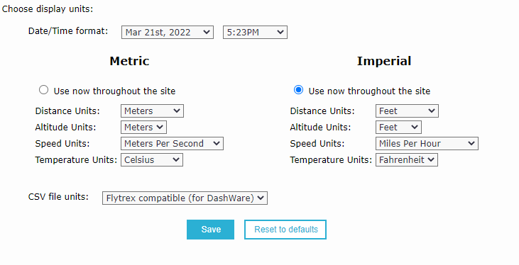
Are you sure you have set Airdata UAV to Imperial?
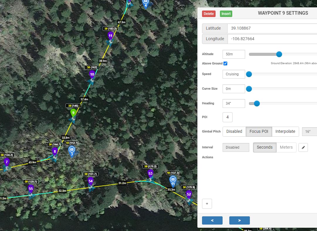
What happened on this flight, is that I was flying around on a rather steep hill, and so had a lot of waypoints that each set the altitude to 50 meters (not feet) above ground. But as I was watching the flight progress, the drone was heading straight into a tree (close to waypoint 9) and I quickly aborted the mission and brought it home. How can I figure out what happened?
1 Like
Here are the notifications in AirData:
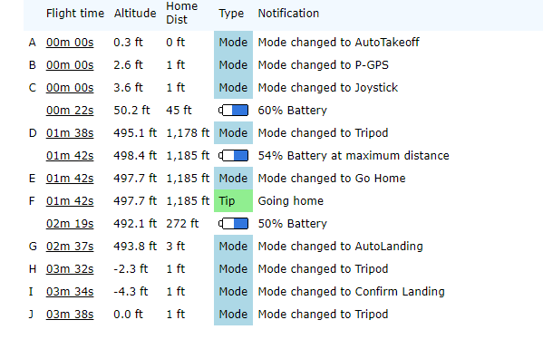
Does “at maximum distance” mean that’s the furthest away from home the drone got on this mission, or that it was reaching the limit of its radio communication?
1 Like