Where is the feature that allows importing KML and CSV files? Will the old platform ‘Mission Hub’ be deactivated? I hope not…
1 Like
You can import the old CSV format only for now. KML import is not supported yet. In the Flight Library, click on + then Import
Batch editing is a must
New Beta hub.
Where does the auto-save function save the missions to ?
Why is there not a mission save-to button ? That is save the mission to a chosen directory on the hard drive.
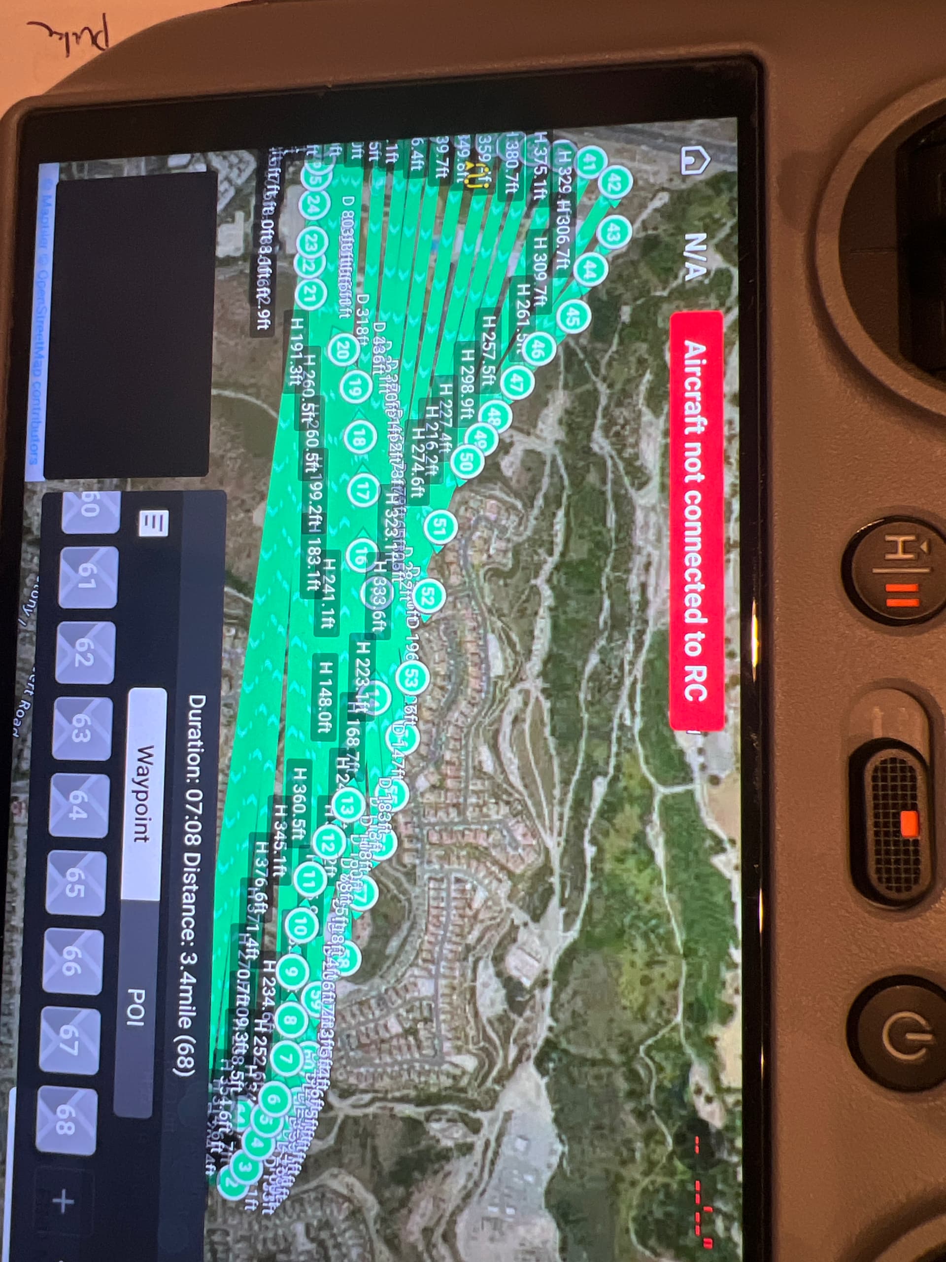
I spent six hours yesterday learning and making several missions, now today three of them are not listed and the other two will not open
because they show zero bytes ( empty file )
The auto-lock feature is damn annoying.
It auto-saves to Litchi’s cloud/server.
There is an “Export” function what allows you to save each mission in various formats locally.
More detail is needed. I have not experienced that.
Yes, I find that I am constantly unlocking missions so that I can edit them.
Ok found it ! Export Files goes to the google download folder.
These files do not open in Google Earth Pro, which is a disappointment, because I prefer that one.
Lost those files probably because I was renaming them incrementally, 1 2 3 etc as I was constantly
adding new waypoints and camera angles.
Re-naming files probably automatically deletes the previous files.
Google Earth Pro would require a KMZ or KML file. The Litchi developers are currently working on that export functionality.
New Litchi Hub Update Released
Here’s what’s new:
- You can now select multiple waypoints/pois to edit them together
- On desktop, use Shift + Click to quickly select consecutive waypoints
- We’ve made significant improvements and bug fixes to curved turn handling
- Waypoint actions can now be re-ordered
- And many other bug fixes!
Regarding auto-locking, is it when loading a new flight or when starting the simulation that you find it annoying?
1 Like
Both. And when editing a current flight plan.
Maybe we could have a separate button at the top to lock the mission.
When open Grid Mapping function ? thx~
Welcome to the forum.
The grid mission planning function is a new feature planed for the new Mission Hub. The developers have not shared a timeline stating when they expect to complete the mapping function. So, all we can say is that it will be available for testing when the developers feel it is ready for testing.
Will it always still be compatible with litchi running on the DJI smart controller for Mavic 2 pro? Its a life saver for sure.
The mission hub will continue to support the Mavic 2 Pro and other older DJI drones that have been supported in the past.
When I load a kmz exported mission, it looks like this in the rc2 remote. The path seems to still follow the correct order but I’m not sure why it looks like this.
Yours is probably a straight-line mission. For some unknown reason, DJI Fly is sometimes unable to properly display a straight-line mission. If you set the path mode to “Smooth curves” and load the KMZ into DJI Fly, it will display properly. This is a limitation of DJI Fly.
Got it. I’m using the beta mission hub and there isn’t an option for smooth curves anymore. It’s just curved turns which doesn’t allow me to export to dji kmz. Can the smooth curves options be added back in to the beta mission hub?
Using the straight line option, the drone always slows down before each waypoint and turns to the new heading. The smooth curve option allows the drone to fly through each waypoint at full speed.
Glad to hear older DJI drones will be supported as I’m flying an original Mavic Pro. Separately where do I report an ongoing problem with the new hub when I try to export a mission to Google Earth Pro?
TIA Dave
When I change the altitude at a waypoint, does the drone stop moving [horizontally], change altitude, then resume moving towards the next waypoint? Or is there a way to gradually change altitude between waypoints?
For example:
Waypoint 1 altitude 500 ft.
Waypoint 2 altitude 1000 ft
I want to gradually go from 500ft to 1000ft between waypoint 1 and waypoint 2.
I don’t want to travel between waypoint 1 and 2 at 500 ft, and then straight up vertical climb to 1000 ft at waypoint 2.
I would like to see a feature that can estimate flight transmission range/distance.
There’s a lot of variables for this feature, but I’m flying the same location a lot, with different variables (mainly altitude), and I think the app can track the distance when the transmission is lost and mark it on my map. Between altitude and distance, there can be a range ring or overlay, or some sort of alert while planning.
1: POI Orientation
While flying along the waypoint path, I would like to see which way the camera is pointing. I can see the direction the drone is traveling, but I can’t see which way the camera is pointing.
I am assuming the camera will orient towards the POI. But the information is not indicated on the map. Also at the next waypoint, I can’t easily see what is going to happen when that waypoint is no longer oriented towards the POI.
Would be great to see a dotted line towards the POI, arrow for camera orientation, gimbal info, flight path direction arrow, and a FOV on the map.
Would also be nice that once I’m no longer focused on the POI, it resets/resume to whatever setting I previously had. POI orientation is just something temporary as I’m flying by.
In addition, if I select to orient towards the POI, that should also include the gimbal pitch.
#2 POI Name
I would like to name POI’s.
#3 Home:
“Home” should be included.
I would like to be able to select “Home” as a POI. So when I complete the mission, the drone flies towards home, and I want the camera/gimbal to be focused on the home.
1 Like