Does anyone here own a Mavic 3? I am writing a utility to convert a DJI Mavic 3 waypoint mission into a Litchi mission. I need some example Mavic 3 kmz files for testing purposes.
If you have a Mavic 3 and would like to provide some sample data, please let me know.
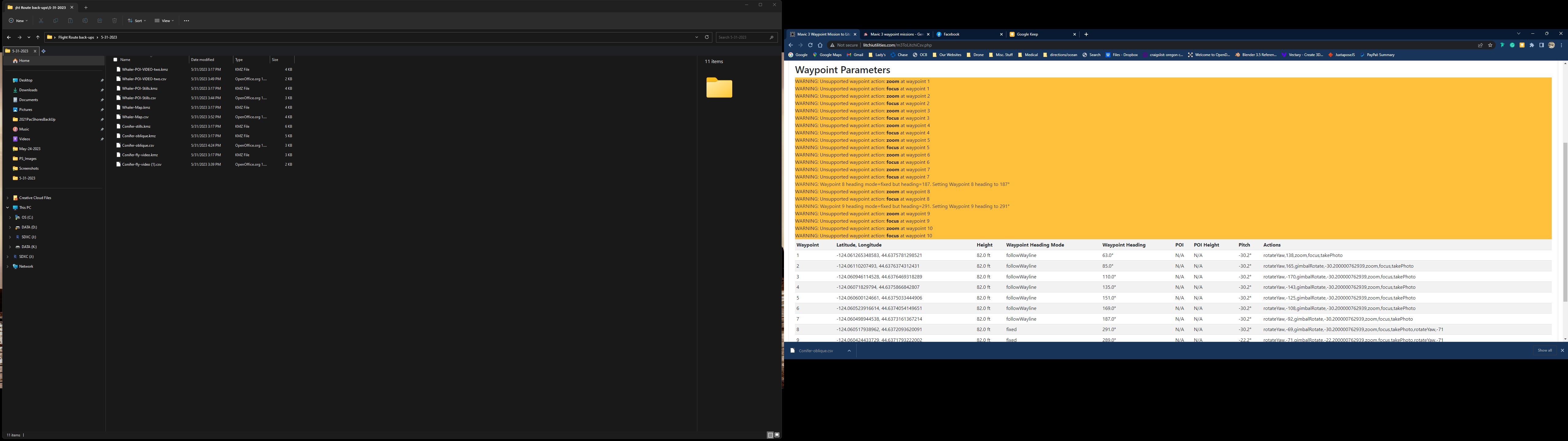
I have an “alpha” version of the “Mavic 3 Waypoint to Litchi” converter ready for testing. Because it is based on seeing only one Mavic 3 KMZ file, there are undoubtedly cases where it will fail. If it does fail, please contact me. I need to examine more Mavic 3 KMZ files to ensure that this converter will work reliably.
I would think they are the same. Yes, I would like to see some examples. I also have a “Litchi To M3” converter mostly written. However, I need to see more sample kmz files first.
I just bought a Mavic 3 and I want to experience with waypoints. I had first a Mavic 2 zoom and used Litchi verry often. So I am interested in what you are doing.
So far I can see now the waypoints in te Mavic 3 don’t use online elevation . Is that correct?
When I have more experience with the Mavic 3 I will send you exemples of missions.
Yes, that is correct. However, neither does the Litchi app. On-line elevation is only used in Litchi’s Mission Hub if the “Above Ground” option is checked when planning missions.
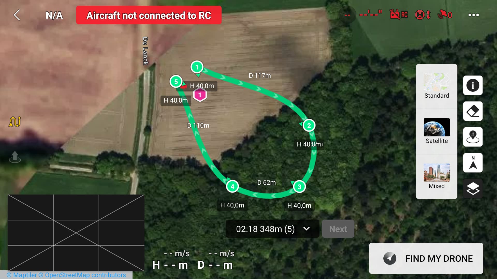
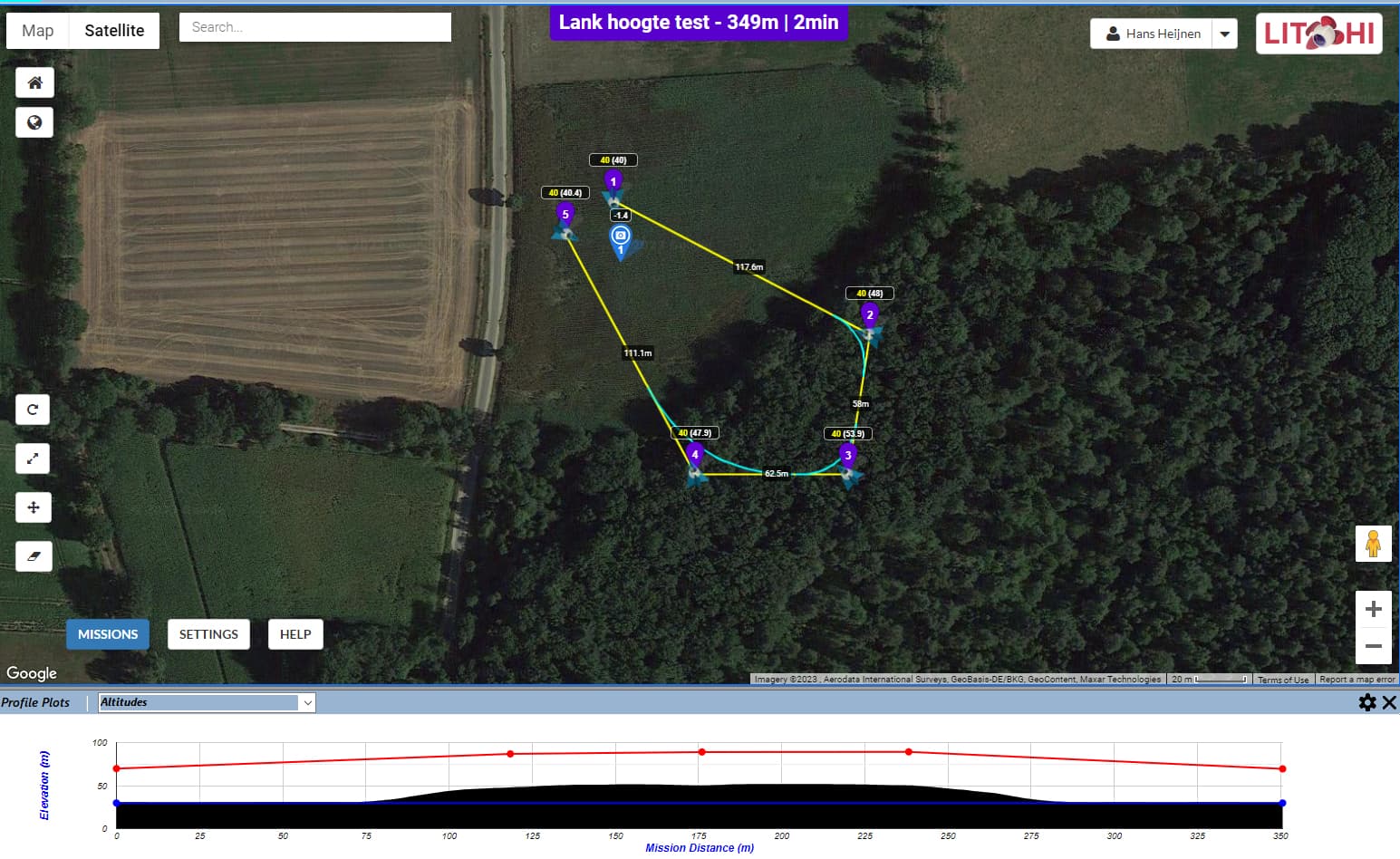
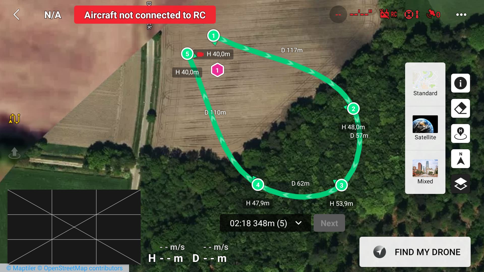
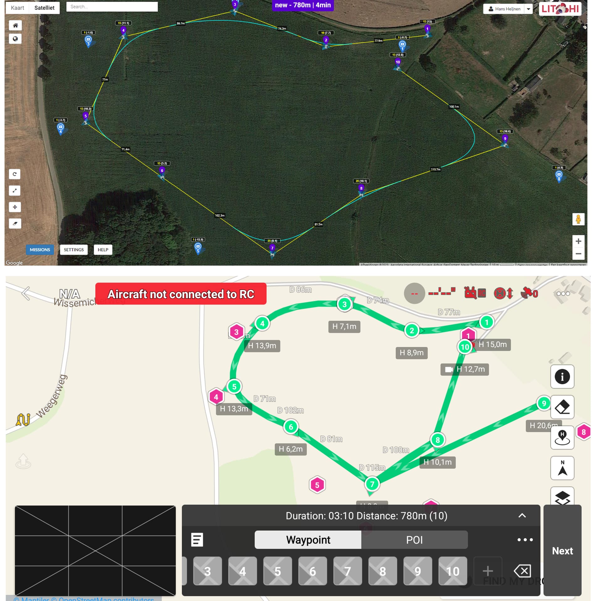
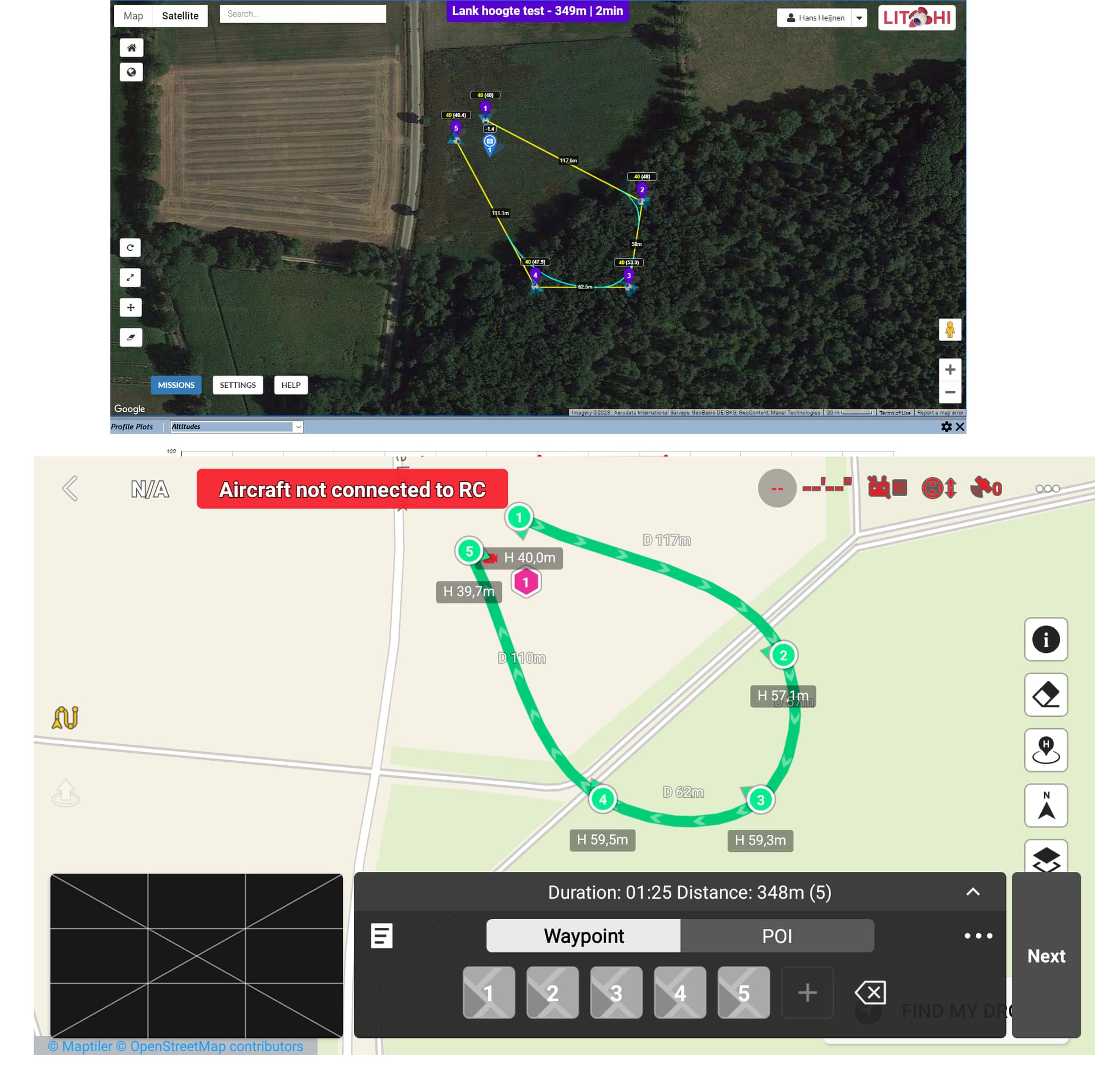
I converted a Litchi flight (CSV) to the Fly app (KMZ), see both screenshots.
You say On-line elevation is only used in Litchi’s Mission Hub if the “Above Ground” option is checked when planning missions.
In Litchi’s screenshot, you see that terrain elevation is taken into account and the converted version in the Fly app does not. Therefore, isn’t it tricky to use this conversion in the Fly app?
You are correct. This highlights an unfortunate difference between exporting a Litchi mission as a CSV file and flying a Litchi mission using the Litchi app.
In your case, you set the height of all waypoints at 40 meters above ground. When flying this mission using the Litchi app, the drone will fly to the heights shown in parenthesis at each waypoint. WP1=40, WP2=48, WP3=53.9, FP4=47.9. However, when exporting this same mission as a CSV file, the above-ground heights are written to the file. WP1=40, WP2=40, WP3=40, etc. If this CSV file is converted to an M3 mission, it uses the values in the CSV file which are all 40 meters.
This is an unfortunate result of only storing the above-ground heights in the CSV file. I wish we were given a choice. There is a work-around. Depending on the number of waypoints, this may be time-consuming.
In Litchi’s Mission Hub, create your mission as you have already done with the “Above Ground” option checked. Then, at each waypoint, enter the height shown in parenthesis and uncheck the “Above Ground” option. Do this for every waypoint. This way, the above-ground heights will be written to the CSV file and those same above-ground heights can be converted to an M3 mission.
I have modified my “Litchi to Mavic 3 Waypoints” converter to make a Google Elevation API call when converting a mission with the “Above Ground” option checked. This enables me to adjust Litchi’s “Above Ground” heights to “Above Take-off” heights in the Mavic 3 mission. Please give it a try.
That is weird. Looking at the WPML code, I do not see what would be causing that. Would you do two things:
Please try converting your Litchi mission using this temporary development version of the converter and then load the resulting KMZ file to your flying device and see if it changes anything.
[link removed]
Please create a similar mission using DJI Fly (the exact coordinates do not have to be the same) and then send both the DJI KMZ file and your Litchi CSV file to me. I would like to compare my conversion with your DJI file to see the differences.