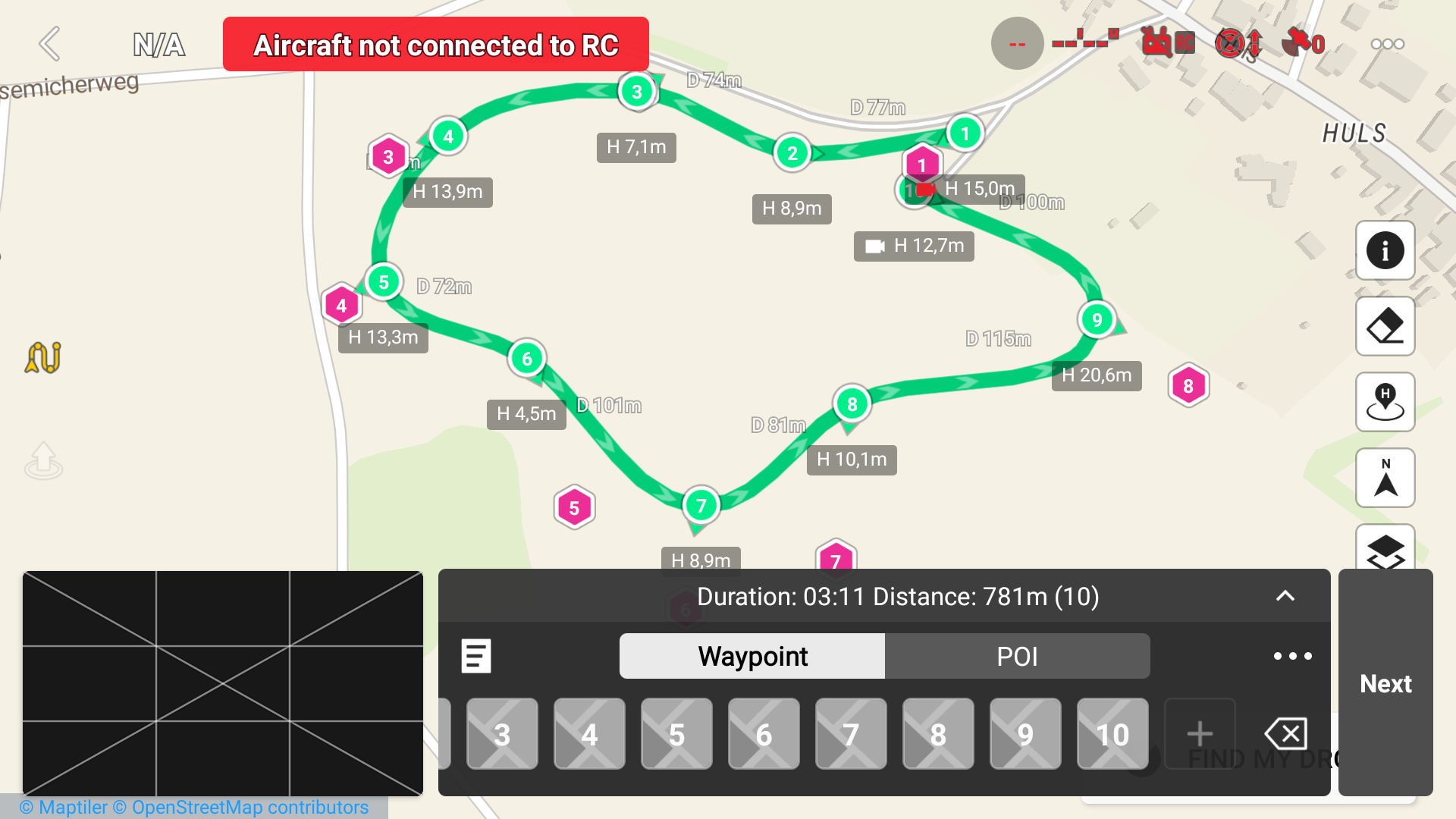
Your waypoint 6 appears to be inline with the two waypoints on either side. If Litchi is using a curve size of 0 (zero) for waypoint 6, that will cause the WPML data to use a straight line at that waypoint. That is not a WPML error but I don’t think that DJI Fly provides an option for straight lines so it is unclear how the DJI Fly would handle that case. I can see from your DJI Fly snapshot that from waypoint 6 onwards, the mission uses straight lines (and is weird).
Please try setting the curve size at waypoint 6 to a non-zero value in Litchi’s Mission Hub. Then use my utility to convert the mission and load the KMZ file into DJI Fly. Let me know if this work. If it does, I’ll remove the straight line option from any converted mission.
Excellent. Thanks for that. I’ll make a change to my application to prevent straight lines when using a Mavic 3.
I have noticed that the results from Google’s Elevation API are a little different from what I see in Litchi. Send me your Litchi CSV file and I’ll manually do an API call and post the results. You may have to send me a private message to attach a file.
Yes, I received the CSV data. I have tried a couple different ways to query the elevation data using Google’s Elevation API. Both ways have returned the same values. These values yield slightly different results from what is shown in the Mission Hub. However, these values do match what I see in Google Earth Pro.
Thanks for the quick responses and good luck with your further investigation
You say : ‘‘These values yield slightly different results from what is shown in the Mission Hub’’
I would like to point out that in the Lank.csv flight, however, the differences are much greater
What method does litchi in the Mission Hub use for determining height?
My calculations that I use in my mission converter match what I see in Google Earth Pro. I can only conclude that Litchi is using a different elevation model from Google’s, but I don’t know what elevation model that is.
OziExplorer uses NASA’s Shuttle Radar Topography Mission (SRTM). I found in OziExplorere the following SRTM values for the five waypoints:
wpt 1 28 m
wpt 2 37 m , so + 9
wpt 3 40 m , so +12
wpt4 36 m, so +8
wpt 5 27 m, so +1
The looks very similar to the values used by Litchi.
The accuracy of the data is not high; the maximum deviation in altitude is about 8 meters. The NASA data has certain drawbacks: there is no data north of 60° N or south of 60° S, and there are gaps in the data for some mountain and desert areas.