Help request: Mavic 4 Pro - Hub>Fly workflow, in-field without computer or internet

Hello,

I have multiple questions and, rather than starting new threads for each, or randomly asking in existing threads, I hope you’ll agree that putting them here in one place will be better for context and cohesion.

I’m using the Mavic 4 Pro (w/ RC Pro 2 controller) to video “map” several hundred acres in a remote area with no internet (and ideally, no laptop or tablet once in-field). My questions are:

  1. What are the waypoint limits for the Mavic 4 Pro/RC Pro 2? I read somewhere that it’s 450 waypoints. If so, do I need to stay within 450 waypoints per mission, or can I create a mission with say 1200 waypoints and split it?
  2. Best battery swap/resume mission method? If a battery swap is needed before the mission completes, or if it needs to be aborted due to high wind, precip, manned aircraft, etc. is there a way to know what the last waypoint completed is without writing it down at the moment of RTH? AFAIK, auto resuming is not currently an option.
  3. When changing the flight speed, the mission duration estimates aren’t changing - is this a known bug? Any workarounds (other than calculating it manually based on the speed and distance)? The test mission that I’m learning with right now is 8.58 total miles, but the total time estimate is 35:44 even if flight speed is maxed out at 33mph.
  4. Minimum overlap workaround? The minimum overlap is stuck on 10% - it would be helpful to be able to set this to lower numbers. In our case, we’re not creating an ortho, so being able to set it to something like 5% (or lower) would help us save time and batteries (both in-field and when later analyzing the footage). Is there a workaround?
  5. Recording behavior - I assume that, when the waypoint action is set to record, that recording doesn’t start until the first waypoint; if we instead start it at takeoff, will that cause an issue with the mission?
  6. When the Mavic 4 Pro’s gimbal is nadir, it frequently flips up (to 0 degrees, or somewhere in between) when the drone accelerates/decelerates, even at slow speeds. We’ve experimented with the settings/EXP, but haven’t found a solution. What do you think the behavior will be using this Litchi>Fly method? My guess is that when the gimbal flips up, it won’t go nadir again until the next waypoint - but I don’t know if the gimbal gets instructions for its tilt at each waypoint (as an aside, it would be useful if Hub didn’t force nadir as the only option for 2d maps).
  7. After reading some threads here, it’s my understanding that Path Mode should be set to Smooth Curves for all missions now. In one of the threads, there was discussion about how this can cause the drone to descend below the waypoint. We will be using Altitude Mode = Above Ground for terrain following. Due to tall pines in the area and the need for approximately 1.2cm GSD, we don’t have much wiggle room. Does the drone still descend below waypoints in the current version, or has a solution/workaround for this been found? Or, should we use Straight?
  8. If we split up our missions into say 150 acres each and transfer them all to the controller ahead of time, when we’re in the field, will we still need internet and/or a tablet or computer in order to do this overwrite process for each mission?
  9. How can we view “nearby/previous” missions while planning? This is crucial in order to see where to lay the polygon boundaries for subsequent flights. Especially when the new areas needing to be flown are not yet known.
  10. Ideally, we can Continue the mission upon signal loss (USA location) - does anyone have feedback/confirmation that this is working without issue for the Mavic 4 Pro/RC Pro 2 (the M4P is of course technically an international model)?

Many thanks in advance, I know this is a lot to tackle. FWIW, this is for a good cause, so any and all help is sincerely appreciated.
  1. to our knowledge the only limit is how powerful your phone or tablet is, I very much doubt there is a limit of 450 waypoints in DJI Fly
  2. probably keep track of the waypoint number on the DJI Fly display is your best bet. We cannot add features such as auto resume to DJI Fly, for that you’ll have to use Litchi Pilot and a compatible drone model among the ones listed here: [OPEN BETA] Litchi Pilot
  3. please share a link to the flight so we can diagnose the issue (guide to share a flight: [GUIDE] How to Share a Flight or Folder)
  4. added to our backlog
  5. Should not cause any issues
  6. strange issue, have you tried to disable obstacle avoidance? the gimbal should stay at -90 all the time when in 2d mapping mode
  7. you can always check the flight path in 3d or google earth map view, that will answer your question directly. we have tried to make sure this issue is minimized
  8. if you transferred the flight, then they’re already overwriten therefore you don’t need to do it again in the field
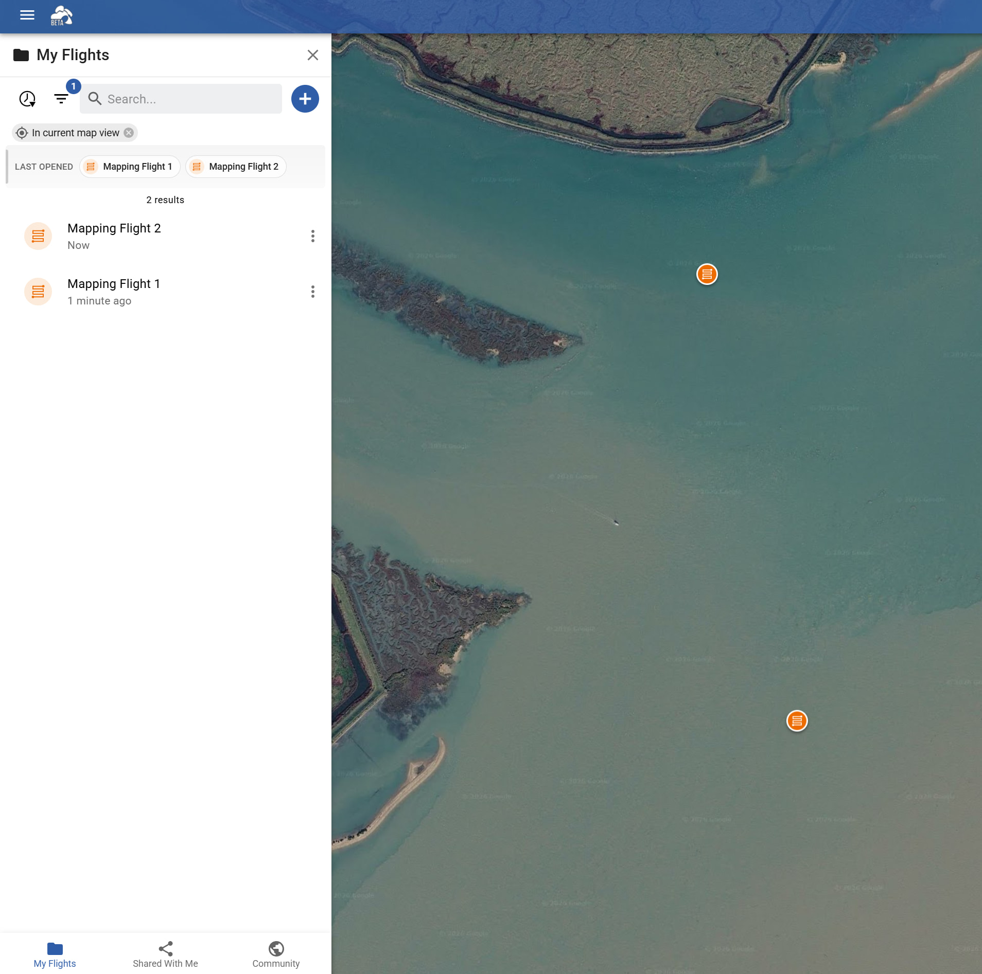
  9. Open the flight library, then you can see all your flights on the map displayed with blue map markers, click on a marker to open each flight. Only one flight can be open at once.
  10. Should work in theory but I don’t live in USA nor do I have a M4P so cannot confirm.
1 Like

Thanks, Vico. This is very helpful.

Following up:

1. This is great news. If anyone with an RC Pro 2 (or other DJI smart controller) can share what they’ve found to be their upper limit, it will help us plan.

2. Happy to do that privately. Or, I could do a screen recording of the left panel and upload it to an unlisted YT link. Otherwise, if you (or someone else) could DM me with an email to share it to, I’ll get that sent over. Also, I have not yet connected the controller while planning in Hub - not sure if that’s relevant.

6. We’ve tried changing OA to brake (which we saw in a YT video changed the entire stick responsiveness) and we’ve definitely had OA off while in Sport mode, but I’ll have to double check if we’ve had it off in Normal mode. The M4P (at least our unit) does not fly like any other DJI drone we’ve flown in the past (which is most of them, including enterprise models). It’s very touchy, even in Cinema mode. I suspect the gimbal design itself is the issue (related to this, the aircraft cannot fly at max speeds with the gimbal down), but hopefully FW can mitigate it. Also clarifying, this is in manual flights - not sure if the behavior would be different when flying waypoints.

8. Ok, good. And this is the case, even if we have say a dozen missions to transfer for the day?

9. Can you please elaborate on this? Within Hub beta, when I open the left nav, I see a list of flights, but they’re only plotted on the map one at a time. What we’re hoping for (and this is critical for many mission types across many industries/use cases) is the ability to have all the previous missions plotted on the map at once and to then be able to use this information to create a new mission and set its boundaries to align with one or more of the previous missions. Without this, I don’t see a way to ensure contiguous coverage of an area (within Hub, and without first having to create KMLs in GE/GEP/etc.). Even if the waypoints could be set via specific coordinates (which is another useful feature to have), it would be very time consuming to have to grab them from the previous missions and set them for the new missions, particularly with irregular polygons with many boundary waypoints like we typically have in wilderness areas. In most non-drone map apps, one can create unlimited polygons, that all exist on the map at once, and then grab their boundary waypoints to quickly adjust and align them as needed.

10. Understood. If anyone else is able to confirm this functions as expected, please do.

Thanks again.

2 .You can either share a public link and paste the link here, or share it privately with our account vctech@flylitchi.com (do NOT send an email, just share the flight with that email)
It’s not required to connect your RC to the Hub.

  1. No difference no

  2. This is what I mean, you can see the markers indicating where each flight is, you can not however open 2 flights at once:

Hi,

Re: 9, I don’t understand how Litchi pilots are planning their flights within Hub then. I’ve rarely flown a location without the need for multiple contiguous mission polygons and, without this basic function, we’d have to create the polygons in GE/GEP/etc. first. Is this in the pipeline to be addressed?

Thanks again for helping us learn the app.

For a large area you usually don’t need several polygons at all. Draw a single polygon over the whole area, then in the export dialog pick DJI KMZ and enable Split into Multiple Flights, setting Max waypoints per flight and/or Max flight time per flight. The Hub splits the survey grid into as many flights as needed and each one starts exactly where the previous stopped, so coverage is contiguous by construction and each part can be sized to a battery. I just tried this on a 2300 waypoint mapping flight: at 150 waypoints per flight it exports 16 flights. That also covers your question 2, since each part is its own flight in DJI Fly.

If you do prefer to work polygon by polygon, note that you don’t have to retrace anything you already have. In the mapping flight settings there is an Import Mapping Area button that accepts KML, KMZ and GeoJSON, so a boundary drawn in Google Earth or any GIS tool becomes the survey area directly.

To keep earlier flights visible while planning the next one: open the previous flight, Export it as KML, then Import that KML back into the Hub. It is added as a Map Overlay (Map View Settings), which stays on the map independently of whichever flight is open, with its own on/off toggle, color and opacity. It shows the flight path rather than the polygon outline, but for a mapping flight the extent of the lanes is exactly the area that was covered, which is what you want to align the next area against.

To answer your question directly, no, showing several flights at once is not in the pipeline as this is the first time we have had that request.

There is no hard limit for the number of waypoints in DJI Fly. Instead, a waypoint mission is probably limited by size of the WPML data. The WPML language is very verbose. Adding a camera action adds as much code as adding a waypoint. I’ve worked with people who have flown missions with over 800 waypoints (with no actions) using an RC Pro. The only way to find out how large a mission can be loaded and flown with an RC Pro 2 is through trial and error.

In my mapping missions the flight duration changes with changes to the flight speed. Is this happening on all of your mapping missions or only on one of them?

This will only occur under specific conditions. Knowing that on the newer DJI drones with native waypoints, the flight path is forced to pass through each waypoint. If a series of waypoints are configured a certain way, the flight path may be forced to be lower than any of the controlling waypoints. Using the Google Earth view is the best way to check for this. I have not heard of this happening in mapping missions.

All DJI models are “international”. Country-specific behaviors are controlled by the firmware and GPS location. A DJI drone flying native waypoints in the USA is able to continue flying the mission upon signal loss. You can easily test this in a safe area by flying a mission and then turning off your controller to see if the drone continues or returns to home.