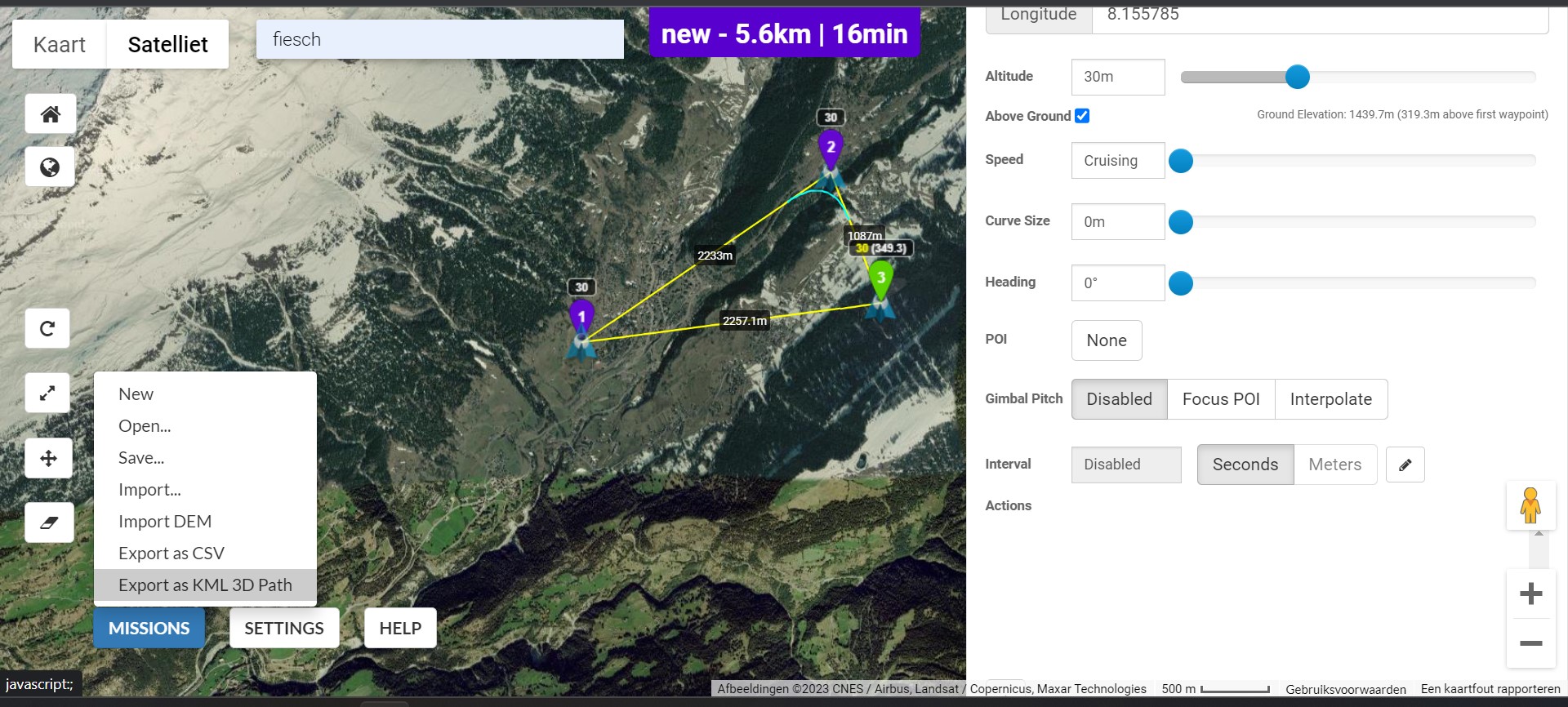
What am I doing wrong. I’m making a test waypoint for when I go to Switzerland. I make a random route and when I want to see the example in Google Earth 3D the route goes through the mountain it seems. When I actually do the flight, would it crash into the mountain? I set the max height to 500, but at 30 exactly the same problem.
Maybe the mountains are much more than 500 Metres higher than your launch point.
1 Like
I indicate above ground in the menu. Isn’t it the case that he will fly the indicated height above the ground?
@Philip_Groenendijk
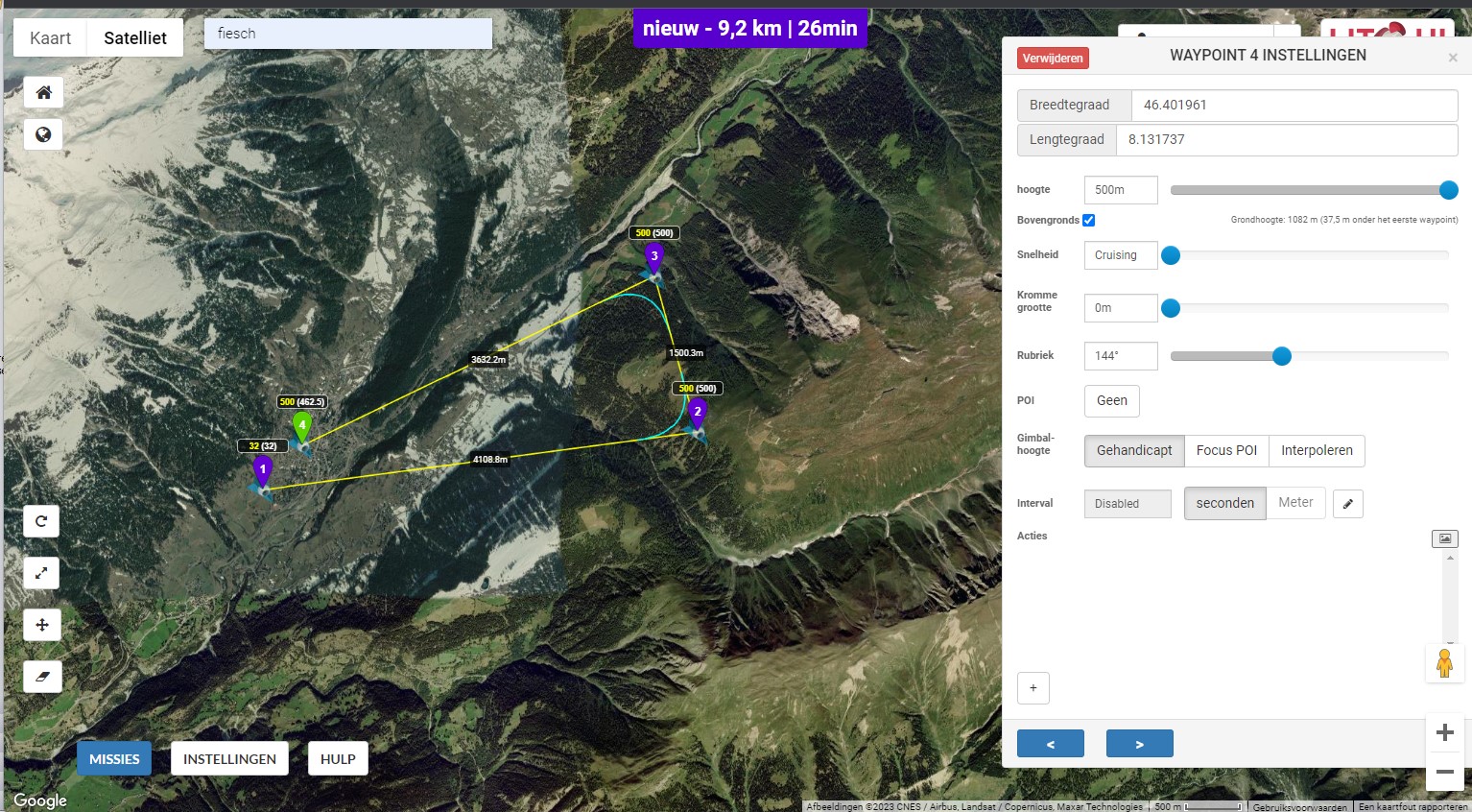
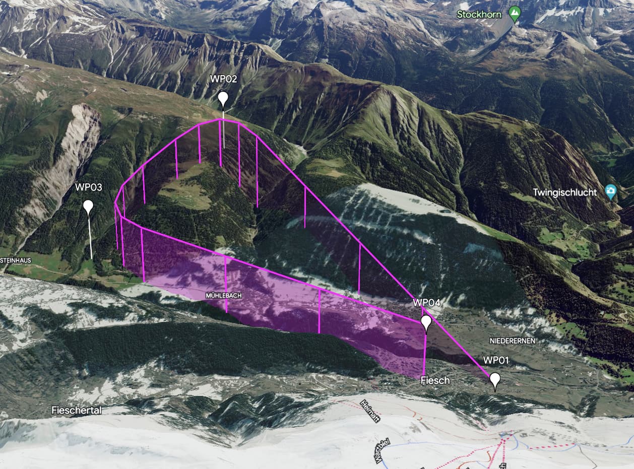
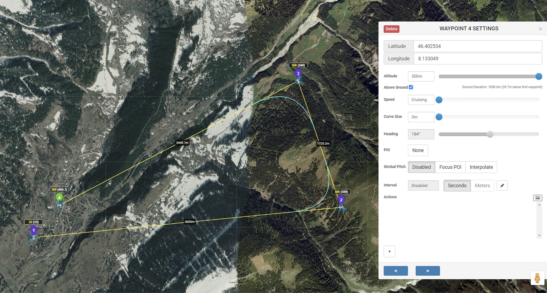
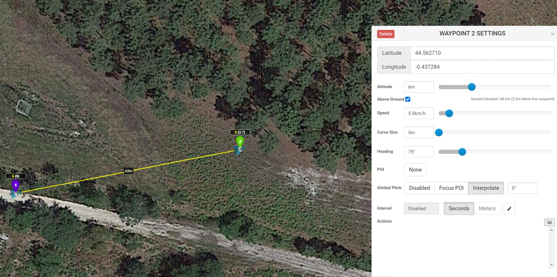
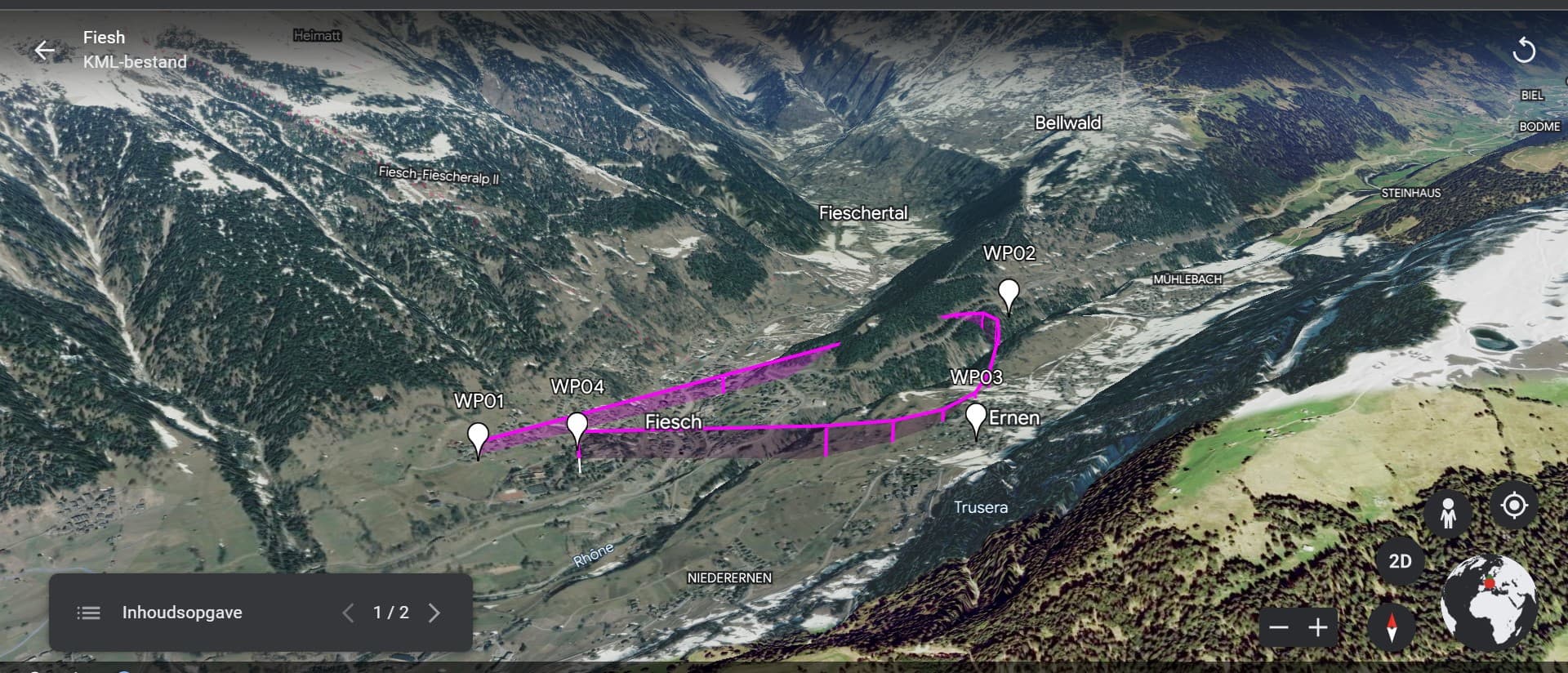
I could not duplicate your error. I picked waypoints close to yours and I get this view of the flight in Google Earth.
Then I’ll take a closer look at what I’m not doing right in Google Earth. So it works well above ground. Thanks for your reply
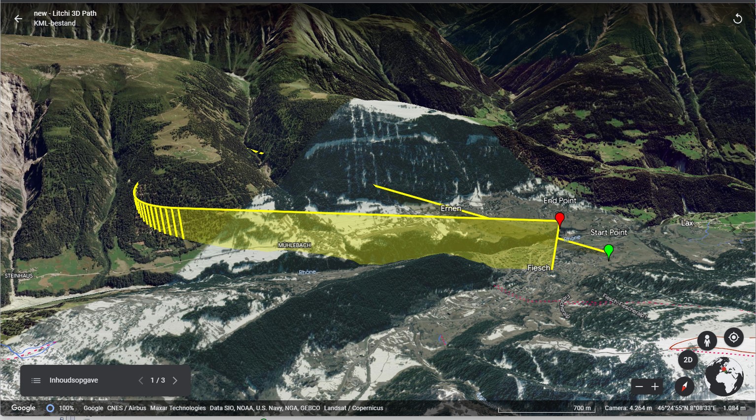
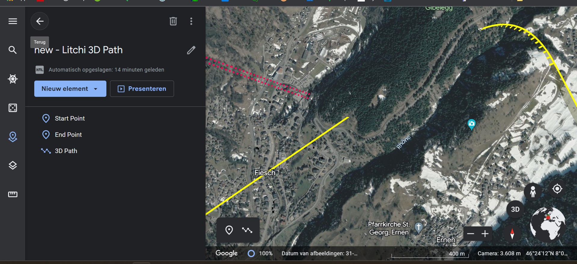
No idea what I’m doing wrong. It is still export as KML 3D path and then open in Google earth. Or is it not that simple.
If you would like to share your mission, we can look at your actual settings instead of trying to duplicate what you have set up.
Not always, be careful…
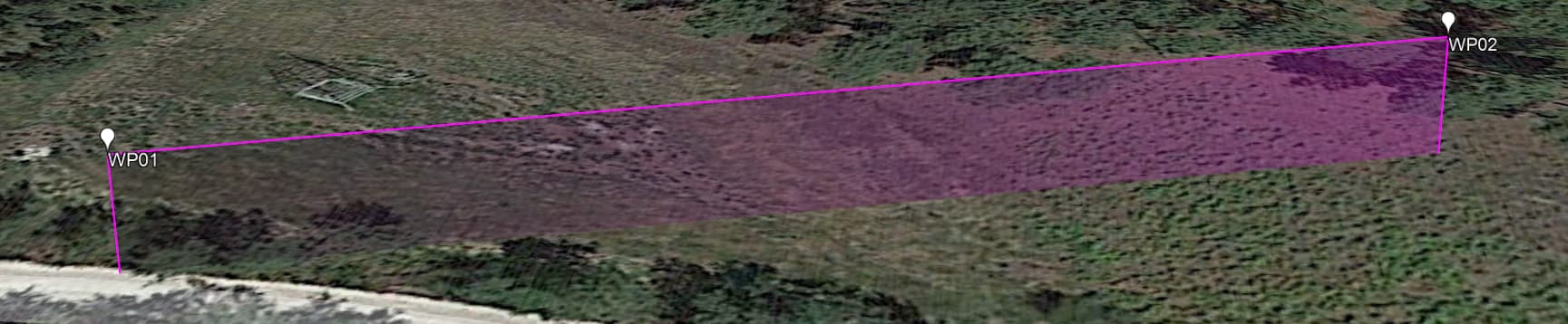
In this case, if you export to google earth it’s OK but if you fly with Litchi at 3.7m you crash the drone:
the settings in Litchi or Google Earth?
Yes I did not see that.
It should have gone over the mountains.
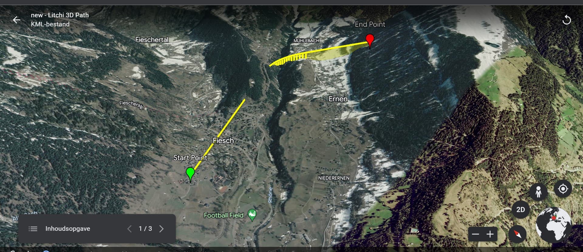
like this? Mission Hub - Litchi
Are you:
- Creating the mission in Litchi Mission Hub
- Exporting as VLM
- Importing the KML file into Google Earth
This is the screen selection I see in Google Earth
Unfortunately I have to go out now. I’ll look into it further tomorrow. Many thanks to everyone for the responses.
When you have hill (or mountain) between waypoints like you have between WP01 and WP02, Litchi will not make an altitude change to go over that hill. Litchi only knows what to do at waypoints and it will interpolate altitude changes between waypoints if the waypoints are set at different altitudes.
To get over that mountain between WP01 and WP02, you will have to add a waypoint between them at the peak of the mountain. Then, it will fly fine.
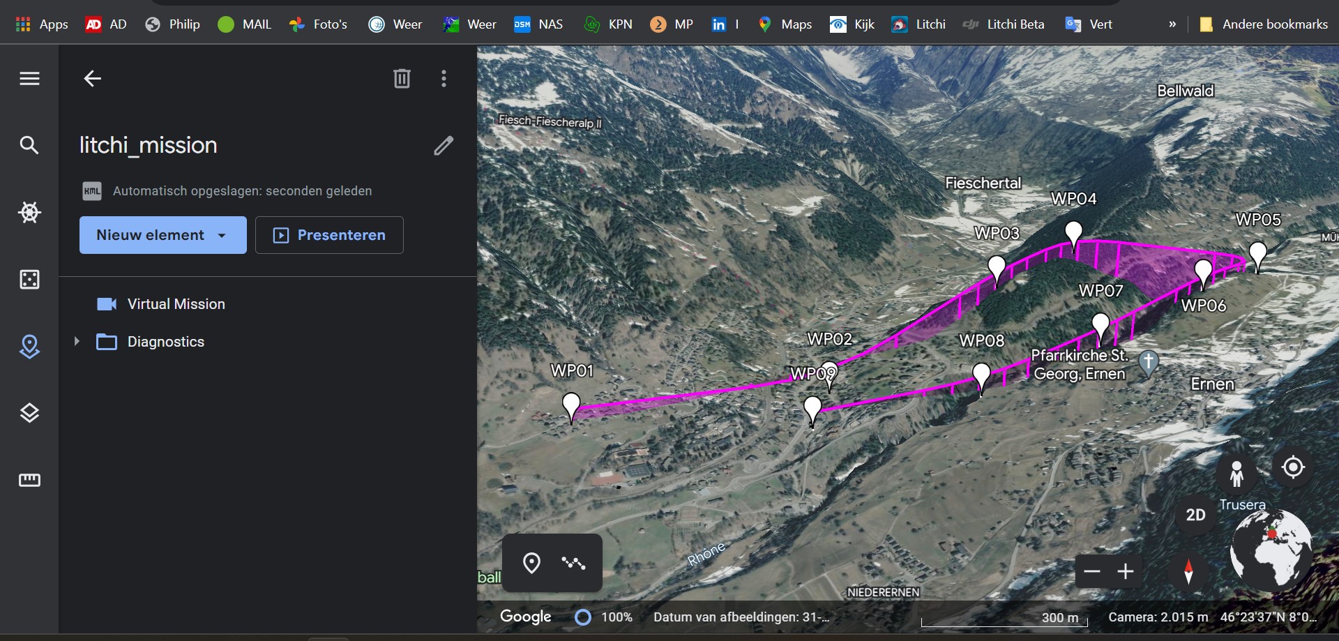
couldn’t resist picking it up again. After extension VML and the good heights with enough waypoints it works thanks to your help. Just making waypoints in a mountain area is quite dangerous. But when you know the situation, I think it’s doable, but not huge distances. This link takes you to my Youtube video, made today with the Lichi Beta for the Mini 3 Pro. Everything flat ![]()

You’re right! It is a bit unnerving to venture into uneven terrain without some degree of confidence.
Its very doable and satisfying when you work it out. Cant wait to see some of your final footage. ![]()