извините, я не могу ответить все по-русски. если вы ещё не можете понимать, пожалуйста дайте больше вопросов.
Z-check is a setting used to balance how often a waypoint is created along a line. As you increase Z-Check, less waypoints are generated, but photos are still taken where a waypoint could be (Photos by distance interval is implemented).
These are the main ideas behind this setting:
-
Drones slow down when they approach each waypoint, costing extra time. The less points you have, the faster you can fly. I can’t change this mechanism.
-
Waypoints are the only way to adjust elevation to match the terrain. You need waypoints if you want good consistency in photo detail.
-
We can compensate with how many waypoints are needed, based upon how demanding the terrain beneath us is. If we fly over a flat farm, only waypoints at each end of the line are needed. When there are hills, etc, we can reduce Z-Check to update our elevation more often.
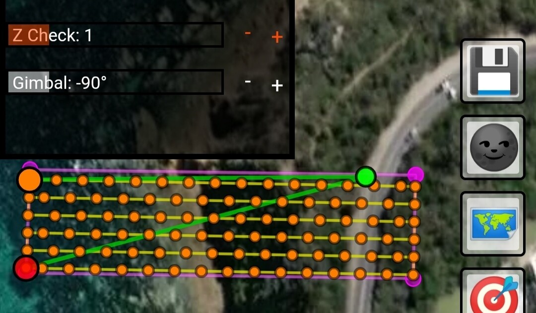


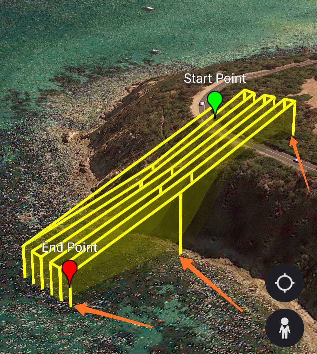
The higher Z-Check is, the less often we observe the difference in elevation between the terrain and the drone. Please also observe that digital elevation model isn’t exactly perfect to begin with. You can see how dangerous it can be to fly near cliffs at low elevations.
Another way to describe it could be “Waypoint Frequency”