Again it’s been answered but roughly on the web app.
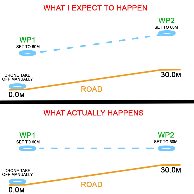
Using the phone app (iOS) when I setup a waypoint mission on a straight road with a hill.
I set WP1 altitude with the slider to 60m.
I then set WP2 altitude with slider to 60m.
(Hoping it will know that the road is on a hill and rises by 30m)
WP1 should be 60m above the ground.
If the road hill rises to 30m at WP2 then surely the drone should be 60m above the road? So to keep 60m above the road it should go up by 30m?
When I get to the site I put the drone on the road and start in FPV MODE. I take off and fly the drone up above me. I then switch to WAYPOINT MODE and load the plan. I press PLAY and it goes to WP1 at 60m but when it flies to WP2 it does not rise up with the road?
I don’t have that setting in the app as per photo. So when setting WP altitude I need to know the elevation of the hill and add accordingly? The app doesn’t have the height data from the map?
I thought with the pictures attached even you could understand? I appreciate the effort however that you put into your useless answer. Do you use that practice in your daily life?
But it doesn’t work. Some kind of application bug. The application needs a request to hub.
But even if you adjust the height. For a height of 0 meters, the drone will consider the takeoff point. If you take off from the hand, and not from the ground, then the mission height will be + 1.5 meters.
Oh daaaang! So that would then go to show that the app map does indeed have height data! Shew, I wish there was an admin from Litchi or employee that could iron this all out finally! (Iron it out! Flat… )
Relative to takeoff point ONLY.
Takeoff point and waypoint 1 or NOT the same.
You can have WP1 500m away and at a different groundlevel than the takeoff point.
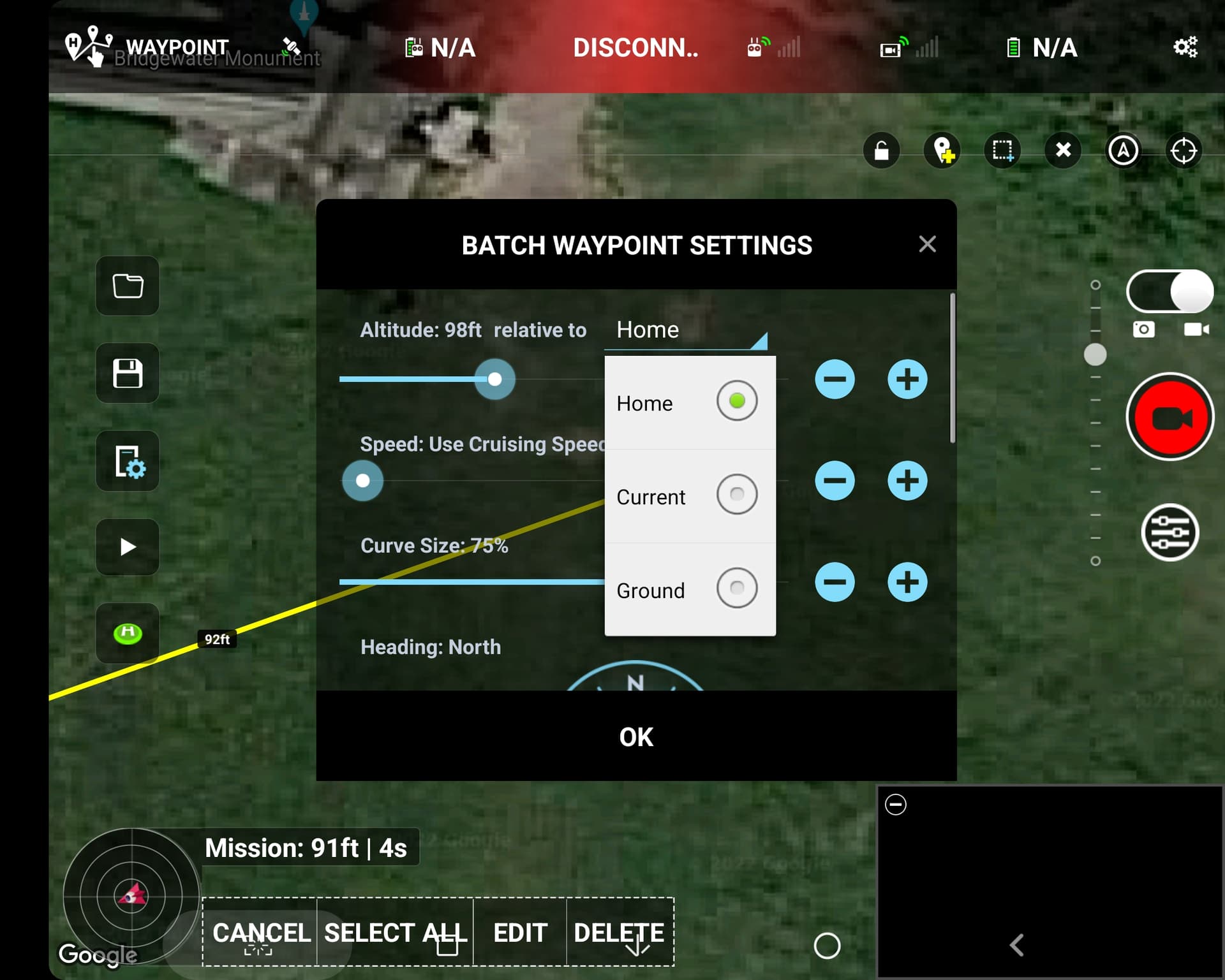
Relative to ground ONLY works in the Mission Hub !
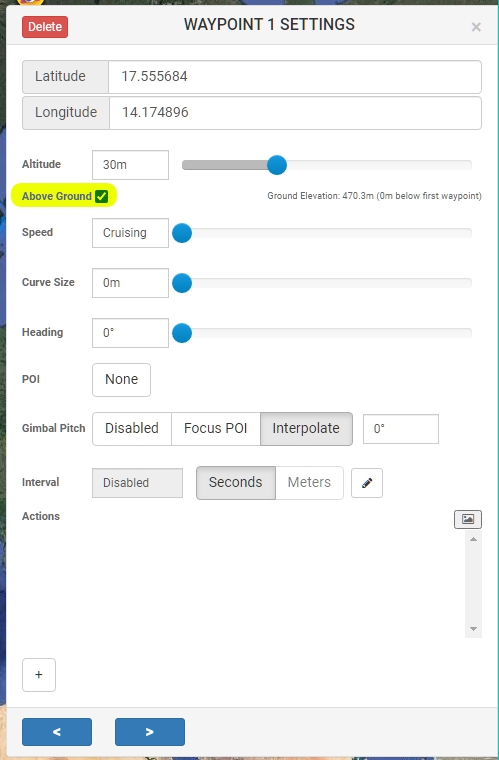
By default waypoint altitudes are relative to the take off point (which is also usually the home point). If you enable the “Above Ground” option in the waypoint settings, the altitude you enter will be relative to the ground below the waypoint. The “Above Ground” option can only be enabled if elevation data is available for the waypoint (see Elevation Data section below). When “Above Ground” is enabled for a waypoint, the waypoint’s icon will show 2 altitudes, the altitude above ground (yellow) and the calculated altitude (white) relative to the take off point which will be the altitude sent to the drone. Important To calculate these altitudes, it is assumed the first waypoint is in the same location as the take off.
The drone cannot know the height of the sea level. The drone always calculates the altitude from where it took off.