It would be great to be able to create a mission from flightlogs such as Airdata csv files.
The flightlog includes all necessary info but is complicated to extract to a limited number of waypoints.
You can do it through the mission hub
I would like to have such a function in a smartphone.
This would be fantastic, have tried importing the waypoints from an airdata csv or kml, lots of waypoints to have to filter out, time consuming.
2 Likes
This app already exists :
Just tried this and got a file too large error message
Would you tell me the size of the file (in kb) you are trying to upload?
Hi Wes, the flight log i tried it with is 3784 KB, if you like i can PM you a dropbox link to the file
Please do. That file is much larger than what I’ve encountered before.
Same here, works good for some smaller missions/flights, however throws error about file being too large. A smaller mission with more turns and movements that was 9KB worked. Larger files in the 1KB to 5KB+ range however throws errors. Even if the missions had few actual waypoints and turns, will get the error. For example, used the airdata csv from a litchi mission with a rectangle inside of a rectangle and common POI, under 50 waypoints, however appears that mission length and time flown generated so many airdata points resulting in large file that the tool throws an error.
I increased the allowable file size this morning. Please try now.
1 Like
Just tried it and still getting file to large error messages.
I have further increased the allowable file upload size. Please try again. If you still get the error, let me know the file size in kb that you are trying to upload.
Gr8, thks, good news and bad news.
Good news
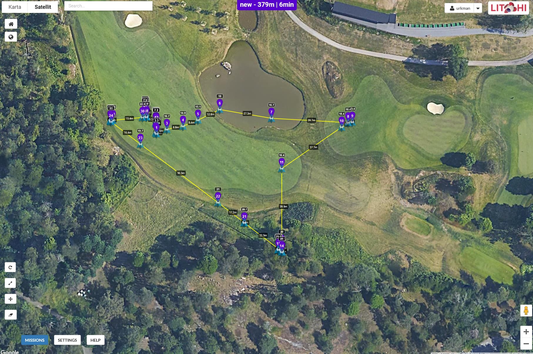
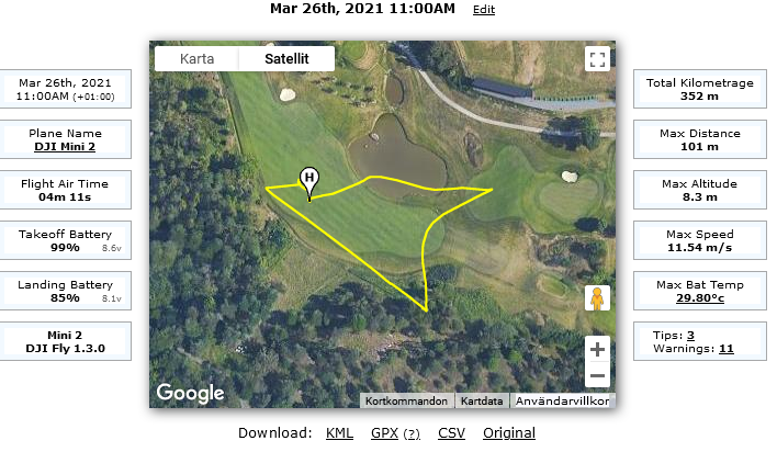
Appears to be working for files sized under 5KB. Used a litchi mission that was uploaded to airdata, then download, import back to litchi to compare. Nice job on translating aircraft attitude (e.g. appears just as in airdata hd playback). Will make it easier to add POIs based on where aircraft pointing in addition to its path of travel.
Bad news
Not working for file sizes above 5KB, good progress though, thks.
You must have some rather long missions. I bumped it up to 6KB. What is the longest/largest mission you have?
Thks, bumping up to 6KB seemed to work for reading the missions with 5KB+ file sizes. Yes, have some long missions and flights that are subset of larger missions. Not sure what longest, largest would be, probably in the 20-25 min range, 6-7KB size.
Works great, I have a 4,809 kb file, part of a map (battery 1), it did not run before, but it ran great now!
Thanks for this utility.
wesbarris
Thanks for a great tool!
2 Likes
Great idea building a web app for this. I have been using a database to import and convert these, but will consider using this instead. An observation though - It seems the gimbal is not entirely accurate. Are you using “compass_heading(degrees)” or “gimbal_heading(degrees)” for populating Litchi’s “heading(deg)”? I found that the “compass_heading(degrees)” field is much more representative of the gimbal’s yaw.
Great tool, thanks again!!