I want to plan a flight to fly in a circle to travel approx. 30m high but only along a Y axis. Is this possible using Litchi and if so, how accurate is it?
Just to be clear, do you want the drone to ‘travel’ in a straight line while rotating around?
Like a spinning top going in a straight line?
Maybe the best way to describe it is I want the drone to travel like a Ferris Wheel.
Gotcha! Like an Orbit mission, turned up on its side.
1 Like
It will be as accurate as any other waypoint mission. Consumer GPS is accurate to plus or minus a couple meters.
1 Like
Without doing some serious math calculations, you could do a vertical diamond shaped path with waypoints (or even octagon shaped) but I dont think it will be a smooth circular path.
What you want sounds similar to @wesbarris Cardinal Coordinate mission planner turned up 90°
Does anyone know of a way (free software?) that can be used to generate shapes like this (a vertical polygon) in kml coordinates? I would love to write something that allows you to do light painting with a drone.
This link could be helpful:
Vertical Drone Missions tool for Light Painting
@Yordie,
My circles always came out as ovals (shorter vertically than horizontally), even drawing the circle with the Tool in Google Earth. Anyone have luck with Alexey’s tool? or get similar results to mine?
When you look at a circle from an angle it only looks like an oval.
For this reason markings on a road are always stretched.
@Yordie,
As usual, it was an interface problem (between the keyboard and the chair).
I had to change the Settings in Litchi Mission Hub to Metric, before importing the .csv file from Alexey’s spreadsheet. I now have round circles.
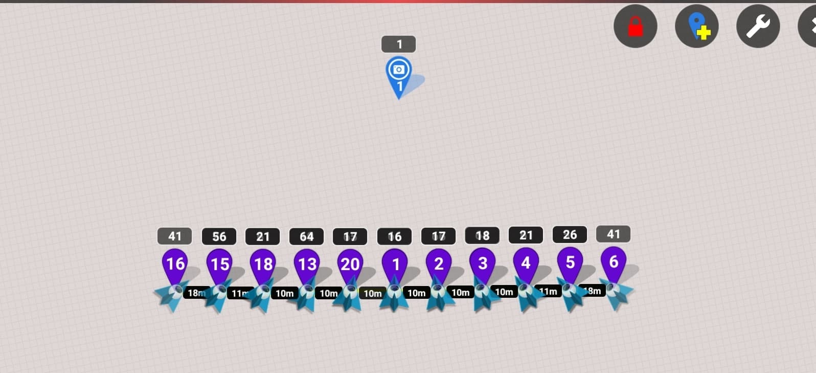
@Gwoody had wished to fly a vertical circle mission (Ferris wheel shape) to take video or images of a POI. Here is another tool in our arsenal. It involves a couple of steps, but it could be useful for real estate, a different view of weddings or other events, etc.
Scott Murray (scottmurray.me) has a lot of GPS related tools. I contacted him and made a request for a Vertical Circle.
He provided the following, which I hope users will visit and try out.
The site looks like this:
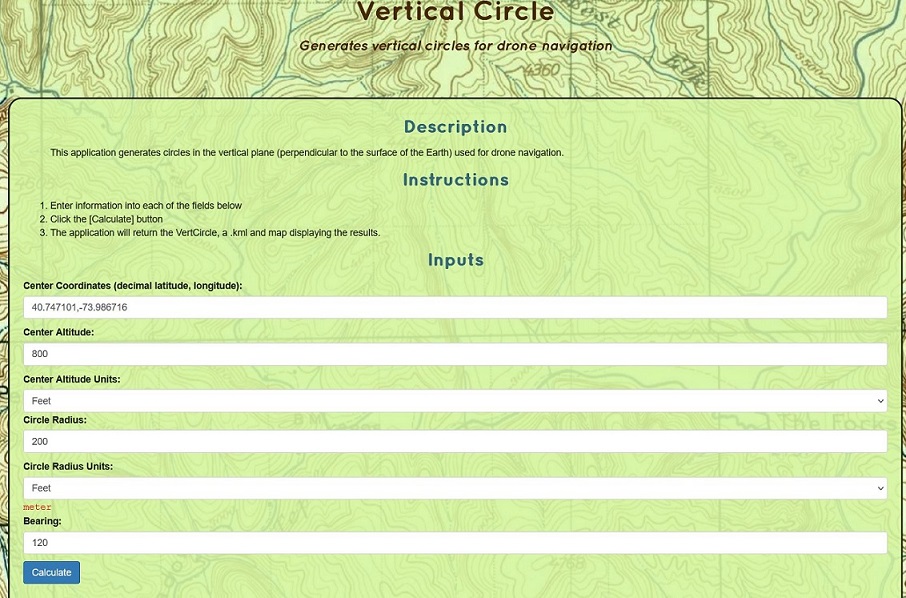
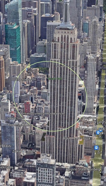
The coordinates that I entered are near the Empire State Building. (I know the Center Altitude is above the legal limit. I just used it for illustration purposes)
Clicking ‘Calculate’ at the bottom shows the following results.
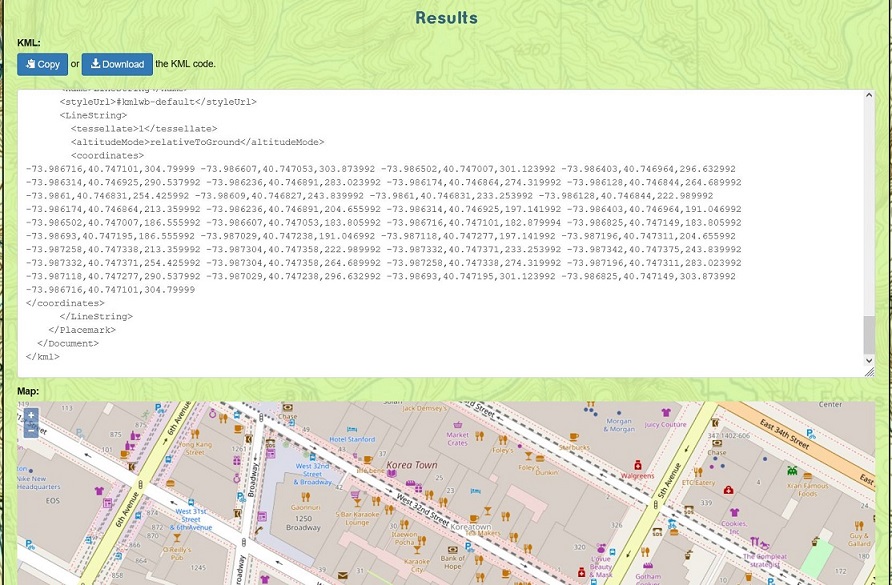
‘Copy’ will do what it says. Now, that its in the Clipboard (I’m using a Windows PC, so I apologize to MAC users), you can paste it into a Text file and save it with a .kml extension.
The .kml file can be opened and reviewed in Google Earth Pro. My inputs show the following yellow circle.
And (now for the really good news), it can be Imported into the Mission Hub. Add a POI, Move the mission if it needs shifting a bit, Rotate it, Scale it, etc. In other words, season to taste.
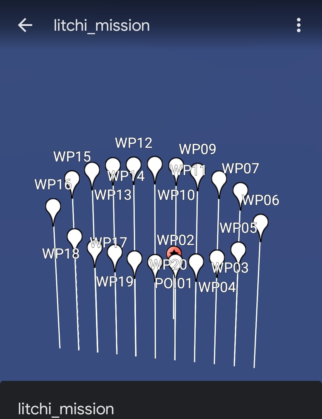
My mission setup looks like this in GE Pro.
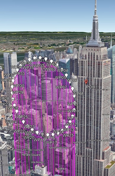
There might be some adjustments that Scott can make (number of Waypoints, starting point, etc).
The first iteration has a fixed number of 36 waypoints (#1 and #37 are the same, so it’s a full circle) and the starting point is at the top.
If anyone has suggestions, he is open to them.
1 Like
@Sam_G Thank you for your idea of a vertical circle generator. I want to fly small vertikal circles with my drone. When I generate a 20m circle everything works fine. When I generate a 2m circle I get an invalid mission error in Litchi. It says that the 3d distance between waypoint 36 and 37 valid range is (0.6,1999)m. When I check the waypoints in the Litchi Mission hub everything seems fine for these two waypoints. Do you have any idea? I dont understand why I get these message. Regards David
A circle with a diameter of 2m has a circumference of 6.28m.
The minimum 3d distance between 2 waypoints is 0.6m.
This roughly means that this circle may have a maximum of 6.28/0.6=10 waypoints.
Most likely ALL your waypoints are too close together.
The Mission Hub does NOT check for this, the Litchi App does.
Also check this thread:
As TriBar explained, that small circle contains too many waypoints. If you want a circle that small, you can only have 10 waypoints or less (6.28 / .6 = 10.46).
You could eliminate all but 4 waypoints (top, bottom, left and right) and let the “curved path” smooth out the path. The downside is… no waypoint actions.
Edit:
You will need a 5th waypoint (same location as WP #1) to complete the circle.
Hello,
Maybe you can use this website, they offer some tools for litchi. One is exactly your described “Ferry Wheel”:
I have not tried it myself, just stepped over the website, which looks like usable tools.
BR, Werner