It does.
Just set waypoint 1 one metre in front of where the drone takes off from, and one metre higher.
Set to above ground.
No more thinking required.
Whenever I suspect that actual thought may be about to materialize in my mind, I simply lie down and relax until it goes away.
2 Likes
It´s my first post in this forum… This afternoon received this error.
I tried to adjust the altitude… But error appeared again.
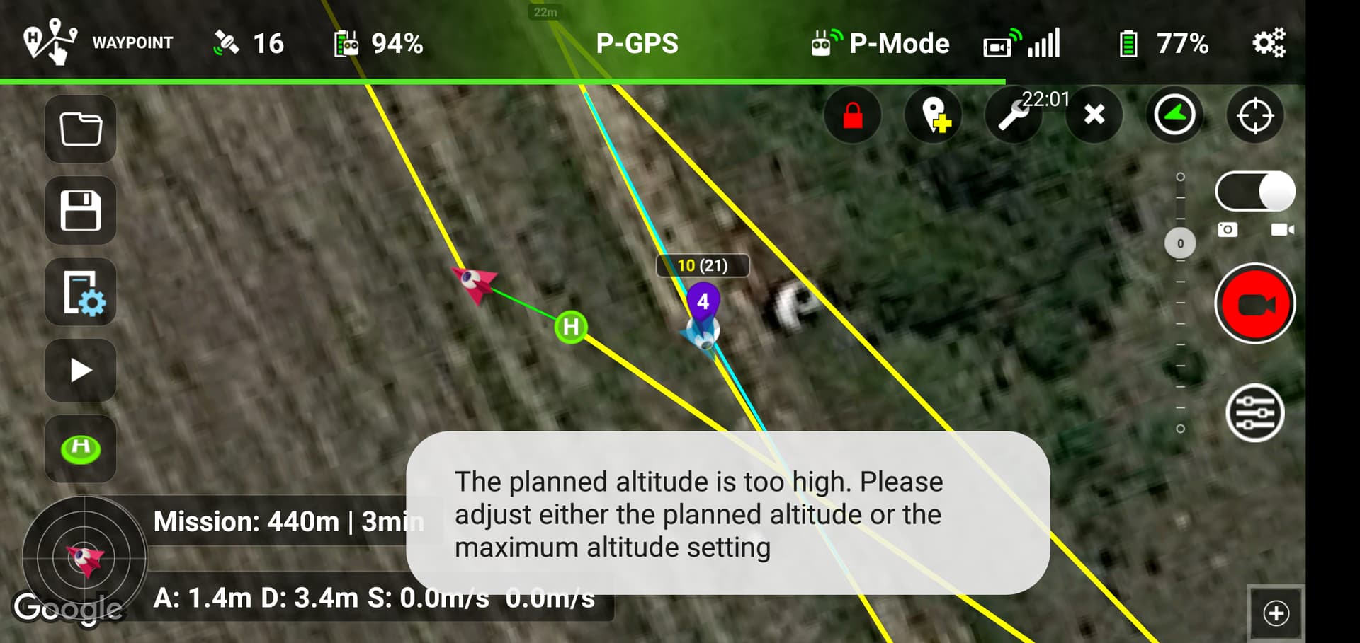
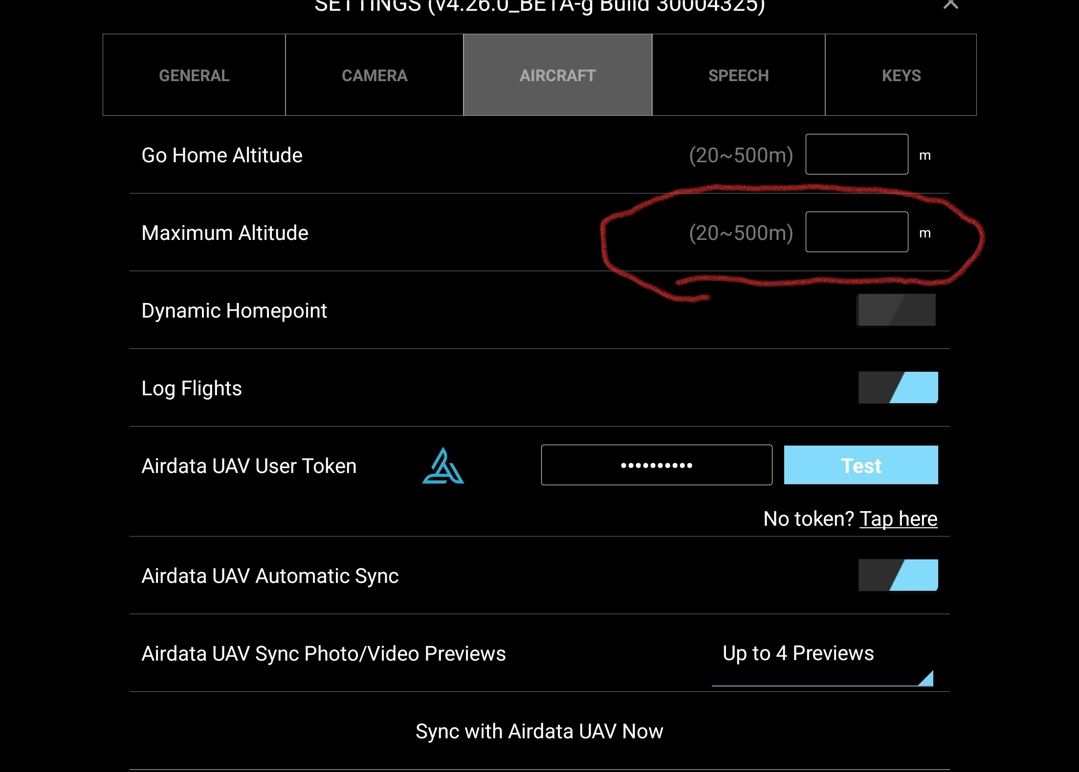
with the drone connected if you go into the settings in the litchi app, what height does it show I the field checked in red
2 Likes
[quote=“Martin_Reading, post:27, topic:1514”]
ected if you go into the settings i
[
Thank you Martin. First it was 120m then I tried 200m.
1 Like
Check in the litchi app if you have selected metric units.
1 Like
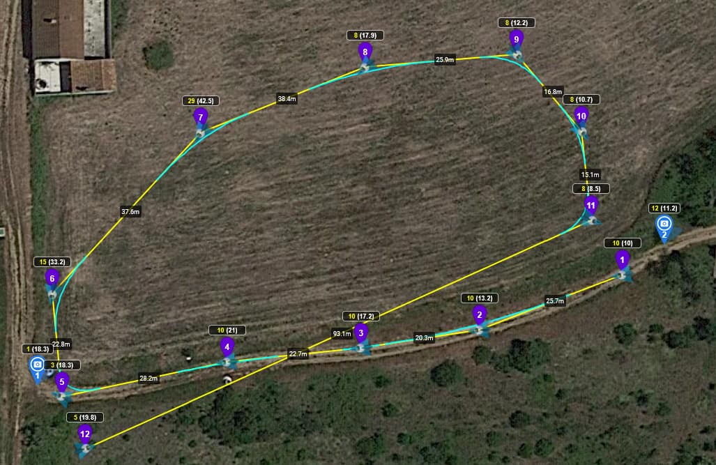
I lost a drone using that feature the drone will go to whatever is in parenthesis so if you take off at 50 meters at home point but downhill now it says 50(10) your drone will go to 10 meters in altitude if you DO NOT use this feature and take off at 50m it will stay at 50m relativize to your home point so if there’s lots of hills take off from the highest hill AND you’ll be fine.
Problem fixed. Great tool. Choose a open area to do the rehearsal flights. I recommend to use the “Use Online Elevation” check box on the settings of the Mission Hub. Draw your mission with the “above the ground” check box active, with a safety margin from objects (buildings, trees…) Wait for the maximum number o satellites to be available before starting. Initially start the mission at a slower speed and make the altitude and speed adjustments after each flight in the Misson Hub. The faster is the mission less precise is the path.
1 Like
Hi, I’m new to Drones and this is my first posting on this forum. Both you and ‘TriBar’ have commented that Drones use barometric pressure to determine altitude. I had assumed the Drone would use GPS to determine it’s height as it would be more accurate. Do Drones ever use GPS for altitude finding and if not, why not? Thanks.
Short answer: For drones, height as determined from relative barometric pressure is more accurate than height determined by GPS.
Long answer: I don’t have a long answer. I’m not an expert in GPS. I’ve read that GPS height is only accurate to plus or minus 10-20 meters. I’ve also read that GPS height (above ground) is only an estimate based on a reference ellipsoid that approximates the earth’s surface. Again, I’m not an expert in GPS so I could be wrong in some of these “facts”. What I do know is that drones use barometric pressure to determine height.
2 Likes
GPS height is the least accurate of the GPS metrics, at least that’s the case with civilian receivers.
Thanks for the replies. It seems that the best satellite arrangement is to have satellites overhead and at least 3 on the horizon separated by 120 degrees. These 3 potentially contribute most to the accuracy in terms of elevation but unfortunately the signal from the horizon is poor and this affects the accuracy of their contribution. I got this information here: Altitude Accuracy
“It only gets complicated if you place waypoint 1 at the top of a hill but take-off from the bottom of that hill. The resulting flight will have altitudes lower than what you might expect”.
This is exactly what happened to me. I created a mission flying around a tree on a hillside with the WPs 4m above the ground on which the tree stood. The drone took off from 50 metres below WP1 and when it arrived at WP1 it began descending to what I assume was 4m above the level it took off from!
How do you create a mission knowing the altitudes will be correct when you are in the field?
Place waypoint 1 very close to your take-off location.
I’ve read all the above posts and i want to assure everybody I did my best to understand everything but I still have some doubts. My question is:
If I check “Above the ground” for every single Waypoint and I enable “Online Elevation” for the mission, does the take-off location make any difference? If the answer is Yes, I’m totally lost. I need to replicate the same mission several times with the flexibility to take-off from different location, is it doable?
Thanks!
yes !!
ALL ALTITUDES ARE RELATIVE TO THE TAKE OFF POINT.
When PLANING a waypoint mission Litchi only knows the ground elevations of known coördinates (waypoints), it does NOT know where the take off point is so it does NOT know it’s ground elevation.
That’s why it is VERY important to place WP1 as close as possible to the take off point.
When planing your mission place 2 waypoints, WP1 & WP2, very close to each other.
Then when on location first move WP1 very close to your take off point and start the mission. PROVIDING YOU HAVE INTERNET CONNECTION
1 Like
Yes
I explain why here:
1 Like
I am a beginner when it comes to Waypoints. I made some fires with the Waypoints in flat area, all went well. I have read through this topic. One point I want to be sure of before I make a mistake and whether I have understood it correctly. In the example, when I start at the bottom of the mountains near a glacier and have to go up, I am therefore fairly close to Wp 1 and have enabled “above ground”. Can I then trust the drone to keep the yellow input so that the drone stays 30m above the glacier and that the white indicates the difference of starting point Wp1. Or will I soon crash into the glacier. And can I turn off “Curve size” better because I read somewhere that the drone then Wp. skip points.
(my english is not perfect, hopefully the translation from Dutch to English will go well)
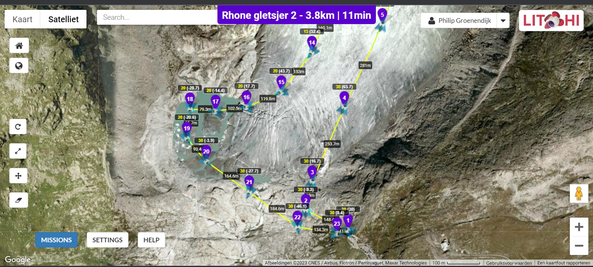
I’m French so I’ll try to explain. If you take off close to the WP1, the altitude numbers are generally good.
The drone will follow the WHITE Numbers. Normal for example in WP4 if you asked to be 30m above ground, when climbing it will be at 65.7m compared to WP1 (30m).
And to be sure, I’ll compare with Google Elevation by exporting your mission (with above ground) in csv and import in Wes website: Litchi Above-Ground to Google Elevation then export mission and re-import as a new mission to see the difference…