I can use Litchi Hub to crteate a mission, and export it as a .kml file to my PC. I can then substitute it for a dummy mission and get the route displayed correctly on my RC Pro 2 controller. However, if I save the mission on the controller (having made a last-minute change) it screws up the geometry of the flight. What am I doing wrong?
I have moved your post to its own thread because it was not directly related to the thread where it was posted.
A KML file exported from Litchi’s Mission Hub is meant for Google Earth, not a DJI drone. Perhaps you meant “DJI KMZ”.
Would you clarify if your “last-minute change” was done in Litchi’s Mission Hub prior to exporting or in DJI Fly after the KMZ was imported?
Also, would you clarify exactly what you mean by “screws up the geometry of the flight”?
Thanks for the move.
The kml file is imported into the RC Pro 2 controller fine.
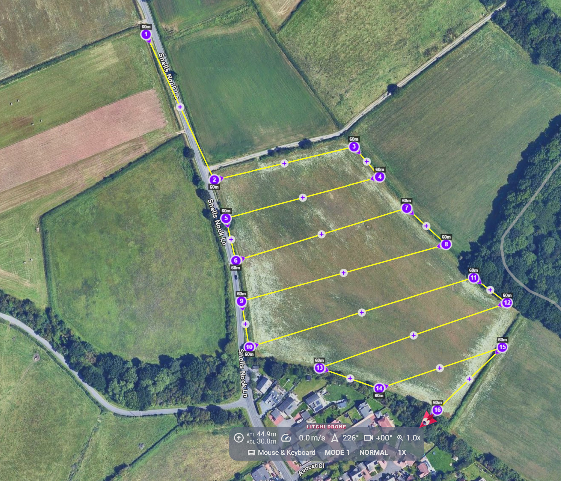
It displays on the controller just as it does on the PC that created it.
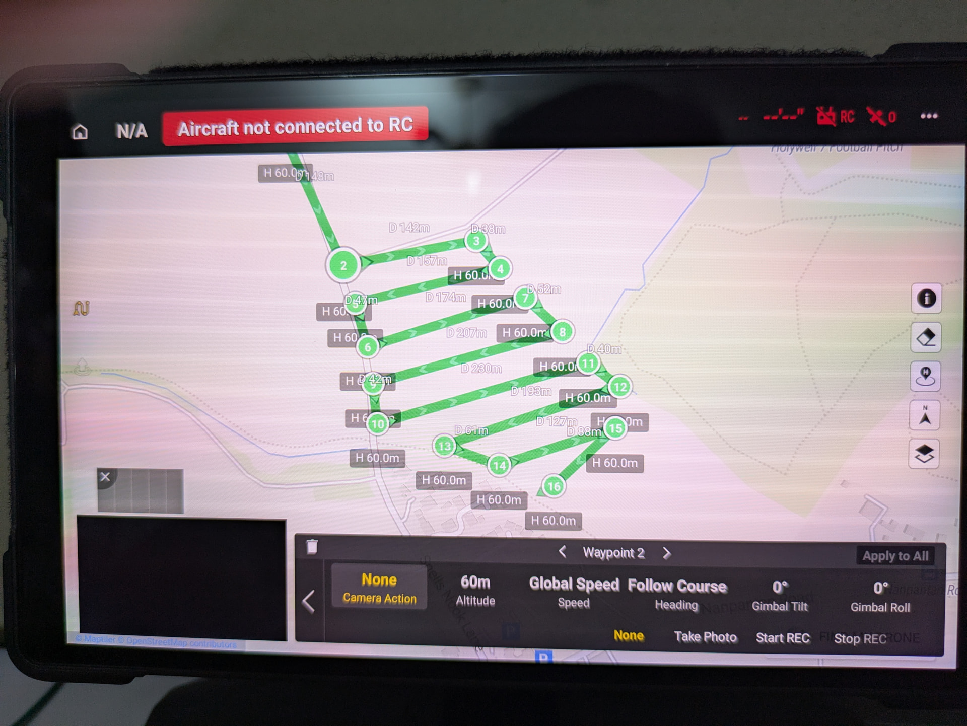
If I then make a change in the controller e.g. changing the altitude or speed, and then save the edited mission, when it is re-loaded, I get this:
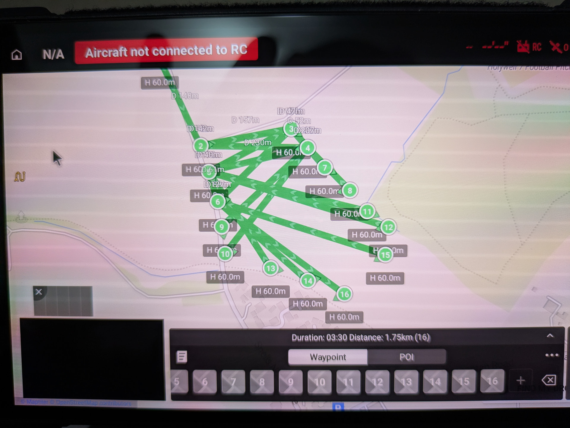
… which is what I meant by ‘screwed up geometry’. Am I doing something dumb, or are these files not field-alterable by the DJI Fly app?
Cheers,
Bryan Dawson
The “screwed up” mission displayed is unfortunately normal. DJI does not fully support straight-line missions. The Litchi Mission Hub supports straight-line missions, the WPML language (in the KMZ file) supports straight-line missions, and your DJI drone supports and will fly straight-line missions successfully. It is just the display of the mission in DJI Fly that looks wonky. Here is another example of how DJI Fly displays an otherwise normal straigh-line mission:
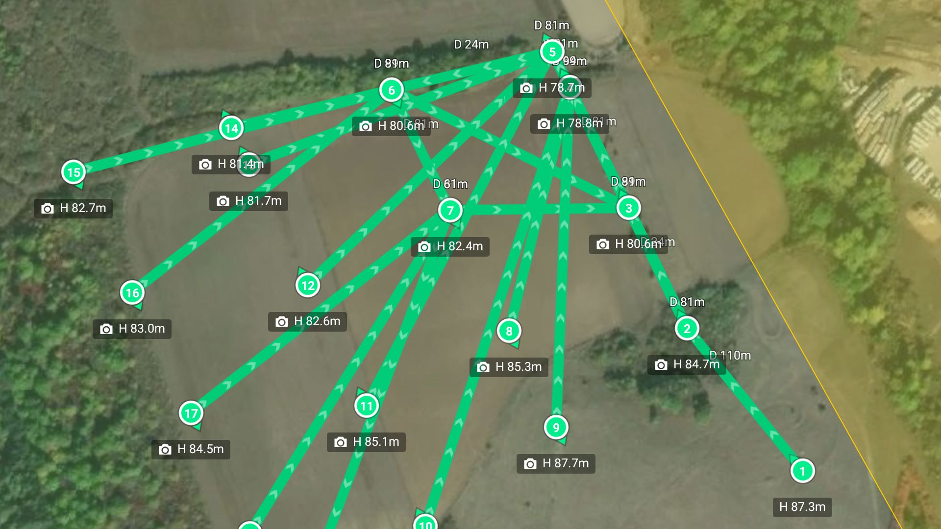
Also, you keep mentioning “KML”. The KML file that can be exported from Litchi’s Mission Hub is meant for Google Earth [Pro] and contains Keyhole Markup Language. DJI Fly would not successfully parse a KML file. What you are exporting is a DJI KMZ file which contains WayPoint Markup Language and is different from a Google Earth KMZ file.
If you use Smooth Curves as path mode, you won’t get that issue.
For area mapping we have made several improvements so smooth curves in general is probably what you should use anyway. It does however use more waypoints (they are needed to straighten the curves)
Thanks for your help and explanation. I can use curved paths and double waypoints using DJI Fly (easy enough on an RC Pro 2 with a bluetooth mouse) to get quasi-straight paths. So Litchi, using smooth curves, isn’t providing anything I can’t already get with the stock software and less file import hassle.
The bug you see with straight lines forming a spider web is not something fixable except by DJI. DJI does not want to allow straight lines/mapping for their consumer drones, the only reason we support it is because they forgot to block it completely on android like they do on iOS.
There is no hassle to transfer the KMZ if you use Litchi Hub Bridge, it’s basically one click.
Just double checking if missions created in Hub (using Smooth Curves as path mode) can be field edited within Fly? And, if the paths appear wonky (such as in the examples in this thread), the flight itself will proceed normally and fly straight lines?
Question 1) yes
Question 2) the path cannot be wonky when using Smooth Curves as path mode, only when using Straight path mode. The flight would still proceed normally, it’s a display bug in DJI Fly
1 Like
While I have not experienced the wonky mission display myself, I have communicated with a number of people who have. All of them have informed me that the mission flies as expected (with straight paths) despite the wonky display. It is just a display bug in DJI Fly.
1 Like
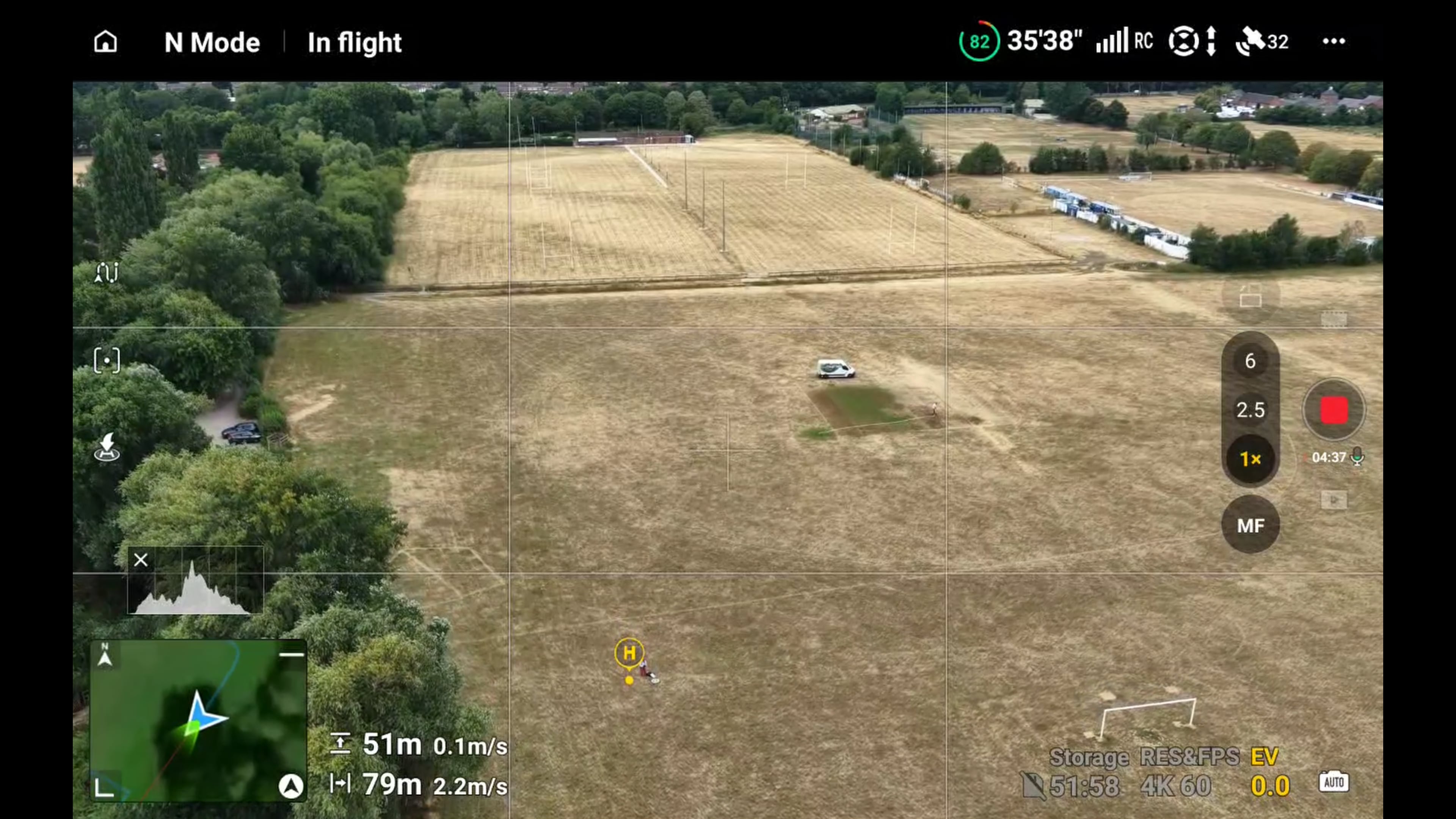
Just to check, here is a video of a grid-search pattern over football fields which looks wonky on the controller screen, but executes perfectly.