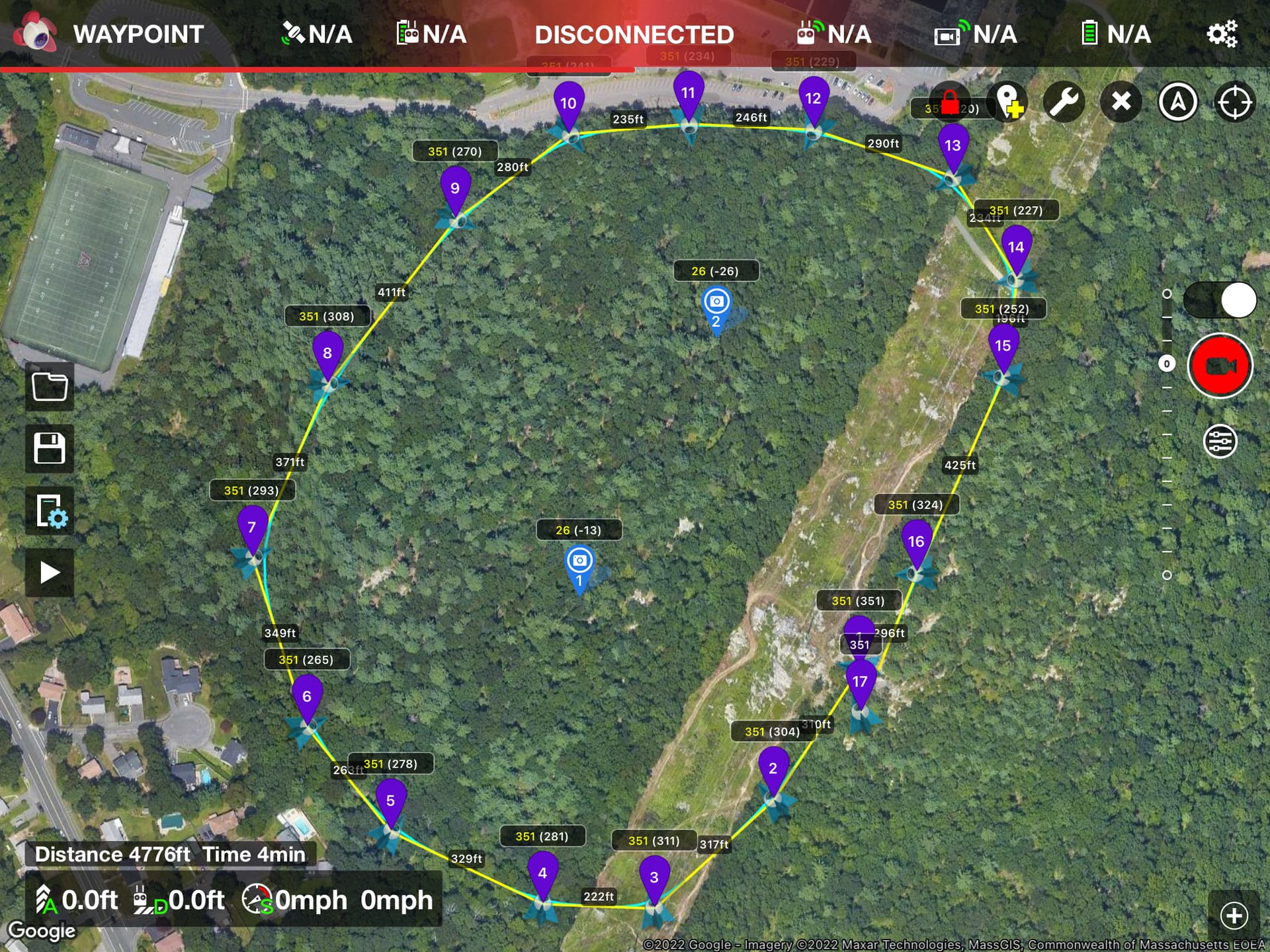
flying a mission and I have set the altitude at 350 ft. I checked the box that says ”above ground level”.
I am starting from a high point and dont want to find later that i was flying over 400’ AGL over some of the lower areas but at the same time want to be clear of the powerlines.
There are (2) numbers next to each waypoint, one is the 350 number, what is the other one? As long as the waypoint altitude stays a 350 , i assume that i am always 350 above the changing ground level- correct or is there more to it?
Thanks
The yellow numbers at any waypoint is the height that the drone is above
the ground directly below it at that waypoint. ( which you have set it to be )
The white numbers at any waypoint is the height of the drone at that waypoint
relative to your take off point.
If the ground is flat there will not be much difference between the yellow and the white
numbers at any particular waypoint.
If the ground is rough and rocky there can be considerable differences.
That’s a better answer, thank you . The site is covered with trees so it’s hard to get a read on the topography without a topo map ( I used USGS topo maps to estimate) but honestly the numbers as shown in the screenshot I posted appear to represent actual conditions pretty accurately.