Photographing top-down an area that is too big to fit in one shot at max allowed height

Hi guys,
I have a Mavic pro 2 and I need to photograph top-down a site (kinda like google maps type of image) which, according to google earth, fits in one shot if taken at around 750m above ground but this is 7 times the max height allowed where I live. I was told I can do this with Litchi but I have no idea if it’s possible to set camera parameters and focus. Has anyone tried this before and are there any tutorials you can point me to?
Cheers!

@Priscilla ,
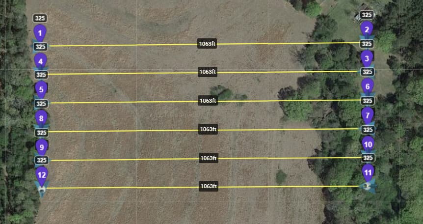
You will have to set up a ‘grid’ type mission similar to this image and take multiple photos, each photo overlapping. You can set individual waypoints to capture the images, or you can set a photo interval (seconds or feet) and capture them
Those photos will have to be stitched together to form a large orthomosaic image.
Litchi can certainly handle the image capture, but it will not stitch the images together.

You can take a look at this topic.

Good luck.

2 Likes

Thanks for your help, I’ll try it today!