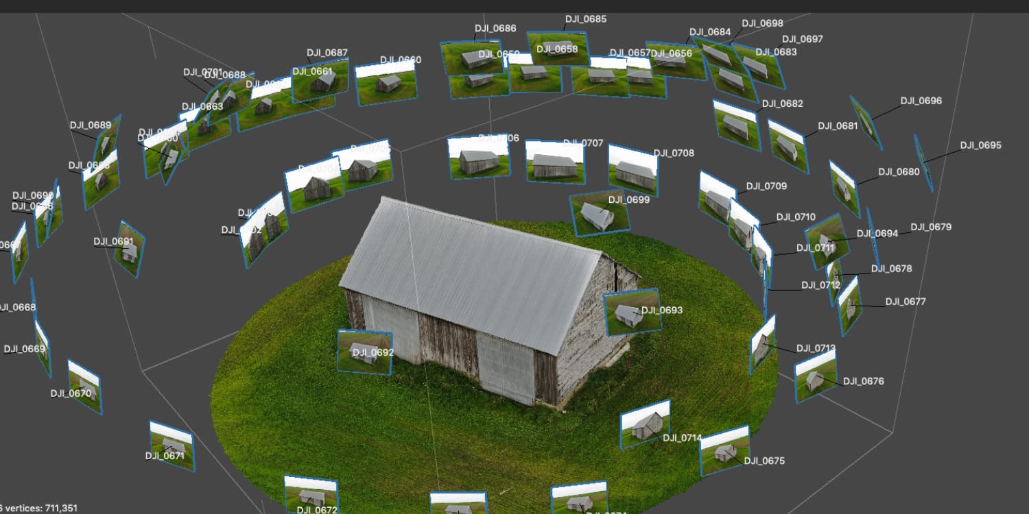
I’d like to see some 3D photogrammetry option in litchi/MissionHub.
I know it’s said there are better/free/other photogrammetry android apps, but as it happens they don’t seem to support my Mini SE’s. It seems relatively simple from a user point of view; select object boundaries and orbit it snapping overlapping images and different angles.
Then upload the large collection of images to a processing site…
I’d like to be able to define an area/object in MissionHub and have it generate a usable waypoint mission with results you can upload(elsewhere) for processing. In theory you could do it manually but it would be painstaking.
Until one or the other is accomplished for your Mini SE (Change in Litchi or support for your drone), one work-around you might consider is this:
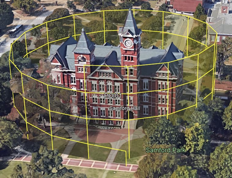
Use Litchi Orbit to video your POI. The orbit parameters (radius, altitude, speed) can be altered in real-time.
Use video processing software (I use VLC) to extract every nth frame. Set the parameters and generate your images, which can then be uploaded to the processing site.
If I am understanding @Onlooker correctly, he is wanting to capture images in a manner similar to this. The captured images would be uploaded to create a 3D model.
Thanks for the suggestion; I wonder, can you recommend a specific web page to set VLC to batch extract the frames into images with the location/direction exif data needed by processing sites? I was under the impression it usually had to be a series of drone taken images for the positioning data/etc…
You’re absolutely right about needing the Lat/Long info. VLC doesnt extract that info. That critical piece of info slipped my mind. I’ll do some investigation.
It occurred to me that Wes Barris has a Spiral Mission tool that might be something for you to try.
The instructions are clear and you can create something like this. Then, adjust your photo interval in Litchi Mission settings and they will be geo-tagged.
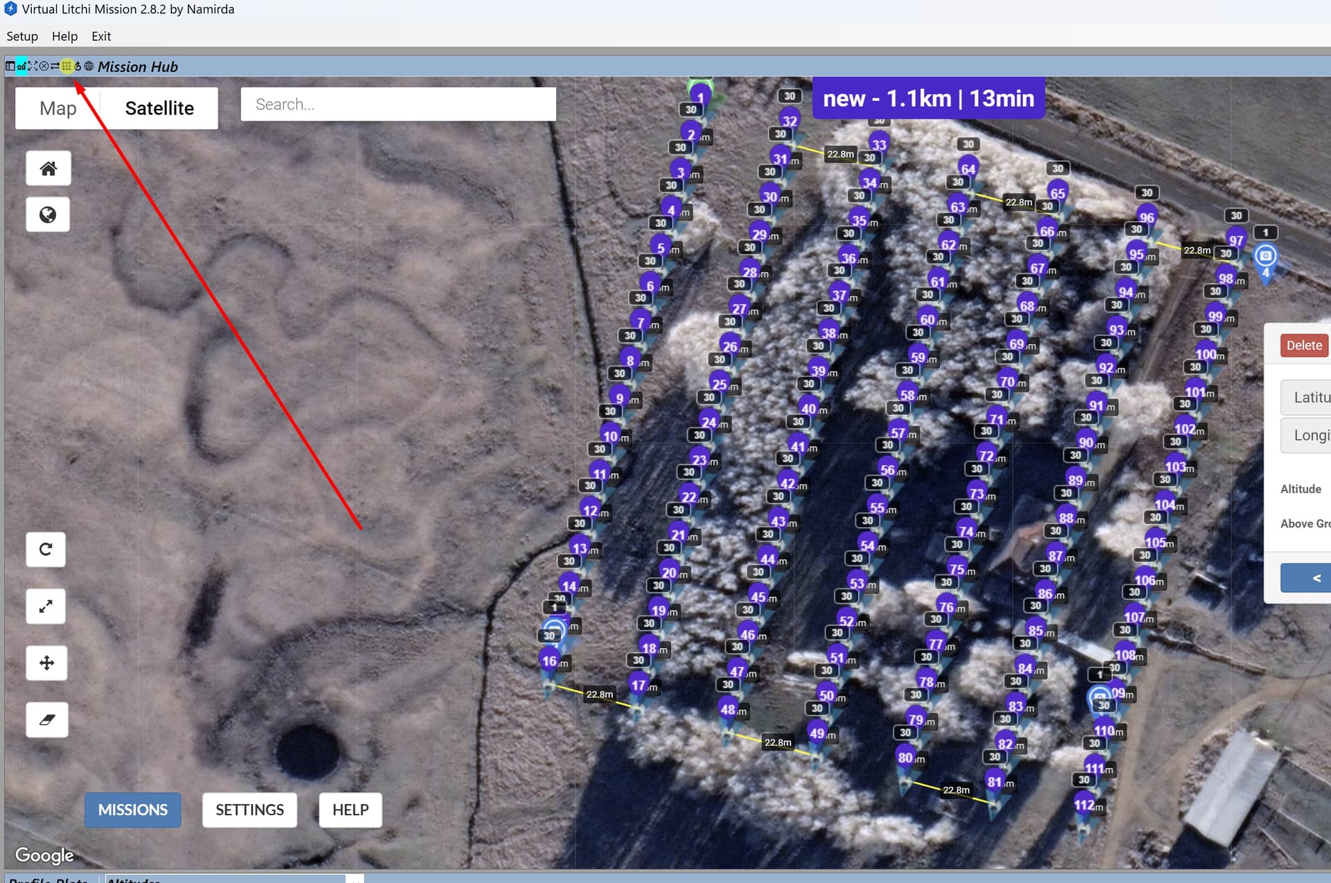
The original question was about photogrammetry for which a grid mission might be a solution. The VLM application provides this feature. The VLM chrome extension does not.