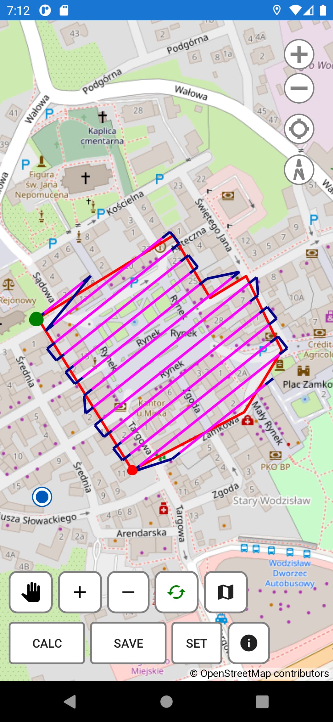
Hello, I have a question. I have created a free program to create a flight path (for mapping) in the form of a grid. The first version was for Windows, now I made one for Android (more polished, I use it in the field for surveying).
I still need to test the final one before publishing, but it’s just a day or two.
The program creates a file in CSV format, which you have to load in Litchi Hub and save, and in the options you have to select “Curved turns”.
I edited the post because it clarified a bit. In android 10+ I can’t access the folders of other apps anyway.
So the user will be able to save the CSV file and use Litchi Hub as before, or, if the user choose to save bin file, and the developers have will have no objections (I will adjust if there are any), move the binary file themselves using file explorer (as described on the Litchi website).
So I have no objections.
I still hope LItchi will add such feature in the future, but I need it now and didn’t want to buy another software, and I I also want to help other users who lack this feature and do not want to move to another app.
Hello, friend!
Congratulations on a successful development. As before, I follow your work, thank you very much for the opportunity to have such opportunities
And it is very strange to realize that Litchi, despite the fact that many users are asking for them, do not implement such a function in the program, it’s a pity.
@atomic77 thank you for sharing your tool. To clarify, we do want to add a mapping/grid tool to Mission Hub, it is relatively high priority and work has already started on it but it is not ready yet
Hello, atomic77!
It’s very quiet!
Are you planning to give forum users the opportunity to test your product? Or this topic has already stalled.
Sincerely, Magomed.
Oh, of course. I just forgot. I wrote about it on the fb photogrammetry group, and I forgot to write here. But now I know it works, tested by many people.
It’s here: Android version
There is also a short tutorial. And the older Windows wersion is here
Hello, atomic77!
Thank you so much, we will definitely test it at the first opportunity, friend.
Sincerely, Magomed.
- Can it be Russified? if there is a need, I can help with localization.
- Is it possible to embed camera parameters for each drone in the drop-down list?
- Another interesting point! Can I additionally enable the full stop function of the drone before taking a photo? This is very IMPORTANT!
- I think another important function is to be able to save (missions).
Friend of atomic77!
Be a friend, please look after these points, okay, without the Russian language, we will somehow survive. But the rest of the items can be implemented by your product, it will just be an amazing product.
Sincerely, Magomed.
I’m a surveyor, not a programmer, so I just shared my program that I made for myself. I’m not likely to add new features, because I know Litchi is already working on it - and it will definitely be much more advanced.
Taking photos at every point would require much more time (it doesn’t make sense to me, because the mission takes too long and I can handle rolling shutter). I need to think about if I will spend more time. It’s just a tool I needed now.
Camera parameters - you can copy yourself a ready profile and later change only the selected parameters. Each profile can be loaded later.
This looks really good! Will give it a run in the field next week. I wish i was as clever as some of you guys… so many things I would love to be able to code!
Thank you
Hi!
So how are you doing, any progress?
Did my program just stop working?
Sincerely, Magomed.