How was your mission created?
Was it done using Ancient.Land perhaps? Or a different method?
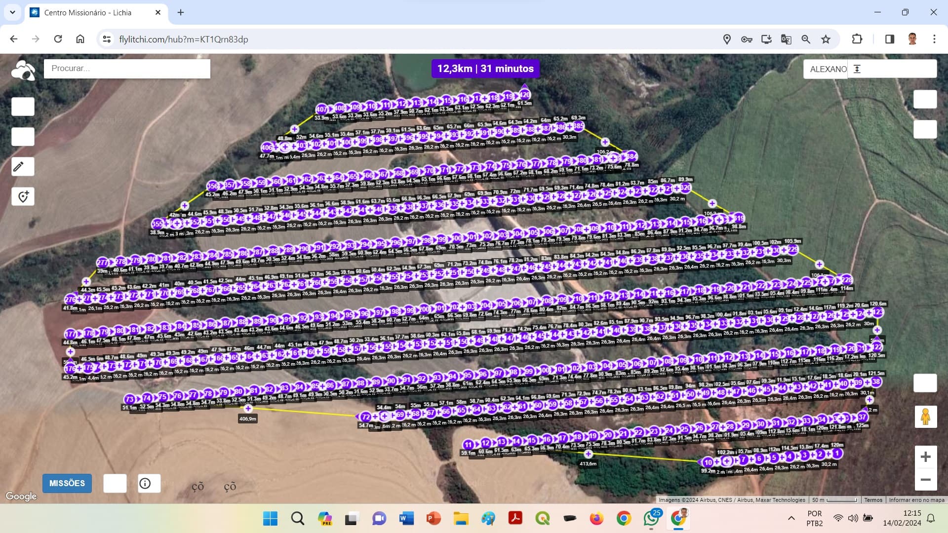
Um aplicativo da empresa T2R ( que fabrica antenas PPK) criado especialmente para elaborar missões para o lichi
Vcs teriam uma recomendação de preparar a missão para o Lichi?
I use this site → https://ancient.land/
Free to use.
Bottom left (3 bars) opens the parameters menu to select drone model, altitude, overlap, etc.
Bottom right (tools) opens Home point location, polygon draw, satellite imagery, etc.
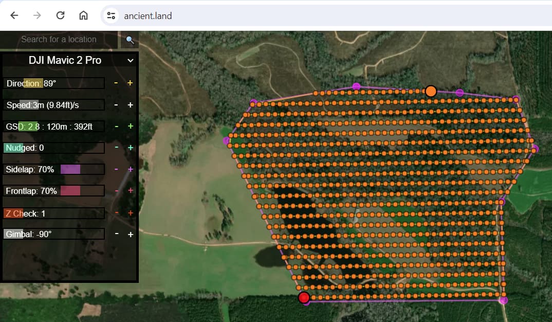
All of the Orange dots along the pathways are waypoints, which you can eliminate by using the Z-Check slider. The Z-Check only goes to 50. If the area mapped is very large, there might be a waypoint remaining along a very long path.
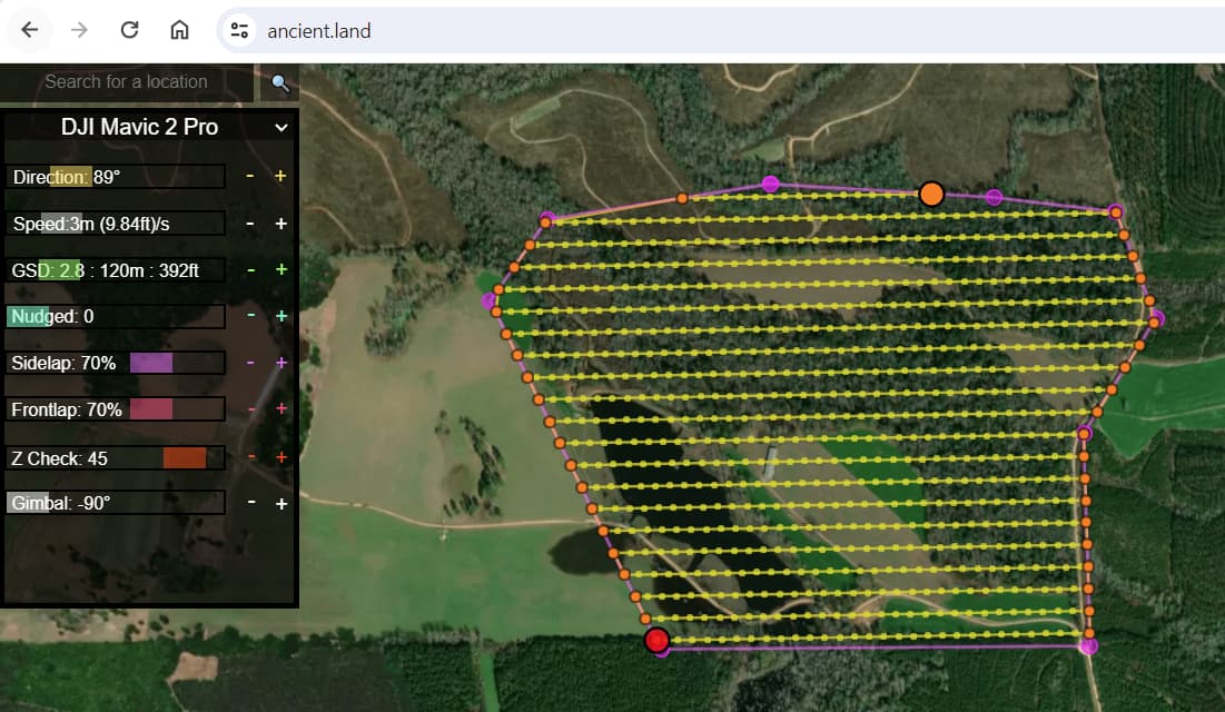
Only the Orange dots are waypoints. The Yellow dots indicate where an image should be captured.
Export the CSV to Litchi. You’ll have to manage the image capture interval (distance or time) using Litchi’s Mission Setting.
Obrigado pelas informações