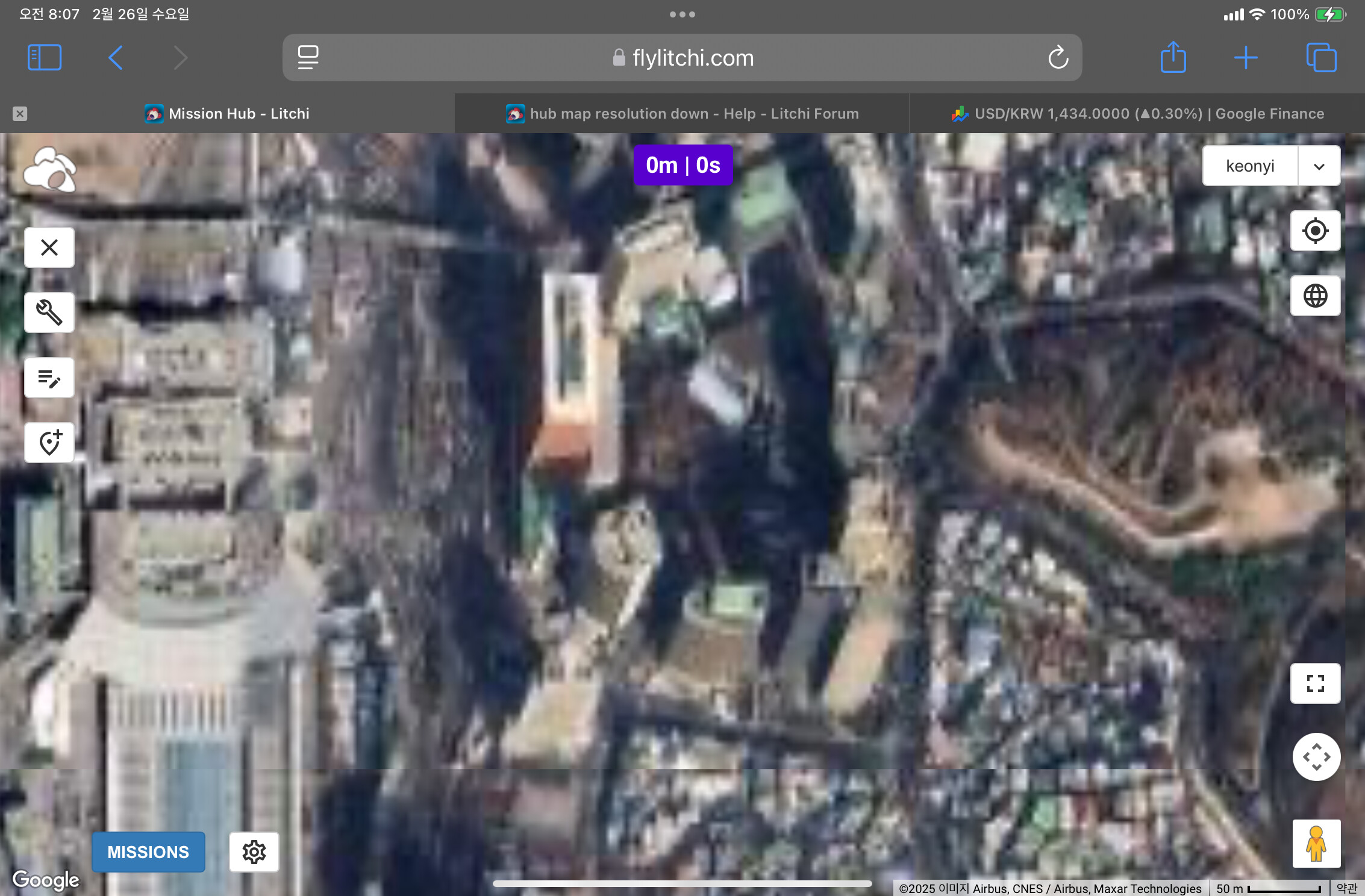
Mission hub map resolution has down suddenly in my pc.
It was very good like Google earth map few weeks ago.
However now it goes down like google map here in Korea.
Any one knows what is the problem?
This happens once in a while but it usually resolves itself in a few days. Check back by the weekend at Litchi is likely to be back up again
Could it be that something has changed in RichHub’s map algorithm?
The resolution of satellite maps in the United States is high, but the resolution of satellite maps in Korea is very low.
Isn’t this the same reason why Google Maps’ resolution is low in Korea?
One thing strange is that even in Korea, unlike Google Maps, the resolution of Google Earth maps is high.

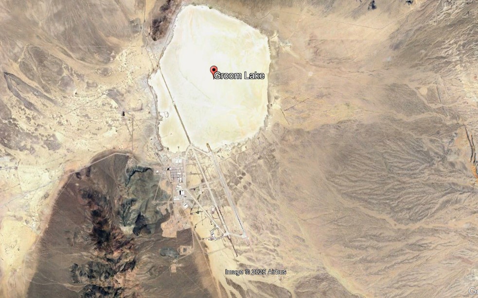
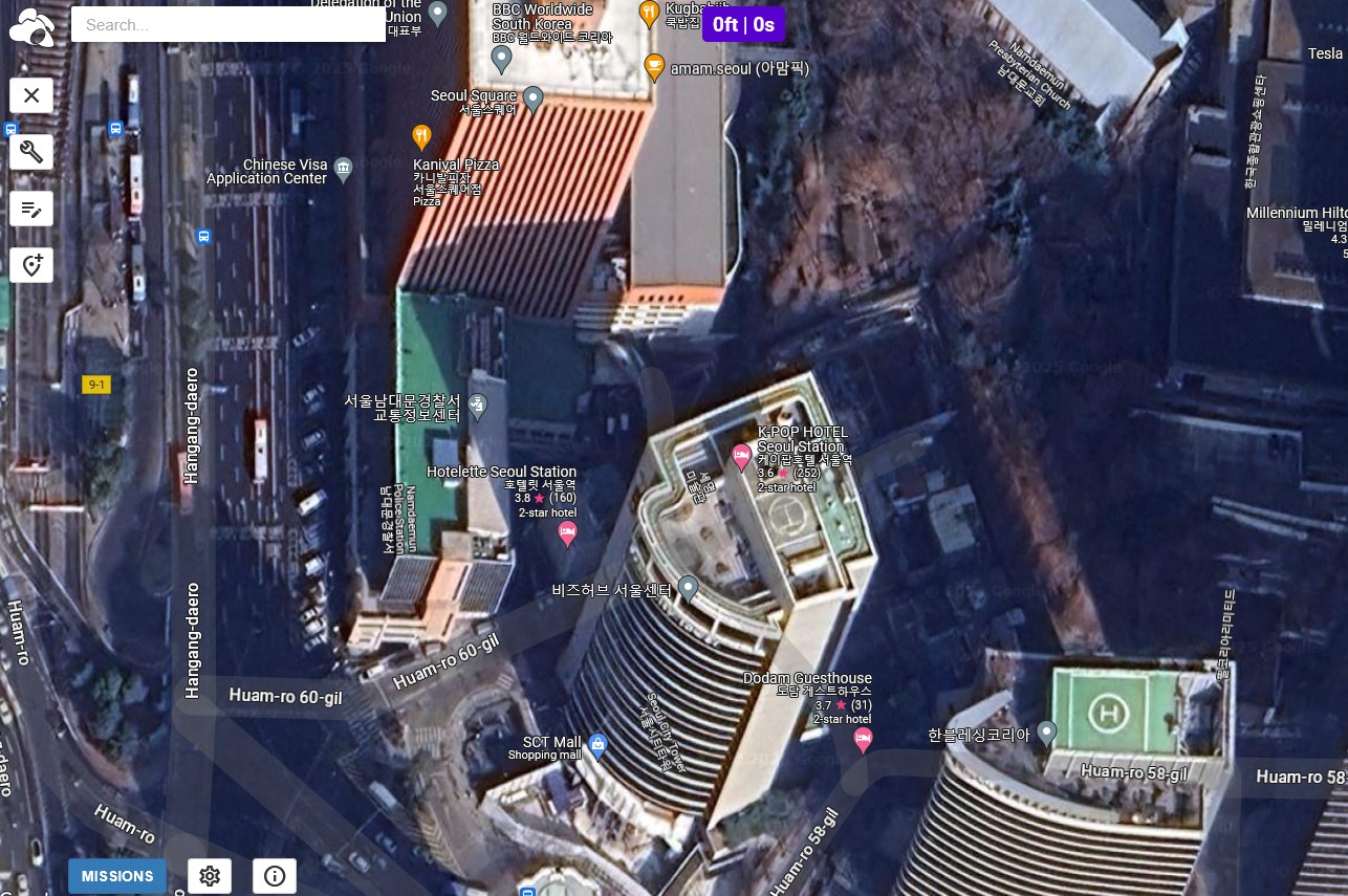
Left for US, right Korea
I hope that by applying Google Earth map instead of Google Map on Rich Hub, we can avoid satellite map resolution issues in Korea.
I don’t know the location you are showing but when I view Seoul in the Mission Hub, the resolution looks normal.
Either the latest satellite view of the location you are showing is poor or it is a temporary issue.
The problem occurs when we access an area of Korean with the IP address for Korea.
After the access of the area in Korea through vpn, we could access fine satellite map again.
I will speculate that Google Earth is deliberately lowering the resolution of its satellite imagery for anyone using Google Earth in Korea. This might be a short-term politically motivated move that is intended to degrade the imagery that North Koreans see online, but then I would imagine that only the connected elite have internet access in North Korea.
In my Third World country of residence not long ago, Google Earth images were completely unusable for years. Locations in the West were depicted with crystal clarity but all imagery from my remote tropical backwater looked like it had been filmed through muddy water.
Then one day, I looked at Google Earth, and the entire planet had been rendered in the same high-resolution imagery. I am convinced that the poor imagery you are currently seeing of Korea is a temporary and localized disabling of Google Earth imagery that might have been insisted upon by spy agencies for a specific reason of a transient nature.
In short, I expect you will wake up one morning and find the blurry look of Google Earth scenery in Korea has mysteriously reverted to its normal sharply focused clarity
1 Like
I agreed with your comment “I am convinced that the poor imagery you are currently seeing of Korea is a temporary and localized disabling of Google Earth imagery that might have been insisted upon by spy agencies for a specific reason of a transient nature.”
I suspect that if you use a VPN to change your IP address to the US or EU, the imagery that you then access from Google Earth will be sharply focused worldwide.
1 Like
In Colorado, several areas on Google Earth (eg. Cathedral Spires, Eagle Rock) have been blurred for at least a month. The Litchi map is fine. Makes it difficult to plan Litchi missions up and down mountains without good Google Earth terrain elevation data. Both are dated 2025. Curious since Litchi uses Google Earth no?