From the Mission Hub webpage, I tried to export a mission in KML format. When I open the file in Google Earth, the waypoints altitude appeared to be calculated as the mission altitude plus the Above Ground Altitude. This seems to be a bug, isn’t it? The exact altitude should be only the waypoint altitude without the Above Ground component. Otherwise, when you view it in Google Earth, the mission track will appear very high if you are in a mountainous region. Can you confirm this issue?” ![]()
![]()
Use the ‘Export as VLM’ extension (if you have it added to your browser). It will display correctly in Google Earth Pro.
Or use Namirda’s VLM desktop program.
Hi Sam, thank you from your prompt reply, I found it on Chrome extension!
Thank you so much!
1 Like
This is not a bug. If it were, we would all be experiencing this. This most likely cause of what you are experiencing is not configuring Google Earth Pro to display elevation properly. Make sure that you have the “Terrain” checkbox checked.
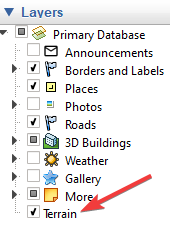
Without that checked, your waypoints heights will appear to be higher than expected whether you use VLM or import a KML file manually depending on the location of your mission.
Hi wesbarris yes you’re right!!! It’s my fault, that was the reason why I could not render the mission properly, thank you so much … that was making me crazy
Question: What are the gaps on the altitude graphic in Google Earth when I export a mission KML? (see attached screenprint)
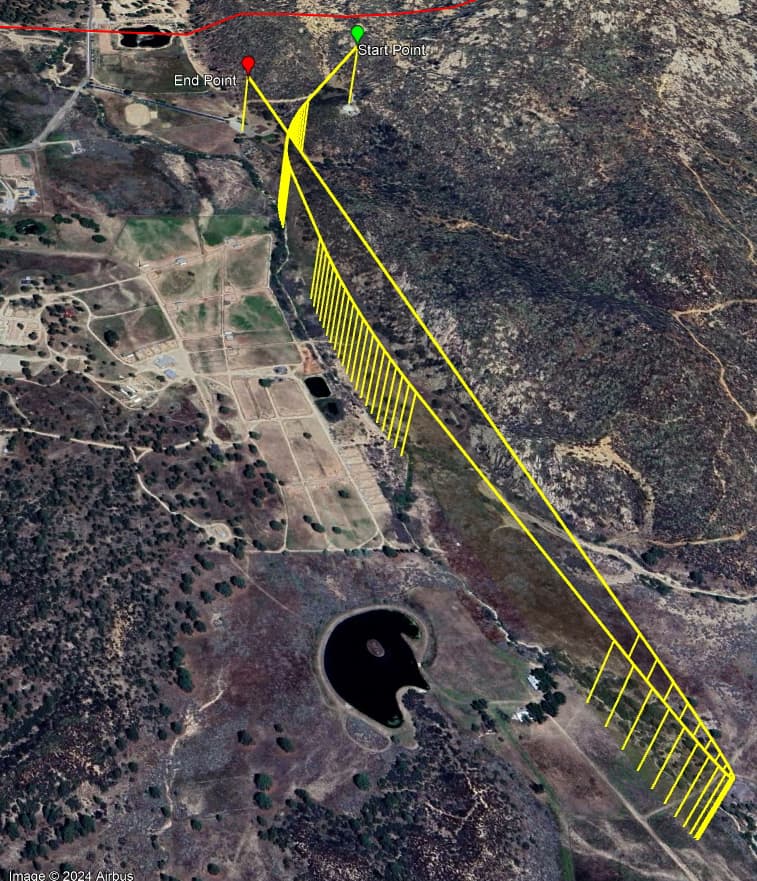
Those long lines (with no drops to the ground) indicate a straight line.
The lines going down to the ground indicate a “pseudo” waypoint that Google Earth puts in to make a curve smoother.