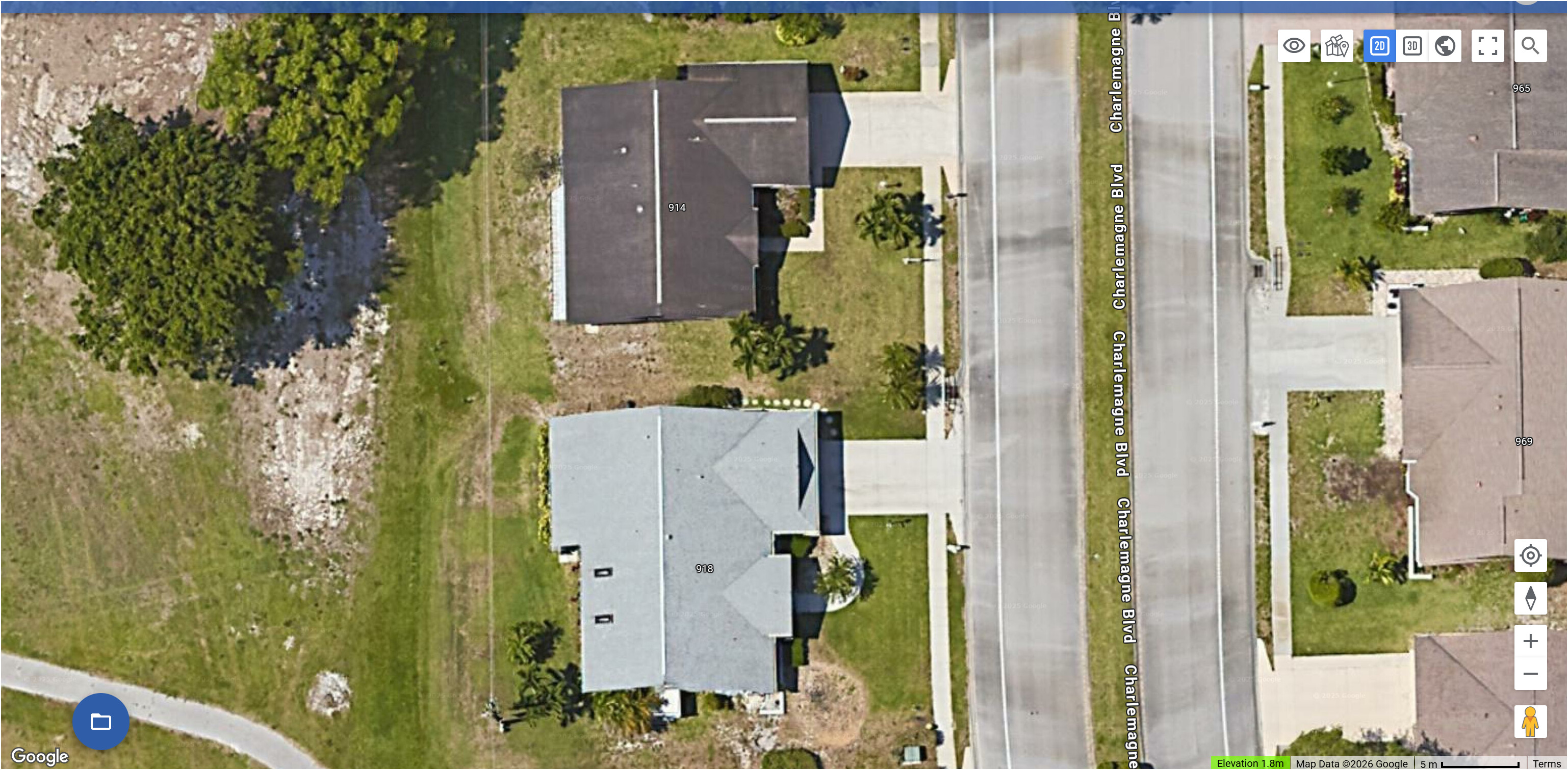
In Litchi Hub on the Web, it looks like there is a zoom in limit. Basically you can’t get the scale needed to put waypoints on the exact point with the current map scale limits imposed. Other mission planning apps permit greater map zoom-ins. Can this be improved soon? This photo show the closes you can zoom in (which is still too far away for accurate planning):
We already let you zoom as much as google maps allows. It can be a little restrictive.
You can get more zoom if you switch to Streets map instead of Satellite imagery. That said, the max zoom level depends on the location.
Vico, What is the general GPS acuracy from a Drone system (maybe 5-10 m) so I am not sure why Daniel_Snyder would want to get in any closer if the GPS is not 100% accurate ?
Actually, GNSS (GPS/GLONASS/Galileo/BeiDou in consumer devices): Typically ±2–3 meters horizontal now It is better in the DJI Enterprise drones. When I use RTK, it gets down to the centimeter level. Zooming in tighter during mission planning, especially in conflicted and challenging airspace. Some of us need the resolution I guess.