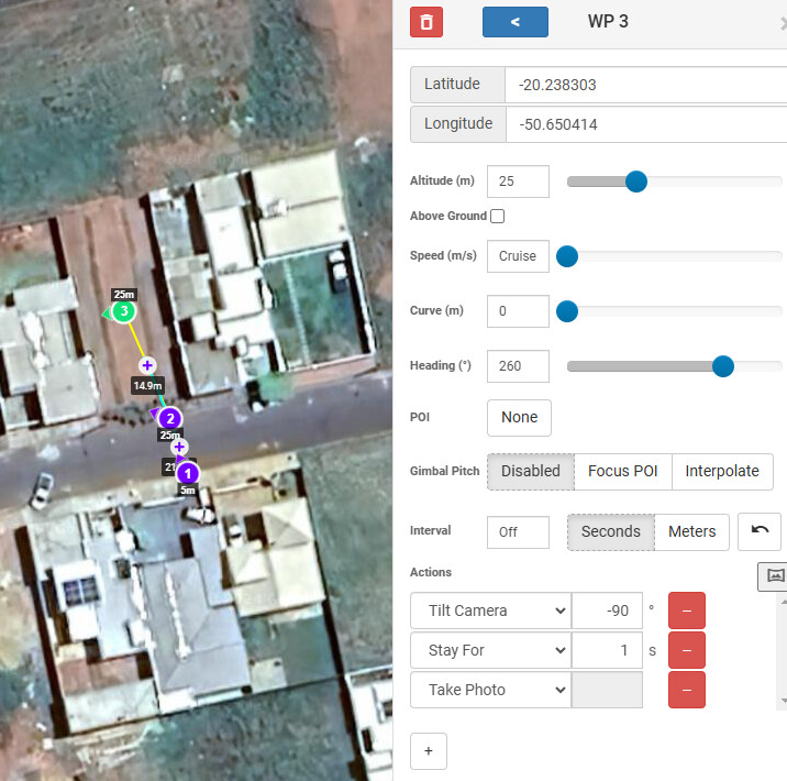
I’ve been testing the beta version for some, I created a mission using “mission hub” with a simple task
climb to a height of 5m, rotate the drone to a certain position and take a photo
Then raise the drone to 25m, move to the next point, rotate the drone and gimbal to a determined position!
I tried taking photos manually and getting the coordinates from the images, and even so, every time I try to execute a mission the drone compares differently!
I’ve already tried to calibrate the heartbeat and the IMU, but it still lacks precision when executing the mission, I believe it’s a glitch in the app or the lack of precision on the DJI mini 3
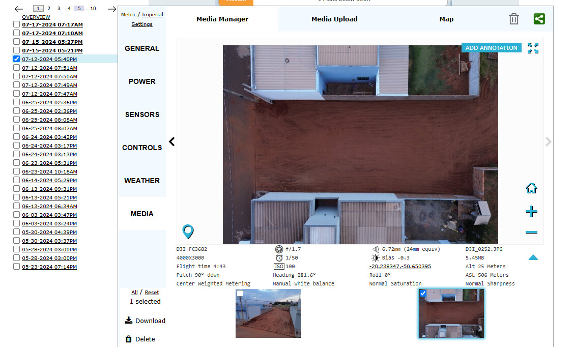
The images from “airdata.com” were taken manually just to capture positioning and altitude information from the drone, with this data I created a mission using “mission hub”. “Mission Hub - Litchi”.
I didn’t attach the images taken on the mission but every time I try to execute a mission it happens in a different way, the drone has no precision in its positioning!
I’m still curious how the actual flight path differed from the programmed mission. This would be easy to compare by doing the following:
Convert the AirData CSV file to a Litchi mission using my AirData converter.
Export the following into Google Earth Pro:
a. Original Litchi Mission
b. Converter AirData CSV file
Clamp both missions to ground and measure the difference between the two.
The above steps will provide the actual difference in feet/meters between the programmed waypoints and the flown flight path. If you would like help with this, let me know.
While a GPS location can be specified with great precision, the accuracy of flying to that GPS location is something less than perfect. Simply stating the accuracy for GPS can be difficult because there are many different types of GPS and many things that affect its accuracy. This is probably why one finds so many different GPS accuracy values quoted on-line.
Smartphones tend to use assisted GPS (A-GPS) which combines traditional GPS signals with cellular network data to increase the location accuracy. Therefore, smartphone position accuracy is generally better than that of devices using standard consumer GPS.
Like many consumer devices, DJI drones use what is called “Consumer GPS”. Depending on your source, the accuracy of consumer GPS implementations is anywhere between ± 3 to 8 meters (10 - 26 feet). However, DJI states the horizontal positioning accuracy of their older drones to be around ± 1.5 m (Mavic 2, Air 2s) and their newer drones to be ± 0.5 m (Mini 3, Mini 4, Mavic 3). I have flown literally 100s of waypoint missions and DJI’s stated accuracy corresponds well to what I have experienced when flying and repeating my waypoint missions. I have never experienced a waypoint mission to be anywhere near 8 meters (26 feet) off of the drone’s intended course.
I’m using a Mavic 2 Pro so lets say the accuracy should be at least 26 feet. I’m shooting a roundabout in an intersection using a POI where I fly to the roundabout and the circle 1.5 times slowly dropping altitude as I go. I’m shooting both as video and photo timelapse separately. The video shoot runs about 3 minutes and the drone holds the POI in the center for the entire flight. However, when I run the photo timelapse the drift is significant. The flight is much slower, being 8-9 minutes long (although the Litchi app shows it to be 14.5 minutes). This is because the drone will only shoot up to 1 photo per second, so I need the flight to last longer in order to get enough frames to work with. The shots seems to hold the POI in the center of the shot for the first half of the run. But after that it slowly drifts to the right. I’m running this flight daily and have had slightly different amount of drift from day to day. The minimum drift seems to be about 25ft to a maximum of about 50ft. Most of the run (other than waypoint 1, which is flying up to the roundabout) is 150ft altitude(AGL) and spiraling down to 75ft (AGL) at the end of the run. Also most of the circling is 75-100ft around the POI.
It is unclear how you are measuring accuracy. The accuracy mentioned previously in this thread is positional accuracy, that is, how accurate the drone’s position is relative to the specified lat/long coordinates. If a drone was 26 feet offset from the specified gps coordinates, that would indicate a serious problem.
My guess is that the accuracy you mention is how accurately the drone keeps the POI in the center of the field of view of the drone. If that is the case then there may be something you can try. Older drones such as the Mavic 2 Pro have what DJI calls a “Hotpoint Mode”. Hotpoint mode is enabled when the following conditions are met in a waypoint mission:
The drone has native waypoints supported in the firmware (Mavic 2 Pro/Zoom and older).
The mission has only one POI.
All waypoints in the mission are associated with that one POI.
I’m assuming that you only have one POI. Are there any waypoints in your mission that do not have your POI set as it’s heading mode?