What would be an ideal flight altitude for a 3D model of a house (average height above the takeoff point)?
What do you think?
In my opinion, you should fly a varying altitude flight (or flights) to capture the house from as many angles as possible.
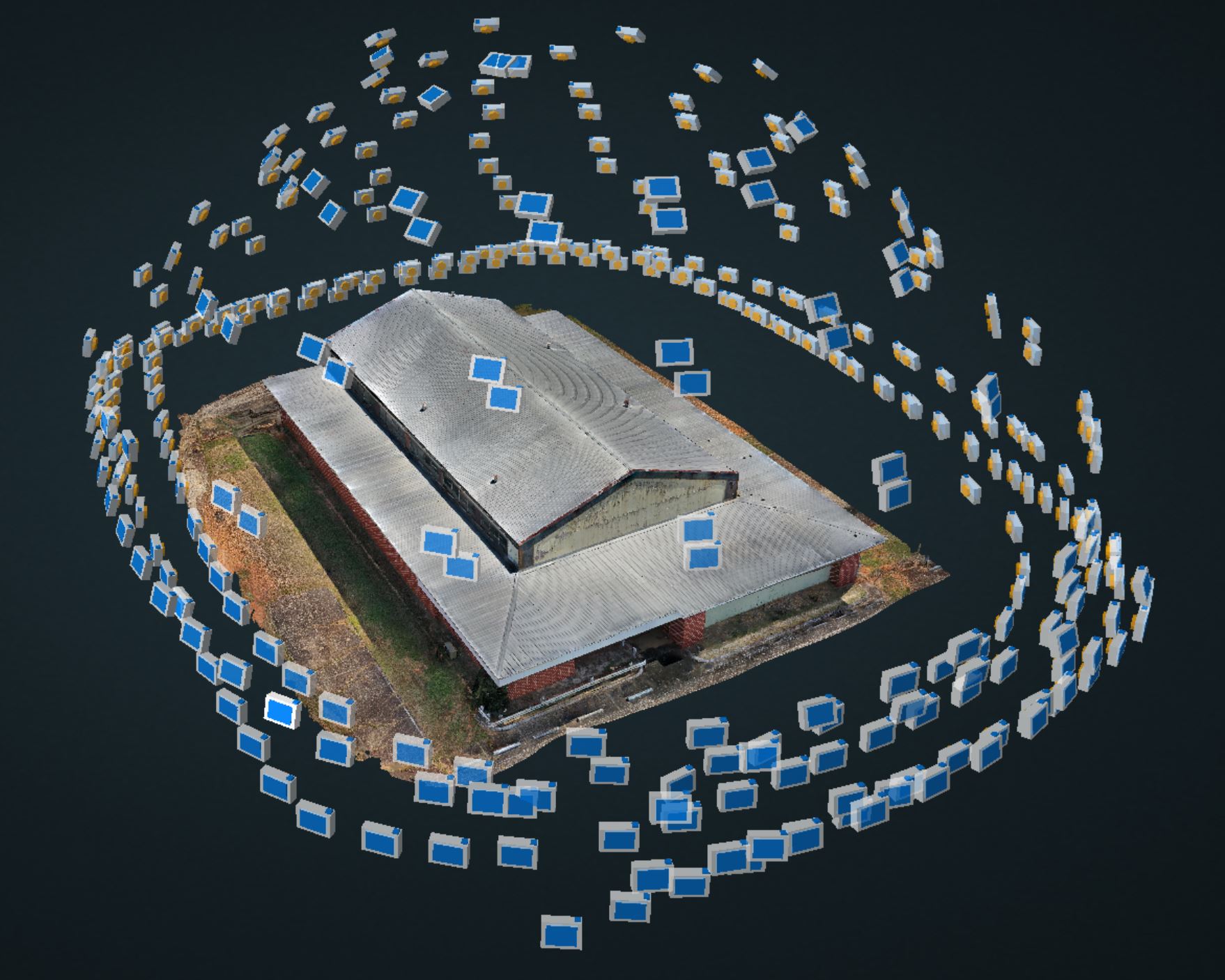
On one of my projects, I used spiral flights varying from 10 ft AGL to 150 ft AGL. I had the luxury of fully open territory around the building.
Here are the camera positions .
2 Likes
In a case like yours, yes, it’s very interesting.
I’ll try spiral flights. But I haven’t had any luck with work on terrain like that, opening up around the building.
There are usually many obstacles; trees, poles, and buildings very close to each other.
Another reason for varying altitudes and angles. Even hand-held drone images can help with those ‘hard to fly’ areas.
2 Likes
I’ll second what @Sam_G recommended with the addition that you want to keep your GSD as consistent as possible.This ensures that the pixels appear the same in the photogrammetry software and provide more accurate tie points. Walking around the facade with the drone in hand is also a good idea if you want crisp results underneath the eaves and covered areas. I typically do about a 30ft offset from the structure, but that will depend on what kind of drone you have, the camera resolution and what the end goal for the data is. It is possible to capture too much data and hurt the accuracy of the reconstruction.
1 Like
Being new to photogrammetry, could you tell me how you set up the spirals at different altitudes? My area mapping has been very basic so far.
There are a couple of different utilities that I have used to set up spiral missions.
1) Spiral Mission Creator for Litchi
Draw and save a circle in Google Earth around you intended target. Import the saved KML/KMZ into the utility and adjust the various parameters. This creates a file that is imported into Litchi Hub.
- Virtual Litchi Mission my Namirda –> Virtual Litchi Mission | DJI Mavic, Air & Mini Drone Community
Its a Windows program wrapped around the Litchi Hub. Create a POI, then set the parameters for a spiral mission around that point.
1 Like
Je me permets de répondre, mais en Français :-), idéalement il faut essayer de garder le drone a environ 10 mètres du sujet, que ce soit pour le toit et les façades, et essayer de faire un recouvrement a 82%. plus si tu veux des détails précis. moins si c’est juste pour avoir le modèle basique. et faire la capture en 3840 x 2160 pixels, pour une excellente qualité. ensuite tout dépend de ta configuration matérielle et logicielle. Bonne continuation