Maybe I am just failing with searching google/the forum but most panorama discussions focus on how to create a sphere. Cute, but what I would like is just a big picture facing one direction, as if I strapped a better camera to my drone.
To me this means (of course) that I have to set grid pattern to linear, but questions I still have:
Can I use AEB mode to take HDR somehow?
What’s a reasonable grid size? etc?
Does the drone stay in place or is there a mode where it actually meaningfully repositions (and how do I avoid it flying into trees?) - I prefer not to have too much ‘fish eye’ effect.
I’ll go do a bit of trial and error so I might report back. Would be good to update the manual with some tips etc.
If by “super resolution” you mean higher DPI, the only way to achieve that is by having either an optical zoom lens (Mavic 2 Zoom) or a telephoto lens (Mavic 3). Then you would shoot maybe a 3 or 4-column by 2-row set of images at a higher zoom/magnification setting.
If by “super resolution” you mean just a wider (and taller) image with a higher MP count, then perhaps shoot 2 or 3-columns by 2-rows.
In either case, they tend to work better with only distant scenery in view. Anything close to the drone will appear warped. The actual number of columns and rows will depend on the size of the subject you are shooting and how much overlap you desire between adjacent photos.
The pano modes will have the drone shoot all photos from one location.
While it’s fine, you don’t need a lot of overlap. My first attempt was a 100 degree, 5x5 and especially the center pictures were pretty much fully redundant (this of course also has to do with the vertical angles you want to capture)
→ Litchi team, if you’re listening, it might be a cool feature to have the amount of horizontal and vertical shots simply depend on the angle you’re trying to cover, rather than picking some arbitrary number.
One thing I haven’t yet figured out is if it’s better to use RAW (DNG) source files or just the JPGs. Of course I know jpeg is lossy so logically lossless is better but the amount of clever tuning, sharpening etc that they do with jpegs means that optically the jpegs tend to look better until you use pro photo magic to get the DNG to the same level.
Does anyone perhaps have some processing settings, camera profiles and further steps documented to get the best out of raw drone photos?
Not yet! Worth a try? I tend to outgrow basic tutorials quickly by just tinkering around, and then missing a bunch of basics because I indeed skipped the 101s.
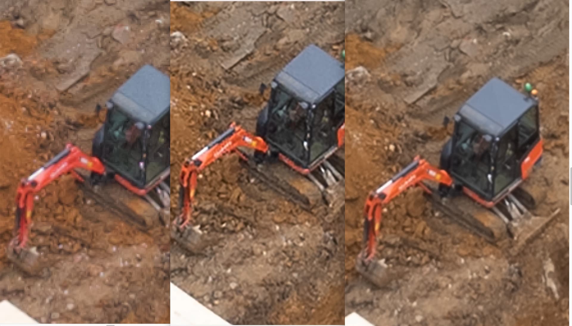
So here’s … a pretty amateur impression of what happens with superresolution.
Left = One original shot
Mid = That shot, upscaled in photoshop to 200% and then used the ‘automatic’ smoothing mode.
Right = 15 pictures taken in a row by drone, then merged in photoshop.
Take that for what you will but #3 certainly is better than the other 2, it’s just still possible that the middle one could be improved by doing a better job smoothing/blurring etc.
Hey all, sorry to bump an old thread but I’m curious about this too. I’m looking to find a way to make a video log profile for the Mini 2, and am trying to figure out how to adjust the gamma curve on the camera, does anyone know how to get into the camera parameters? I know log is possible on the higher model drones, but I genuinely believe there’s no limitation for the Mini 2 to have it as well, it feels like it’s just a way for DJI to make people buy the more expensive drones.
I already attempted the litchi “hack”, but this doesn’t add any data that true log would (I compared two shots, there is literally no difference in data).