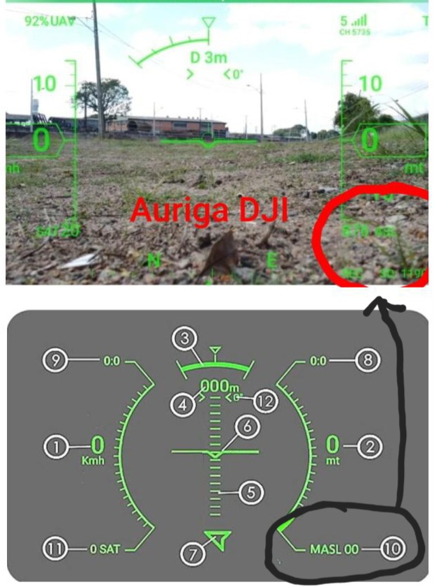
Haveria possibilidade de demonstrar na tela, a altitude em relação ao nivel do mar, no local do vôo, como se mostra no HUD do app “Auriga DJI”?
Grato pela atenção, se cuidem, Deus o abençoe.
Haveria possibilidade de demonstrar na tela, a altitude em relação ao nivel do mar, no local do vôo, como se mostra no HUD do app “Auriga DJI”?
The only way I know of for a drone to obtain height above sea level (MASL) is from GPS. However, GPS height is only an approximation using an ellipsoid representation of the earth and is highly inaccurate. I don’t see any use for this with a drone.
Perfeito, não tinha pensado desta forma, concordo contigo, podemos ignorar esta ideia entao. Se cuide, bons voos, Deus te abençoe:hugs: