How to Use Google Earth to Check Terrain Between Drone Waypoints
A practical method for drones that rely on AGL instead of true terrain‑follow
Overview
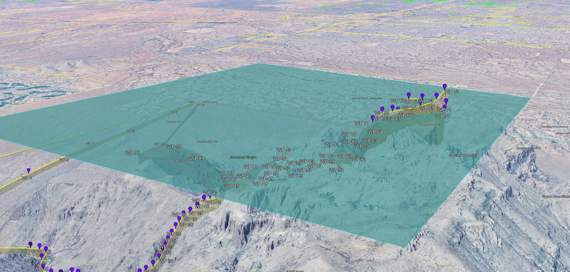
When your drone uses AGL (Above Ground Level) per waypoint, it only checks the elevation directly beneath each waypoint. It does not evaluate the terrain between them. That means ridges, hills, or mesas can intersect the straight‑line path and cause a collision.
Google Earth’s Polygon Tool lets you create a flat “flight plane” at your intended altitude so you can visually inspect whether terrain intrudes into your path.
1. Create a Flat Polygon Representing Your Flight Altitude
-
Open Google Earth Pro.
-
Go to Add → Polygon.
-
Draw a polygon that covers the entire area between your waypoints.
-
In the polygon window:
-
Go to the Altitude tab.
-
Set Altitude Mode to:
-
Relative to Ground if you want the polygon to float a fixed height above terrain, or
-
Absolute if you want to match a specific MSL altitude.
-
-
Enter the altitude that represents your intended flight height (e.g., ground elevation + 200 ft).
-
Choose a bright color and set opacity to ~40–60% so you can see terrain through it.
-
This polygon becomes your virtual flight plane.
2. Align Your View for a Horizontal Terrain Check
To detect terrain intrusions, you need a side‑on perspective, not a top‑down map view.
-
Hold Shift and drag to tilt the camera.
-
Rotate until you’re looking along the path between your waypoints.
-
The polygon should appear as a flat sheet hovering above the terrain.
This horizontal view is what reveals hidden ridges.
3. Lower the Polygon to Simulate Your AGL Offset
Now you test whether the terrain intersects your intended flight height.
-
Reopen the polygon’s Altitude tab.
-
Slowly lower the altitude value.
-
Watch the terrain as the plane descends.
-
If any terrain pokes through the polygon, that means:
-
Your AGL offset is too low for that segment, or
-
You need additional waypoints with corrected altitudes.
-
This is your manual terrain‑follow simulation.
4. Adjust Your Mission Plan
If terrain intersects the polygon:
-
Raise the altitude of one or more waypoints.
-
Add intermediate waypoints to “step over” ridges.
-
Re‑test by lowering the polygon again.
Repeat until the polygon can descend to your intended AGL height without terrain contact.
5. Tips for Better Accuracy
-
Use Google Earth Pro, not the web version — it has better elevation data.
-
Check from multiple angles to catch side slopes.
-
Turn on terrain exaggeration (Tools → Options → 3D View → Elevation Exaggeration) to make subtle rises easier to spot.
-
Save your polygon as a KML so you can reuse it for future missions.