i have asked on facebook and been told this can definitely be done but i cant figure it out myself,
I am on a farm and want to use my drone to measure paddocks, so essentially i want to fly to all four corners of a paddock, and have it tell me that was ( x area )
where do i find “set the waypoint in the plane”? and will it tell me the size of the area i have flown; i dont want the circumference/length of the flight eg 3km, i want 5acres for example
ah okay i see, and then once i have the dimensions (4 corners and distance in between, will it calculate the area for me or do i need to work that out myself?
Litchi can NOT calculate an area.
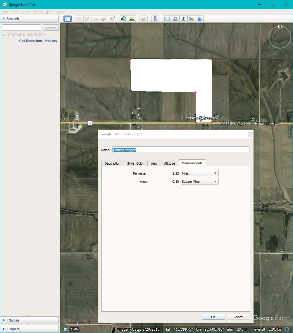
Here’s a simpel way to do so using Google Earth:
Open Google Earth
Zoom in to the paddok
Draw a Polygon around the borders of the paddok, the polygon can have has many points/corners as you want (dubbel-clicking the last point closes the polygon)
i was hoping to measure crop paddocks into smaller blocks with the drone every year as yeild changes alot,
seems i wont be able to do this with the drone, ill stick to doing it manually for now,
If the paddock has been there for more than a couple of years then go onto Google Earth, draw a polygon around the paddock and then you can read the area in acres or hectares.