In the DJI fly app, if I point the camera vertically down (at 5) and initiate a panorama, I will get a capture where the center of the panorama is the region vertically below the drone. ie, if the 9 shots it takes are numbered 1-9, then 5 would be the point exactly below the drone (ie, center of the frame when the camera pitch is -90 degrees).
I tried out a few settings to mimic the DJI Fly app (Horizontal FOV = ~110 degrees, Vertical FOV = ~100 degrees, columns = 3, rows = 3) but I end up with the 8 as the region are exactly below the drone, and I dont get the areas behind the drone in the panorama.
The actual capture is a trianglular region with 5 as the region directly below the drone (5 is where the camera was pointed at when I start the pano capture sequence). Or in other words, even though there are 9 shots taken, the panorama does not capture “behind” vertically downward direction (ie, regions 7, 8, 9 are not taken like in the DJI fly app). The litchi shot catures a scene region like so
I think the DJI fly app yaws the entire drone 180 degrees to get those shots - I never verified this when originally taking the shots and observed this difference only when I came back home and tried stiching the shots taken via Litchi
I (had already) read the user guide. I didnt find the answer to my question above.
I think I did a poor job of explaining the problem in my original post.
I do get 9 shots already, just that the lowest row is essentially just the same region (vertically downwards - all 3 shots are mostly just overlapping, with just different angles of the vertically downward direction being captured).
The problem I have is that I’d like more of the area behind me too (I am standing vertically below the drone) like how it is in the DJI Fly app (which I dont want to use all the time due to outdated height limitations that arent updated, nor can be changed).
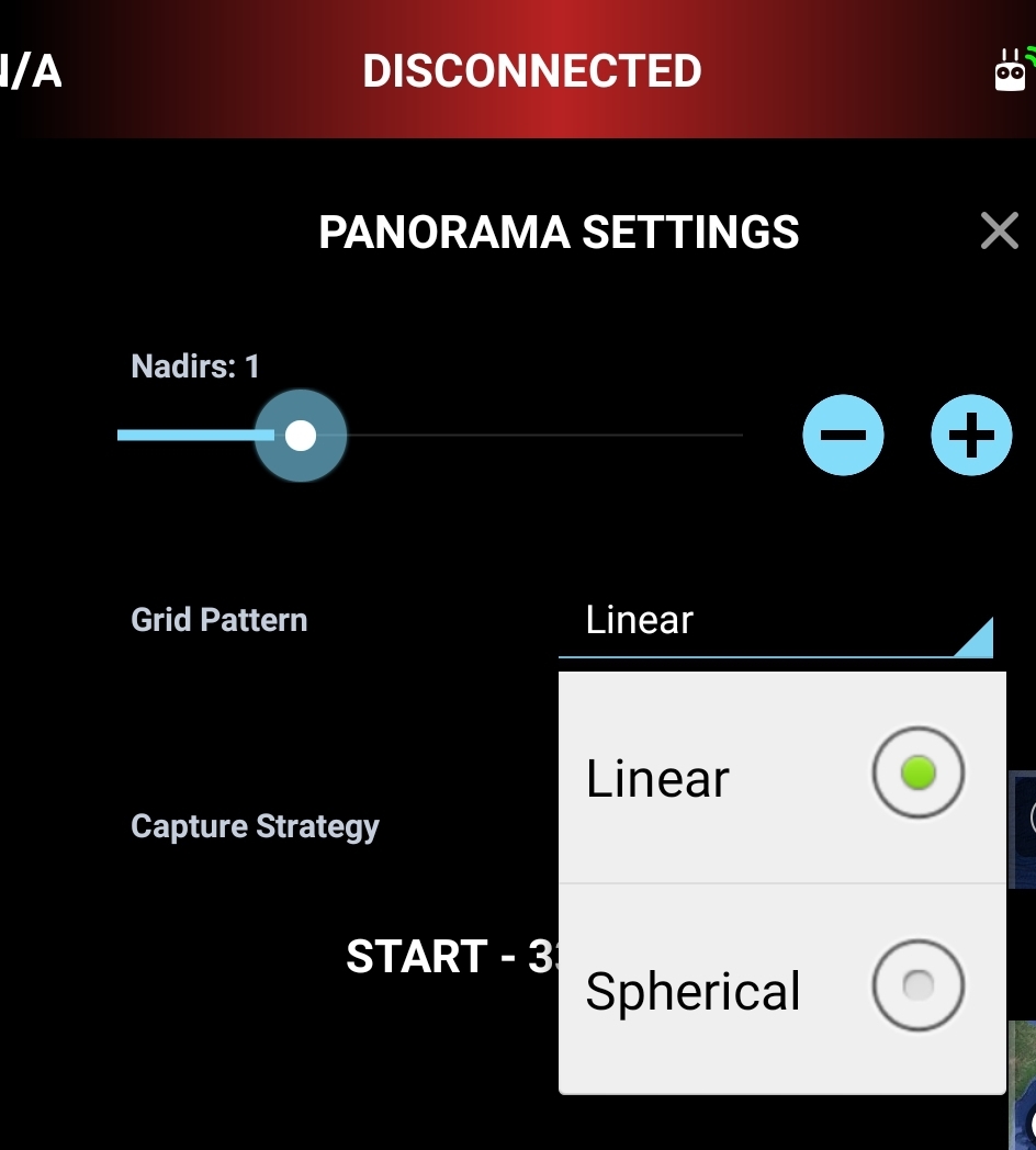
(Also for some reason I am unable to change the nadirs setting even in the spherical grid pattern mode.)
I think I can live with this by getting a 360 panorama and then cropping out to the centre. What do you guys use/recommend (preferably free, but paid is ok too as long as its not a ridiculous subscription like the adobe suite that can’t be bought for less than a year at a time) for stitching 360 panoramas. I am using Affinity photo and its not doing a good job for this case.
I think I have tried all options by now. So tagging @vico in this post as a feature request.
As I understand it, you want the panorama not in front of the drone, but in the form of a map. Then part of the panorama will be in front and part behind the drone. Thus, the drone should turn back. So you need to set the horizontal angle to 360.
It sounds like you are trying to shoot a pano of the ground, something we have not really planned/tested. Have you tried something like 360 width, 1 nadir, 8 columns, 1 row, linear grid pattern, and start shooting the pano at the angle you want the row to be at, for example -70 degrees. The height setting does not change anything when there is only one row
Thanks, I’ll try this. Not sure if this will give what I need (which is to capture area behind me as well - I am standing vertically below the drone), but I’ll try this out and see what turns up.
Because the DJI Fly app (which I dont use for other reasons) used a 3x3 grid to cover a ~110x100 degree field of view, so I used it as a starting point since it guaranteed that I will have overlap between the images.
Exactly. I am looking for a map/birds eye view with sufficiently large amount of surroundings captured - to produce that wide-angle view/warp (and hence the attempt to get a pano, and not just a single shot from high up above)
I’ll try your suggestion about horizontal angle = 360
Thanks! I’ll check him out.
(Hope to get back to flying and test out all of these things as soon as I can, but I doubt I’ll be able to get to it before the weekend.)
That’s right, but this is used for the panorama in front of the drone. Since the drone’s camera cannot be pointed backwards, you need to take 3 shots below the drone and 3 shots in front, and then rotate the drone 360 and repeat, 3 shots below the drone and 3 behind.
Thank you! This does the trick for me. -70 to -65 degrees gives the kind of shots I was after.
I had great difficulty in getting my photo editor (Affinity Photo) to stitch panos consistently well. It could stich upto 8 shots and 70 degree pitch correctly but went berserk as the pitch was reduced (less negative) to increase the view of surroundings or if the number of photos (columns) was increased.
Luckily I found an excellent open-source and free panorama sticher in Hugin. Its got a bit of a learning curve, but produces really good results for my needs. The DJI Fly app’s wide-angle look can be replicated by rectillinear projection and Hugin comes with a lot more projections over and above rectillinear.
Thanks a lot everyone, for your suggestions and help