The flights I need to do require quite precise positioning between high rise buildings to simulate views from different units. The problem I am having is that the drone GPS is showing quite far off on google maps. Strangely in the DJI Go 4 app it is almost dead on.
I realise that I could move the flight path around but this seems a sloppy way to do it and not easily repeatible. Any suggestions on how to deal with this.
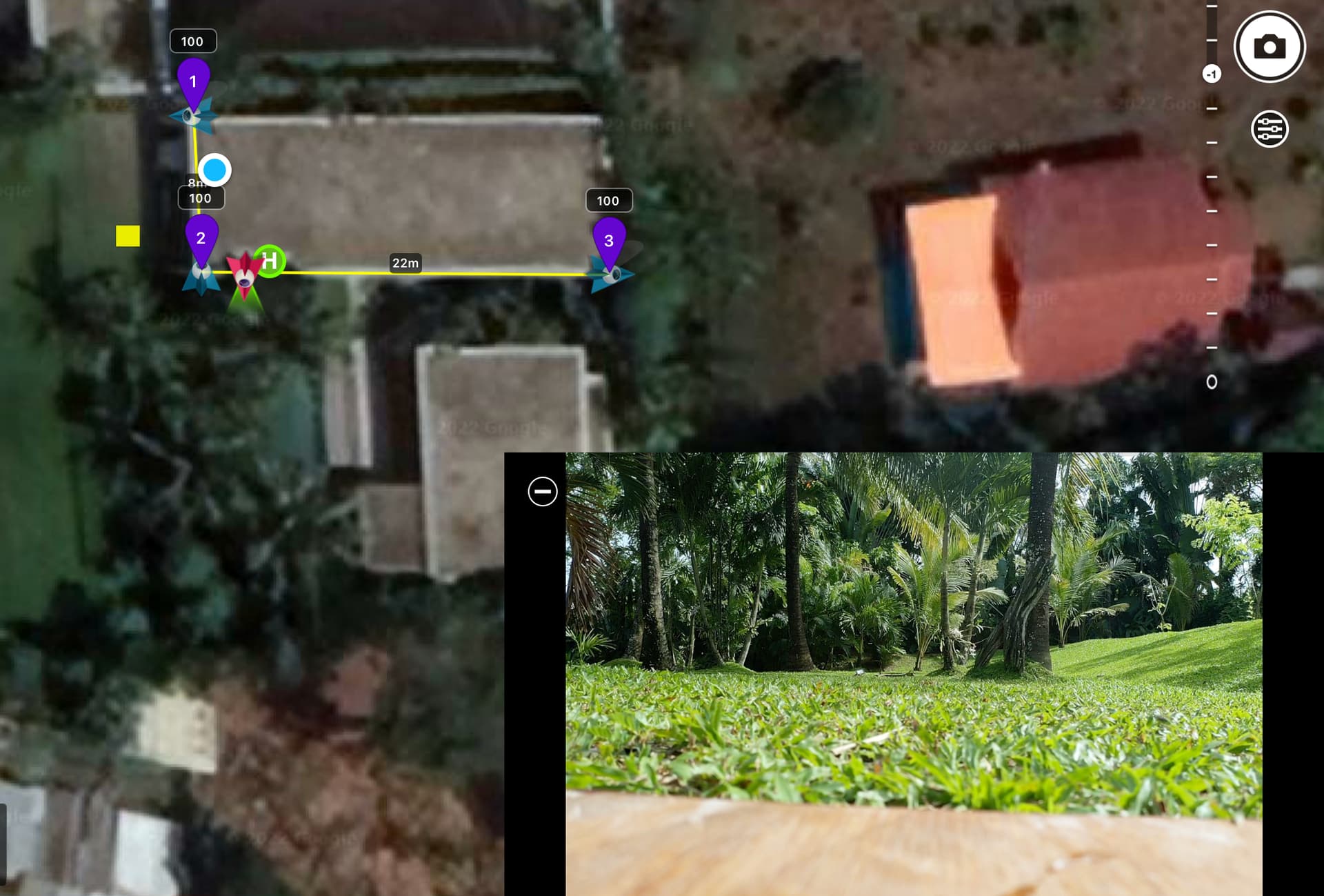
Yellow square in the image is the actual drone position.
How to deal with it? Slide the whole path over so when you observe the drone in reality it is in the correct position and then just cross fingers that it will cancel the error evenly over the entire flight path?
I saw your suggestion that some sort of calibration for the map would be a very useful feature and I must second that.
In the City’s urban canyons, there are fewer satellites visible due to the tall buildings, causing the GPS signal at ground level to be degraded or lost, either through satellite signals being obscured or through signals bouncing off surroundings and forming multiple paths as they reach the street (or canyon floor) resulting in position mismatches.
That may well be in my ultimate destination but the place I am testing has no tall buildings.
Honestly I think it would not be too hard to correct if I could figure out how to move multiple waypoints in the IOS app. select all does not seem to help.
Repositioning the flitepath (mission) would only make sense if the position mismatch is constant, i.e. the same distance and direction along the whole mission and at every height.
There is NO garantee for that.
Commonly the higher you fly, the more satelites will be visible and lock so GPS accuracy will improve.
Also the ‘Urban Canyon Effect’ will vary.
exactly what is happening to me. I think I will have to dial in a correction manually to each set of waypoints when I get to site. Its annoying but I dont see another way. There is probably a way to do it with a bit of math and a csv export but as long as I am within a couple of meters its ok. The problem is that now I am off by 8 which is too much
You are mistaken, there is no effect, because the position of the smartphone is very accurately displayed on the map and on the ground and on the roof of a tall building. I build routes when I am at a location and put points exactly according to the position of the phone on the map.
If I have a route in the field and an altitude of 100 meters or more, I certainly do not need such accuracy. And that wasn’t always the case, I had routes with 1 meter accuracy before and it was excellent.
The author of this topic correctly says that if at the moment the drone is turned on, when the smartphone and drone icon is displayed on the map, at that moment you need the opportunity to combine these points - this will be the gps calibration
If you say so.
A smartphone also uses celltowers for positioning.
The canyon effect will play a roll at the location with high rise buildings the poster wrote about in his first post.