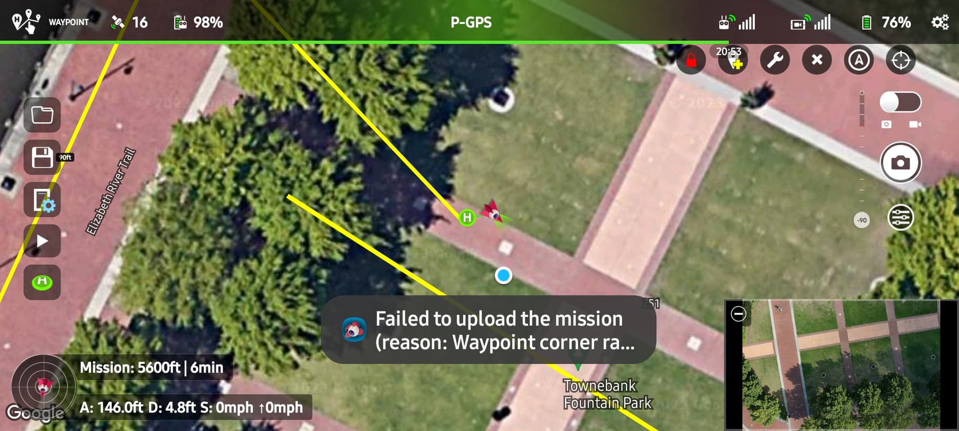
I was unable to load my mission to my mavic 2 pro. It gave an error on the screen but there was not enough room on the screen to see the reason why. Is there a log that I can open to see the message?
Take a screenshot of the portion of the error that is displayed and post it here. While there is a log that begins at power-up, it probably won’t show a mission loading failure.
Also. The distance from the first to the last point is less than 1,400 Feet.
The missing part of that error message is “Waypoint corner radius is out of range”. It is saying that one of your waypoints has a curve size that is outside of the allowed limits. The allowed limit is from 0.2 m to something large like 1000 m. Check he curve sizes in the Mission Hub.
So this was created using the grid tool in virtual mission hub. I think there may be a glitch. I am going to set up this mission manually and see what happens.
I set up a mission manualy. I did NOT use the grid tool in the virtual lithchi mission hub and it ran just fine.
In a Grid created by VLM all waypoints have a curve size value of ‘NaNm’, this is an invalid value.
To fix this:
-Batch select ALL waypoints
-Set curve size to 0% and apply
-Now only the first & last waypoints still have ‘NaNm’
Either delete them or:
-Add a waypoint, then delete it. This fixes the last waypoint
-Insert a waypoint between waypoints 1 & 2
-Delete the first waypoint
-Move the inserted waypoint, which is now WP1, to the correct position
-Check & correct/edit its Curve Size, Heading, POI, Gimbal Pitch & Actions
Thank you. I will try that.