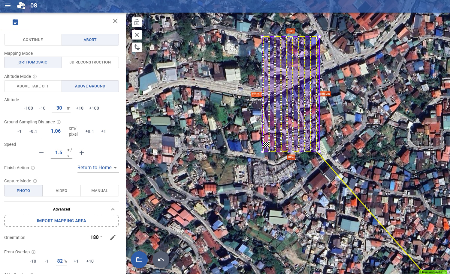
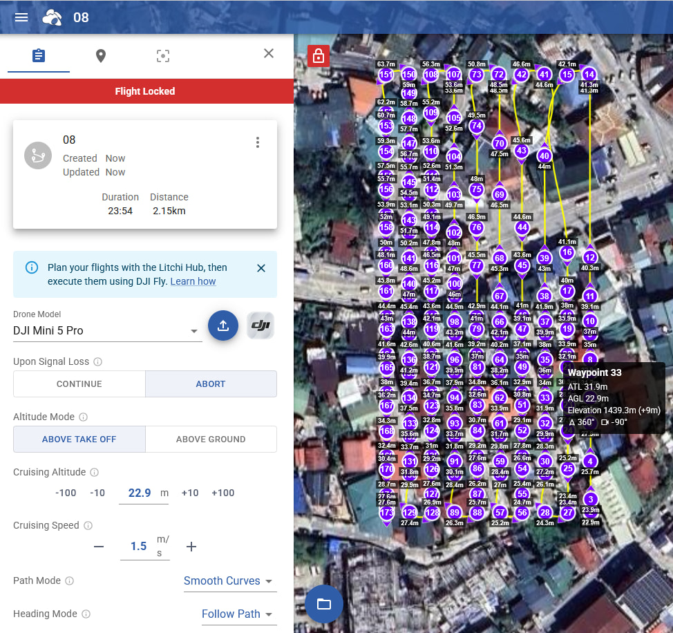
And now I can edit the individual waypoints (which is sadly in my area a necessity because there’s everywhere cranes, electrical wires, mountains, hills, trees up to 40m, buildings up to 100m, Antenna’s etc.)
This whole workflow - doing it for every single individual flight..
Can’t you just add a “button” or under the “three dots” an option to enable the waypoints? Also so it retains path mode ..
Would save me many clicks and export/import/delete etc..
We’ll look into fixing the importing bug with straight lines → smooth curves.
We understand you’d like access to the waypoint, but we’d like to wait and see if there is more demand for this as it requires a lot of testing on our end to make sure it won’t break anything. Right now the area mapping flight type generates all waypoints for every setting change. So if you’d edit a waypoint and then modify a global setting afterwards, it will likely override your custom waypoint changes. Not to say this can’t be handled but it’s not as trivial as it looks to implement and ensure it’s bug free.
Perhaps a simpler option would be to provide an easy way to convert an area mapping flight into a waypoint flight
I think that this is the correct answer. With a function like this, only those with specific requirements can revert their mapping mission into a general waypoint mission where there is more flexibility.
I think that’s a good solution - as long as it makes use of the terrain elevation feature because that’s honestly one of the best features you offer, very grateful for it.
It allows even RPA without terrain follow mode, to do solid surveys with data consistency