Hi Wes,
You are right about the facade Mission Maker. It very closely provides the finctionality that I am looking for.
How hard would it be to support multi point lines (Polylines) ? I feel that I can manipulate the .csv files afterwards to add the camera angles I require.
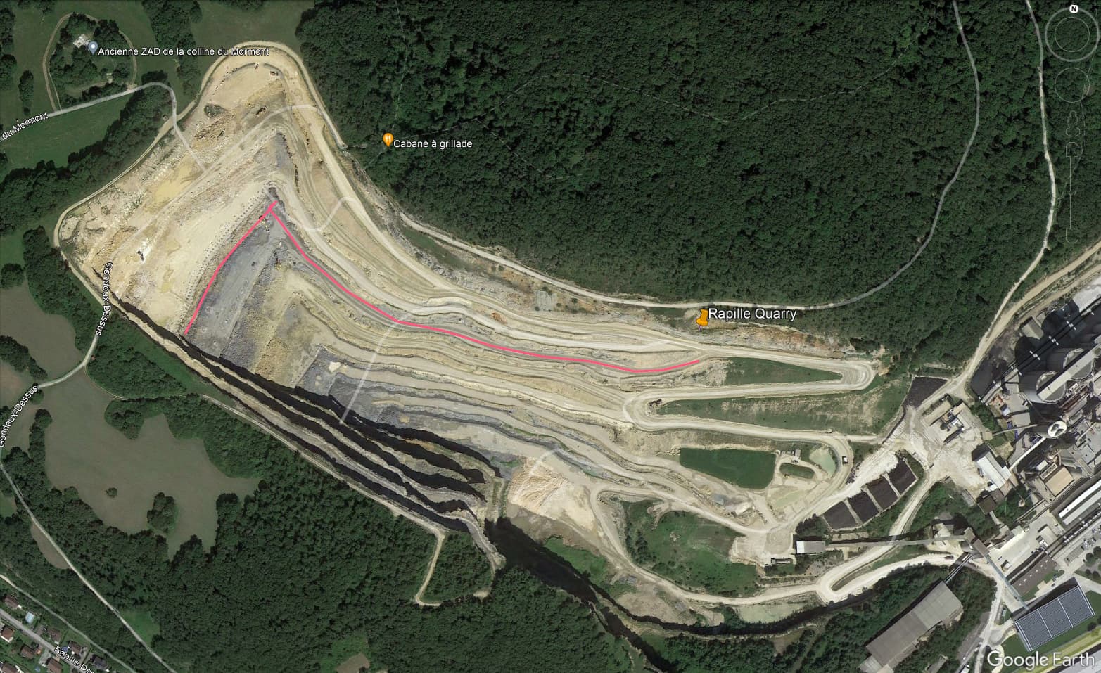
Here is a screenshot from a polyline drawn in Google Earth. The concept of left 90 degrees works well as a constraint for the camera facing direction.
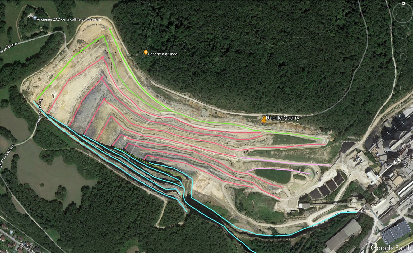
If I was doing an initial mapping of the entire excavation walls (facades) the mission would look more like the second screen grab.
I attached a link the .kml file for the lines as well in case you are interested in having a look. (Not able to upload the kml file directly.) Let me know if the link does not work.
Thanks & Cheers,
Jeff