Hey there. I was trying to do an area mapping in the Alps. Unfortunately, the terrain data (elevation data) in Litchi Hub is missing. Not only for the specific area, but for whole Germany, Switzerland, Austria…
I am wondering if it’s a problem that is on my side or from the implementation of Google? I need to do AGL flying for my thesis.
Are there any workarounds? I am flying the DJI Mini 5 Pro.
Kind regards, Melchior
Welcome to the forum.
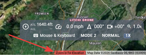
It may appear that elevation data is missing when you are zoomed out too far. When navigating to a “new” area, the Litchi Hub may indicate that there is no elevation data. However, if you’ll notice at the bottom of the screen, it will instruct you to zoom in to obtain elevation data as shown below:
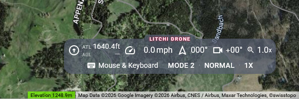
Once you zoom in sufficiently, the Mission Hub will make an elevation query and load the elevation data for that area.
1 Like
Thank you very much. I’ll try it tomorrow again! It works in the WebApp! So I’ll keep you updatet!