I have found many cases where the elevation data used in Litchi’s Mission Hub (when the “Above Ground” option is checked) disagrees with what is displayed in Google Earth Pro. I am wondering if anyone else here has worked with elevation data and can share their knowledge about this.
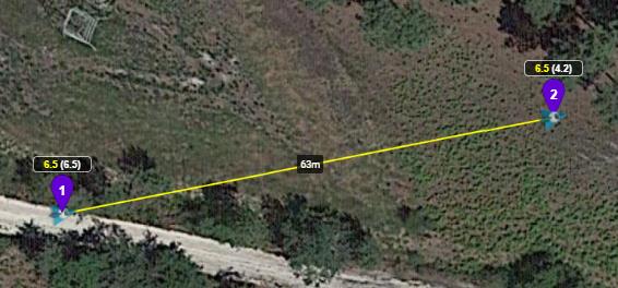
Here is a simple Litchi mission where the “Above Ground” option is checked:
Notice that according to the heights displayed in Litchi that WP1 is higher than WP2. The drone would start at 6.5m above take-off and fly down to 4.2m above take-off to remain 6.5m above ground.
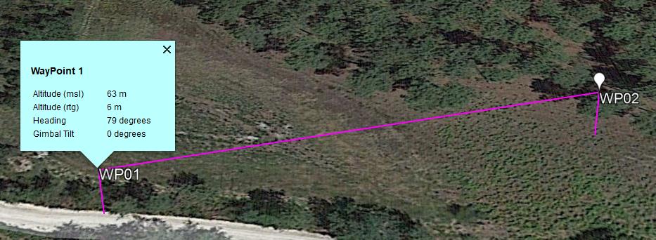
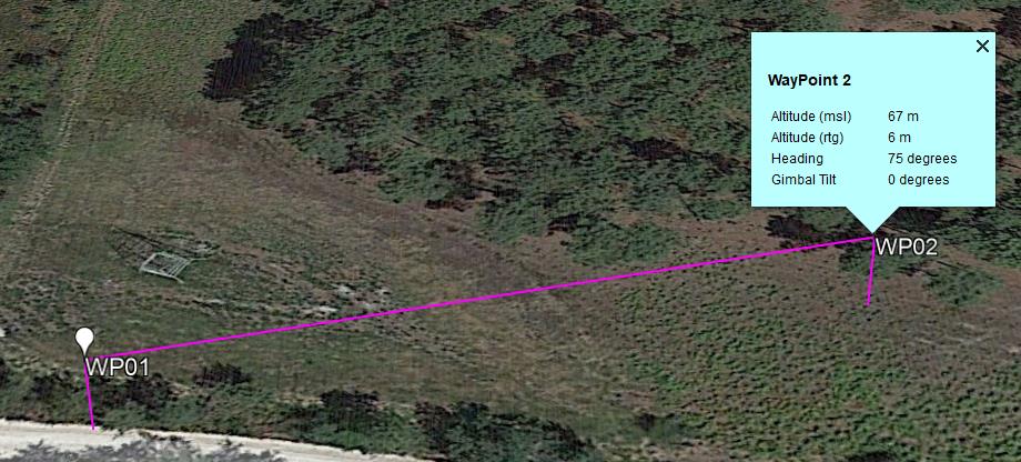
Now, I export that mission to Google Earth Pro and see this:
According to this, WP2 is at 67m MSL (also 6m above ground). This suggests that Google’s elevation model determines that WP2 is higher than WP1.
Both Litchi’s elevation data and Googles elevation data cannot be correct. The person who shared this data with me says that in reality, the ground below WP2 is indeed higher than that of WP1.
I know that there is always going to be some error in elevation data models. Is this example within the expected elevation data accuracy?
I use Google’s Elevation API in my programming. I find it fairly straight-forward to use. I once heard that Litchi used “Mapbox” elevation data. I do not know if that is correct or not. I tried the Mapbox TileQuery API but I find it confusing and unusable because it is only accurate to the nearest 10m:
Mapbox Documentation: Also, since the elevations are returned in 10 meter increments, the results may lose some nuance.
I would enjoy hearing anyone else’s experience in using elevation data and what is used in Litchi’s Mission Hub.
I’ve found this above ground and above current to be very confusing. So I never enable them anymore. When my mission is flying now the audio prompts coming back always report the correct altitude I set regardless of where I fly, on the flat or on inclines.
The ‘Above Current’ setting (which only appears when 2 or more waypoints are selected) will ADD the altitude you select to the current altitude of the selected waypoints. Its a way to elevate all selected waypoints by a set distance without having to set each one separately.
Ex: If waypoint 1 is 50m, #2 is 100m and #3 is 150m.
If you select ALL 3 and click the ‘Above Current’ then set the altitude to 100m and click APPLY, the new settings will be: #1 (150m), #2 (200m) and #3 (250m).
In addition to what I have outlined above, I have found that when designing an “Above Ground” mission in Litchi, then exporting this mission to Google Earth Pro using Virtual Litchi Mission, the waypoint heights displayed in Google Earth Pro are not those shown in Litchi’s Mission Hub.
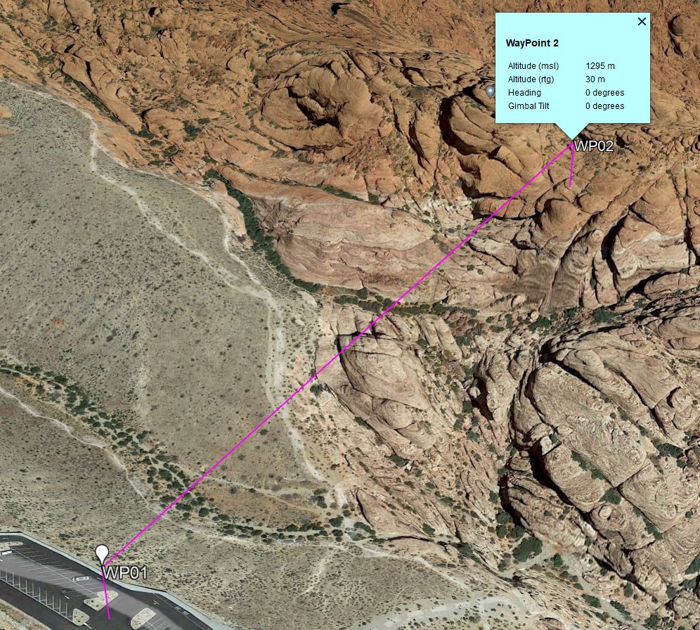
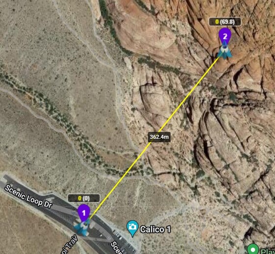
Here is an example mission in Litchi’s Mission Hub. Both waypoints are set to 30m above ground. From what is displayed, the ground below waypoint 2 is 70m higher than the ground below waypoint 1.
So, according to Google, the ground below waypoint 2 is 62m (1295-1233) higher than the ground below waypoint 1.
Litchi: 70m higher
Google: 62m higher
From inspection, I can see that the flight path as displayed in Google Earth Pro is using Google’s above-ground height for waypoint 2, not Litchi’s height. If I go back to Litchi and make the height of waypoint 2 100m and uncheck the “Above Ground” checkbox, then export to Google Earth Pro, the height of waypoint 2 increases to correspond to Litchi’s elevation model.
To summarize… When designing an “Above-Ground” mission in Litchi’s Mission Hub then using VLM to view that mission in Google Earth Pro, the height of the flight path displayed in Google Earth Pro is using Google’s elevation data and not Litchi’s elevation data.