I’m excited to see that the new Mission Hub now supports area mapping! I currently use a Mavic 2 Pro. Previously, I tried area mapping using Ancient.Land (https://ancient.land/) and the older Mission Hub for mission planning. While it worked, the drone would stop at every waypoint to capture images, which made survey times extremely long. For example, it took me around 10 minutes to map less than 2 hectares.
With this new area mapping feature, has this issue been addressed? Can the drone now capture images seamlessly while flying, like DroneDeploy, instead of stopping at each waypoint? Stopping at every point is not practical, especially with limited battery capacity.
I hope Litchi can develop the mapping feature further so it can perform professional surveys efficiently, similar to DroneDeploy or Map Pilot Pro.
If you use the altitude mode “above take off”, then the drone will only stop and turn on the edges of the grid. If you use the altitude mode “above ground”, then it may stop in between in some cases if the terrain elevation requires a change of travel direction
While Ancient.Land was a very useful site for mapping, it (apparently) has fallen into an unsupported status.
The key piece of Ancient.Land that you may have not used was the Z-check, which eliminated the intermediate waypoints along flight corridors.
It was (and still is) possible to delete those intermediate waypoints in the Litchi Hub and use Photo Capture Interval (either by Time or by Distance) instead of using Waypoint Actions.
I can confirm that Area Mapping in the Hub Beta will not create intermediate waypoints for the Mavic 2 Pro (I fly 3 of them).
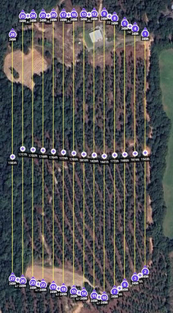
Here is a mission created in Hub Beta, and a screenshot of that same mission in the original Mission Hub. Note: This mission was created using Above Take Off
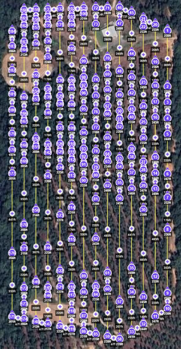
If you use Above Ground to create the mission, it will create intermediate waypoints, because of elevation changes. The same mission will now look like this:
It’s also worth noting that the drone will not necessarily stop at each intermediate waypoint.
With Litchi Pilot (not supported with old apps), the drone will only stop at a waypoint if the 2 segments are not aligned. In the current Litchi Pilot build (526), we consider segments to be aligned if their directions differ by no more than 1 degree. In the next build, this threshold will increase to 5 degrees, so the drone should pass most waypoints without stopping unless there is a significant change in elevation.
i tried area mapping yesterday and happy to see that drone didnt stopped every time to capture image but of course in waypoint when above ground was selected. this reduced the flight time significantly. But i coudnt see the estimated time to finish timer. It would be great to have time lapsed timer and estimated finish time timer during flight. Also, plz also show the no. of photo captured during the flight.
please suggest best setting for area mapping like curved path or straight, Heading mode follow path or initial. what speed would be great for mavic2pro at 100 m Agl 80-70 percent overlap.
Stopping drone for capturing images is the real comparative advantage of quadcopters versus flying wings, since image sharpness is a key parameter in photogrammetry engines
Not only I stop drone for taking pics but also I make it hover for 1 second before taking then and do manual obturation all the way with an eye on the histogram, taking photographs while moving only makes sense if you are seriously battery limited.
It is recomended that the flight distance while the obturation stays open not to be higher than 1/3 of your GSD = ground sample distance, which in practice means very low flying speed for usual obturation speeds in the range of 1/500 s. which is the real target in photogrammetry works, which will result in around 0,5 m/s max drone speed target. In overcast days not stopping drone makes it all very difficult to keep the 1/3 rule, which is the main limitation of flying wings
Does this 5° count in the Z direction too? My flight paused at the waypoints today and that’s all I can figure would be the issue, or has there been a regression? I’m on 595