Hi all,
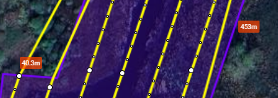
I’m playing with the new (fantastic) area mapping function, it’s going to make my voluntary mapping work a LOT easier. One question though, what do the values in the orange box mean? I assumed they were for altitude but the numbers made no sense at all. In the flight pictured the area is essentially flat but these numbers don’t reflect that. Any ideas? Thanks in advance.