Hi,
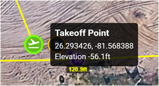
Can someone explain the AGL model to me? Is there a documentation for this that makes sense of these values? I have a Waypoint mission. I take off from a location that according to Google Earth is 17 ft Above Sea Level (msl). However the DEM Litchi seems to say the elevation of the takeoff point is – 56.1 ft. What Coordinate reference system is Litchi using?
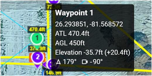
So now on to Waypoint 1. Waypoint 1 says the altitude above take off location is 470.4 ft above sea level, but 450 ft AGL. Also the Elevation shows -35.7 ft. !!! What is the AGL Datum for Waypoint 1? Also the “Elevation” readout is -35.7 ft? Again what datum is this and what CRS is it using? Clearly not msl.
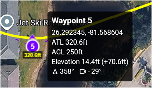
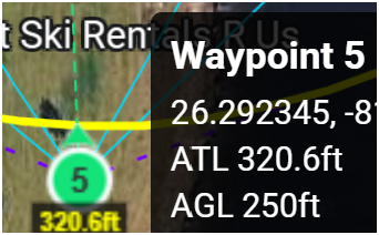
Moving on, to Waypoint #5 which is a short horizontal distance away, some large elevation discrepancies are forming. How to interpret this? Google Earth shows the elevation of the ground is still 17 ft at WP #5, but Litchi is reporting things very differently. How can this be reconciled? WP# 5 shows ALT 320.6ft, AGL 250ft, and Elevation 14.4ft. How are ATL, AGL and Elevations being determined?
Since the difference between take off point and MSL is only 17 ft, shouldn’t ATL and MSL differ by only 17 ft for all Waypoints in the Mission?
Looking for a logical explanation so I can make confident use of the AGL function.
Thanks.
At waypoint 1 the height of the drone is 470.4 ft above take-off level, not sea level. Height above sea level has little to nothing to do with the drone’s height measurements. The drone will only ever know its height above take-off. It has no way of measuring anything else. So, any discussion of a drone’s height should not include sea-level measurements.
When the Above Ground option is selected, Litchi will adjust the heights above take-off based on the Google Elevation API or a DEM that is loaded. For normal waypoint missions, it is important to ensure that the elevation of the ground under waypoint 1 is the same as the elevation of the take-off point. For mapping missions, Litchi allows one to specify the take-off location so that its elevation may be compared to the ground elevation under each waypoint so that it can calculate the corresponding above take-off (ATL) heights.
I have some documentation that may provide a little more detail on how the Above Ground option works:
OK, I did read this document before posting and it did clear up a few things (like the first Waypoint elevation sets 0 ft AGL - but more on that later). So I still do not understand what the waypoints / take off points are showing. Let’s work on some answers.
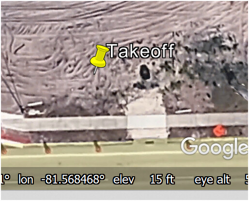
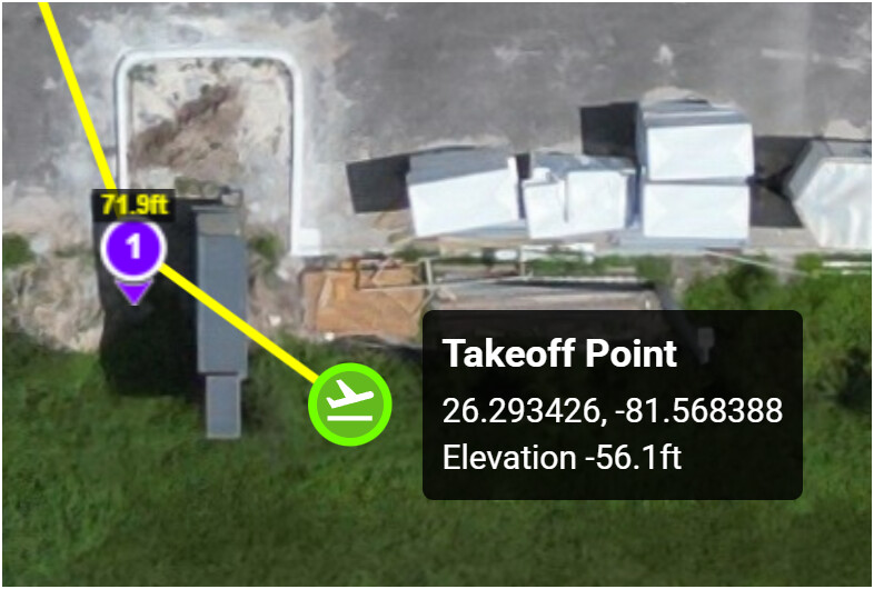
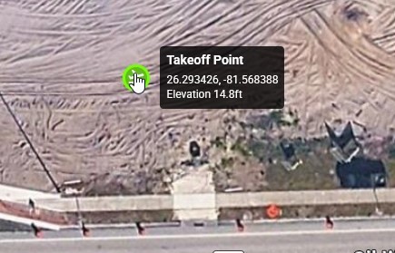
1. Google Earth shows my take off point is around 15ft altitude, This is close close enough to the real elevation MSL. But Litchi shows Elevation of -56.1 ft.
Google Earth:
Litchi Take Off point.
So Question - What is this -56.1 ft negative elevation? Should we infer this take off point is below sea level? So how can this value be rationalized?
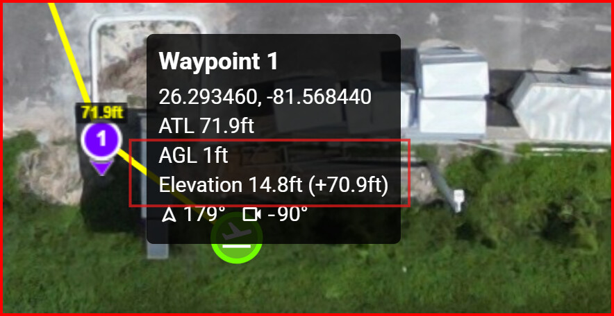
- Next at Waypoint 1 Google earth shows a 15 ft ground elevation still, but now Litchi shows ATL = 71.9ft and AGL = 1ft. Since the first Waypoint elevation defines the datum for the AGL for the Litchi, this is consistent sort of. (but in my opinion this is an illogical implementation and the Litch AGL value should instead be tied to the Take-Off Point, not the first Waypoint height, but Vico may need to weigh in on the reason for this “strange” and unsafe implementation).
So let’s try to explain why the Litchi AGL shows 1 ft, and not 0 ft according to their definition of defining elevation tied to Waypoint #1. Also in Litchi why is the screen shot “Elevation” showing 14.8 ft? Coincidentally this is what Google Earth shows on their CRS for ground elevation. In brackets there is +70.9 ft showing which seems to mimic the height of the first waypoint. Logically shouldn’t the AGL elevation of the waypoint be reporting 70.9 ft (or 71.9 ft), since the waypoint is very near the Takeoff point and that is how high the drone is above the level ground ( yes - the ground is flat in that area). Can this be clarified where each value is coming from and what do they represent?
-
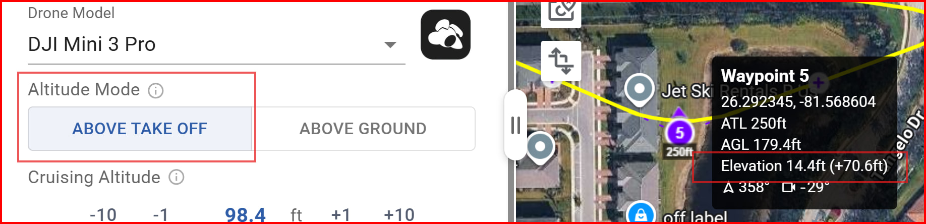
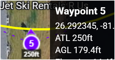
Moving on to Waypoint 5. This is where it becomes confusing. Google earth and Litch agree the Elevation is around 14.4-15 ft. and waypoint 5 ATL is showing 250 ft ATL . and AGL is showing 179.4 ft. So the difference between ATL and AGL is still 70.? ft consistent with the first waypoint offset. I still would say AGL and ATL should be roughly the same over flat ground, but I guess that’s the Waypoint 1 establishing the AGL for the mission again.
-
So note the when the overall Mission Altitude Mode setting = ABOVE TAKE OFF the waypoint altitude is 250 ft on the map itself, but when I switch the Altitude Mode to ABOVE GROUND, the ATL altitude of the waypoint on the map switches to 320 ft! Where now does 320 ft come from?
So what started out as flying Waypoint 5 at 180 ft ATL, should have been around 195 ft ATL when switching to ABOVE GROUND mode from initial take off elevation of 15 ft logically, but now is way up to 250 ft. or 320 ft. That’s big difference and very hard to intuitively rationalize. I am not sure what elevation above the ground my drone will ever fly at in Litchi. Please Let me know how to rationalize the answers to these questions. + @vico
For me, Litchi shows the same elevation as Google Earth Pro.
Have you loaded a DEM file? If so, your elevations are coming from the file you loaded.
Not that I can tell. I’ve tried loading a DEM for other mission locations, but Litchi does not like my CRS (Florida State Plane - EPSG 6438) and throws an error message. So no. But tell me how to verify and I’ll double check since I see nothing in the Map overlay section. But you can see how this is confusing. I see 3 Altitudes on Waypoint # 5 - 179.4 ft, 250 ft, and 320 ft - depending where I look and how the Altitude Mode is set.
Thanks again for your help.
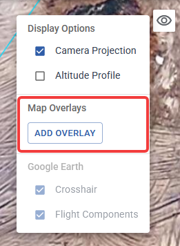
If you have a DEM loaded, it should show up here:
It is difficult to troubleshoot using screen captures. If you want me to look at this, share your mission.
Confirmed - no DEM added. Share attempted - let me know if you see it. Else let me know email id.
Thanks again.
You will need to make it public and share the link here.
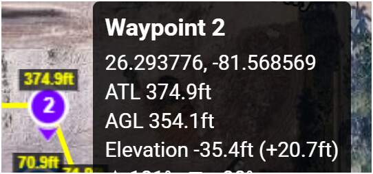
I had a look at your mission. The elevations for the take-off point and waypoint 2 are incorrect. If you ever-so-slightly move both the take-off point and waypoint 2, the elevation of those two points (and the rest of the mission) immediately corrects itself and all heights make sense.
Somehow (and I don’t know how), when those two points were created, they received incorrect elevation data. One can only guess how that might have happened.
OK Thanks. Must be a glitch in the Matrix! So what is the clue when this happens? How to recognize an incorrect elevation? A Negative elevation? Strange that the elevation of WP 1 is good, but WP 2 is incorrect. And then wrong elevations propagate to all the remaining WP’s apparently?
I wonder if anyone else has seen this situation?
The wrong height propagated to other waypoints because:
- The take-off point (reference point) had the wrong elevation
- The above ground option was used.
I have not seen this happen before.