Another chorus of praise singing from me is due in recognition of the magical drone operations that are only possible thanks to Litchi’s stable of ace code meisters. Over the past few days, I’ve been dabbling in the dark art of drone mapping to ultimately produce 2D orthomosaic compilations of my drone’s hundreds of pictures taken per sortie.
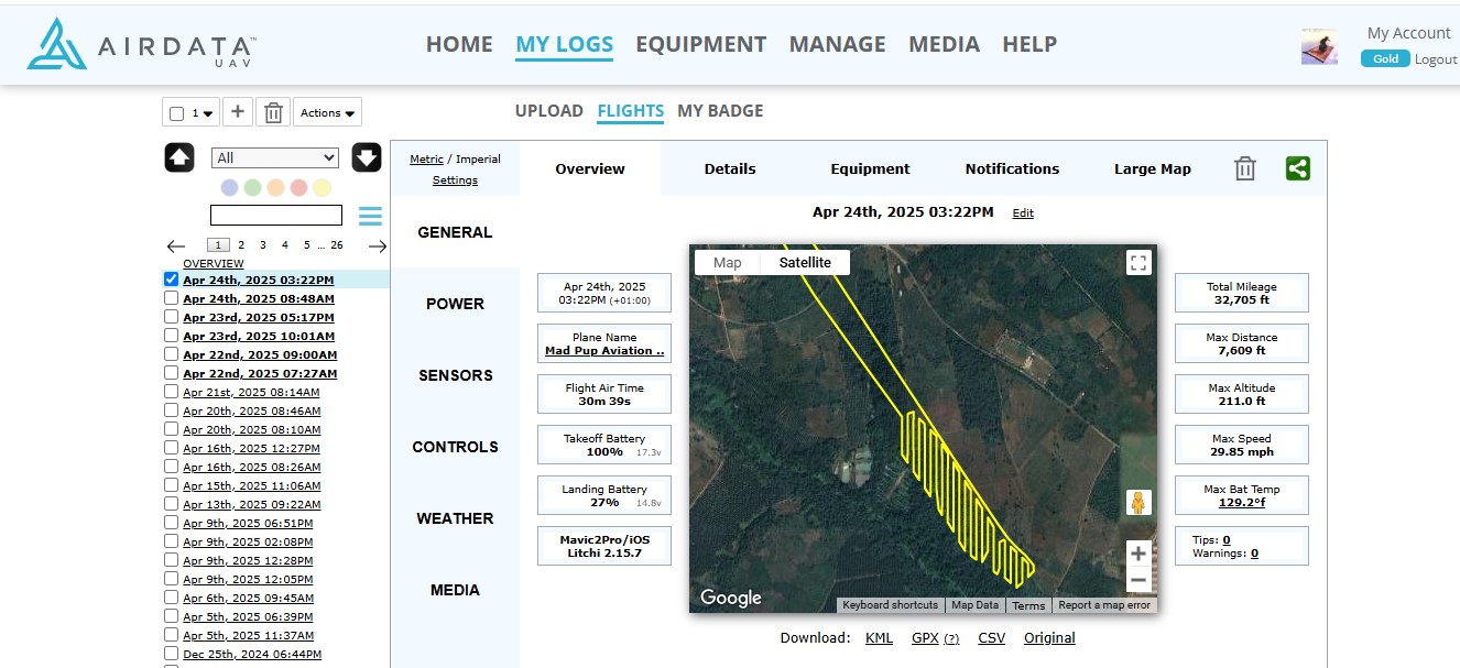
I sent the drone down to the swamp to map a small palm tree plantation that runs along the fringes of a tropical rainforest river. With this foray into drone mapping, the Ali Express steroid batteries I have been using, which can keep the drone aloft for 35 minutes, played a key role in that they made it possible to fly complex mapping missions a mile from the launch pad, and to return the Mavic 2 Pro safely with adequate battery power left half an hour later.
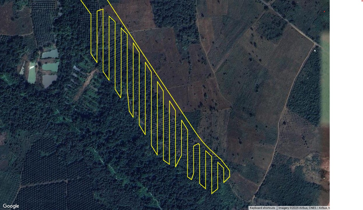
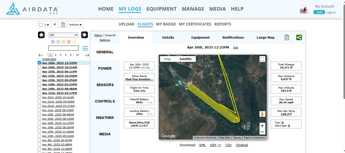
The 30-minute battery duration limits my Mavic 2 Pro’s mapping missions to 6 miles total distance covered per flight, during which about 300 photographs are taken at 5-second intervals as the lawn mower pattern is flown.
I start with the ancient lands website to create the initial mapping pattern, which I then import into Litchi to see if the flight duration is below 38 minutes. Litchi thoughtfully allows a generous margin of error in flight time computations, and experience with these mapping flights has shown that a flight time estimated at 38 minutes will actually arrive back at the takeoff point precisely at the 30-minute mark, with about 25% battery power left on landing.
Once again, I raise a toast to the brilliance of Litchi and its intuitive ease of use. Can’t wait to see how my orthomosaic process works using Web ODM, which is adequate for my bumbling experimentation. Details at ten…
If anyone is wondering how those catfish ponds were excavated, it was done with a 1976 Caterpillar D7G bulldozer sporting those extra-wide LGP tracks that allow that monstrous beast to work in mud that would be a hard slog on foot. It is a thing of beauty to watch that snorting machine roll up and move tonnes of mud per pass.
Without the timely advice you kindly shared here, Sam_ G, I’d still be scratching my head while puzzling over all the variables involved in the process of creating and optimizing a mapping flight path.
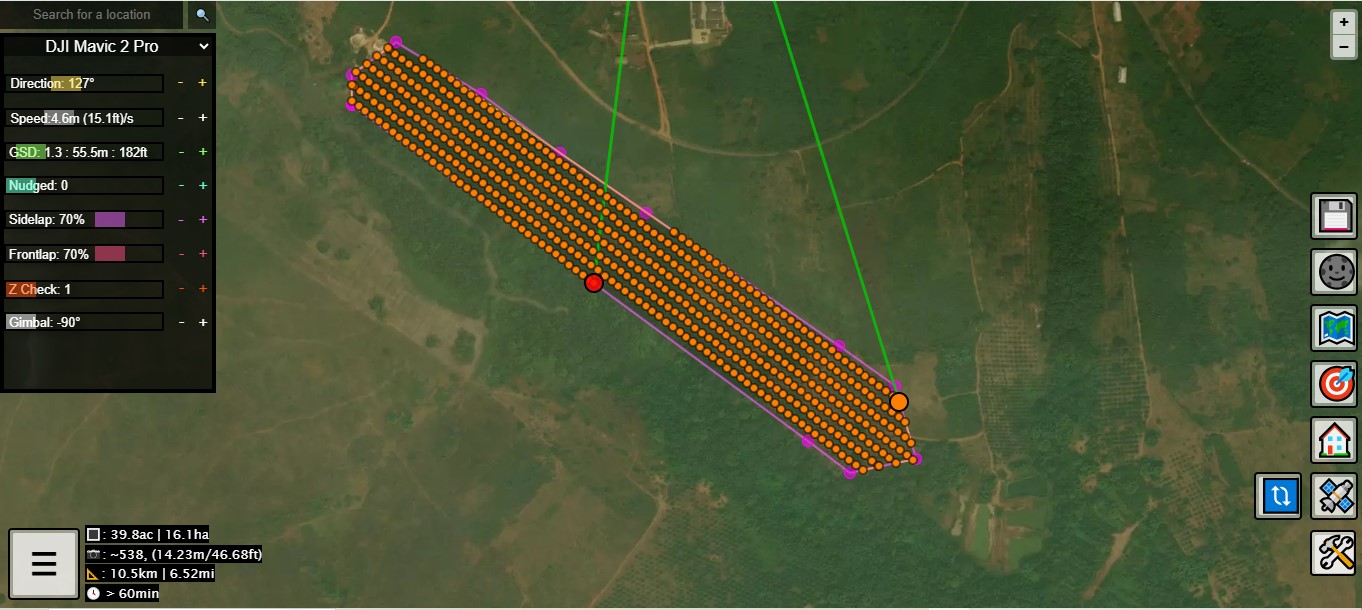
I stumbled on a couple of idiosyncrasies while using the Ancient Lands mapping flight creator. Firstly, I found to my surprise that if I first set the drone type to Mavic 2 Pro before using the “create polygon” button to set the perimeter of the area to be mapped, a couple of minutes could be shaved off the resulting Litchi-estimated flight time in comparison to the flight times that were seen when I drew the polygon before setting the drone type to Mavic 2 Pro.
Ancient Land’s pop-up menu item labelled “direction”, which allows the user to change the orientation of the mapping flight path lines, also had a surprising effect in that subtle changes in the trajectory of those parallel lines made possible significantly shorter flight times than were possible if the default “zero” setting was left unmodified by using the “direction” + and - adjusters.
I decided to explore the Ali Express extended-range battery in small steps, as part of my drone mapping study. This flight covered 6.58 miles, of which the mapping portion was all flown at 10 mph, while the departure and arrival legs of the flight were at 27 mph.
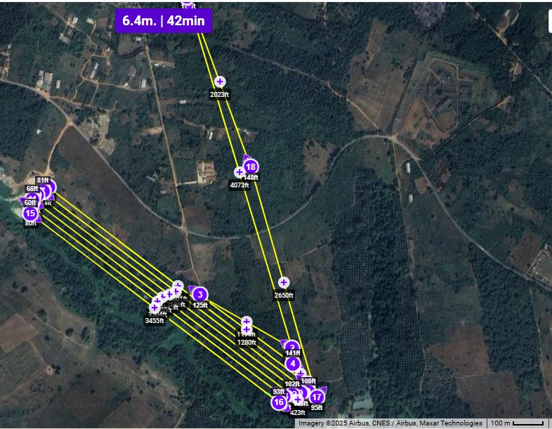
For anyone who uses the Ancient Lands website to construct their mapping flights, it will interest you to know that the flight time estimates made by the Ancient Lands website are greatly overstated by as much as 30 minutes. This mapping flight I created showed a flight time of 60 minutes, while the Litchi estimate for the same flight was 42 minutes.
The flight itself took 33 minutes and 22 seconds, which is slightly over half of the original flight time estimate shown on the Ancient Lands website for this flight.
I’ve used Litchi for about 5 years now, yet I continue to marvel at the geographical precision of all flights launched under Litchi’s control, just as I noted the consistent accuracy of the flight times. I posted this meandering story for the benefit of anyone who also notices the discrepancy between the flight time estimates of Ancient Lands and Litchi, and wonders how those figures compare to the actual observed flight time.