Eu gero as linhas de voo no aplicativo Qgroud e quando importo o arquivo para o Litchi os pontos sobem duplicados e tenho que apagar todos os pontos que foram duplicados. Isso deixa o serviço muito demorado, o que posso fazer para melhorar isso?
O QgroudControl é um software de criação de planos de voo. uso ele para gerar as linhas do drone, após gerar as linhas no Qgroud, eu exporto em kml e importo no Litch, porém, fica duplicado os pontos.
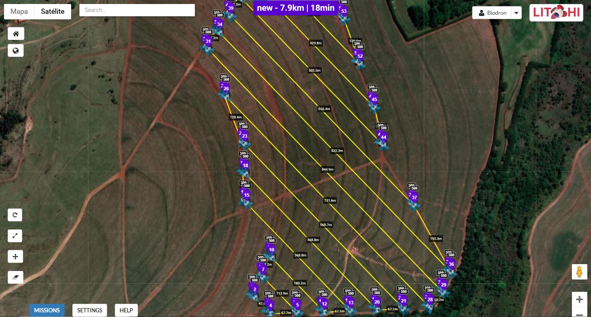
Conforme a imagem:
Parece que o QGroundControl definiu Waypoints adicionais, que são usados para “voar além do limite”, fazer a curva e, em seguida, começar o próximo caminho. Os Waypoints no limite dizem à câmera para parar de tirar fotos enquanto a aeronave está se virando. Quando o próximo caminho é iniciado, um Waypoint é usado para iniciar fotos novamente. Alguns outros programas de layout de grade fazem a mesma coisa.
Se você definir a ‘Distância de retorno’ para 0 (zero) pés ou metros, isso eliminará os Waypoints extras.
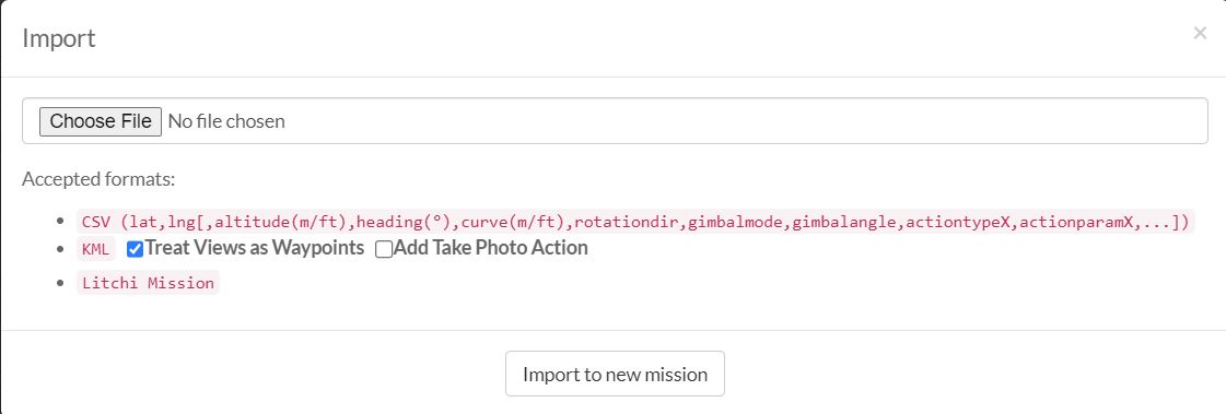
For some reason, Importing a QGroundControl mission (Survey or Waypoint KML file) does in fact duplicate the entire mission. The mission flies, then repeats it again in the Mission Hub.
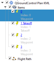
If you examine that KML file in a text editor or view it in Google Earth Pro, you will see that in addition to the “Flight Path”, there are 4 placemarks defined. When importing to Litchi, the placemarks, as well as the flight path are converted to waypoints yielding a path of 9 waypoints.
I have not worked with QGroundControl, but I would check to see if there was a way to not save those 4 initial placemarks/waypoints to the output.
Here is a view of the items as seen in Google Earth Pro: